Current Issue

2026 Vol. 45, No. 2

Display Method:
2026, 45(2): 1-1. doi: 10.19509/j.cnki.dzkq.tb20260002
Abstract:
Genetic mechanism and oil-controlling effect of curved faults in rift basins: A case study of the Bohai Sea area basins
REN Jian, SU Kai, WU Qingxun, WANG Jun, CHEN Shaowei
2026, 45(2): 2-10. doi: 10.19509/j.cnki.dzkq.tb20240405
Abstract:
Objective

There are numerous and widely distributed curved faults in the Bohai Sea, which control the development of structural traps. However, for a long time, the genetic mechanism of curved faults has not been systematically sorted out, and their impact on hydrocarbon accumulation has not been clarified, which restricts hydrocarbon exploration.

Methods

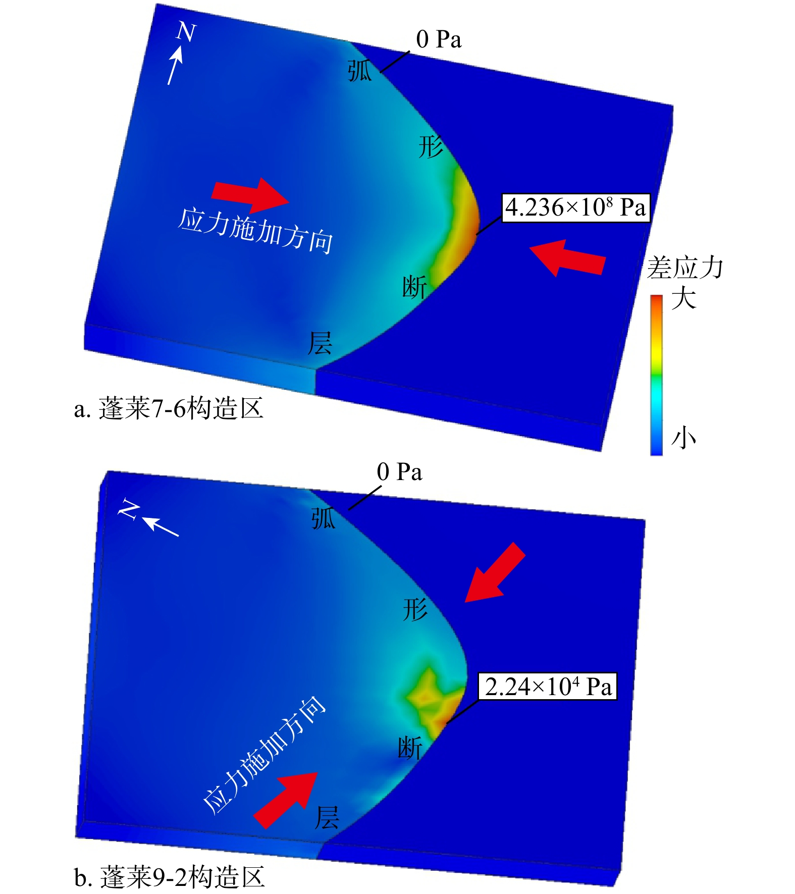
Based on 3D seismic data, fault displacement analysis, finite element stress simulation, and other methods, an in-depth study was conducted on the development mechanism and reservoir-controlling characteristics of the curved faults in the Bohai Sea.

Results

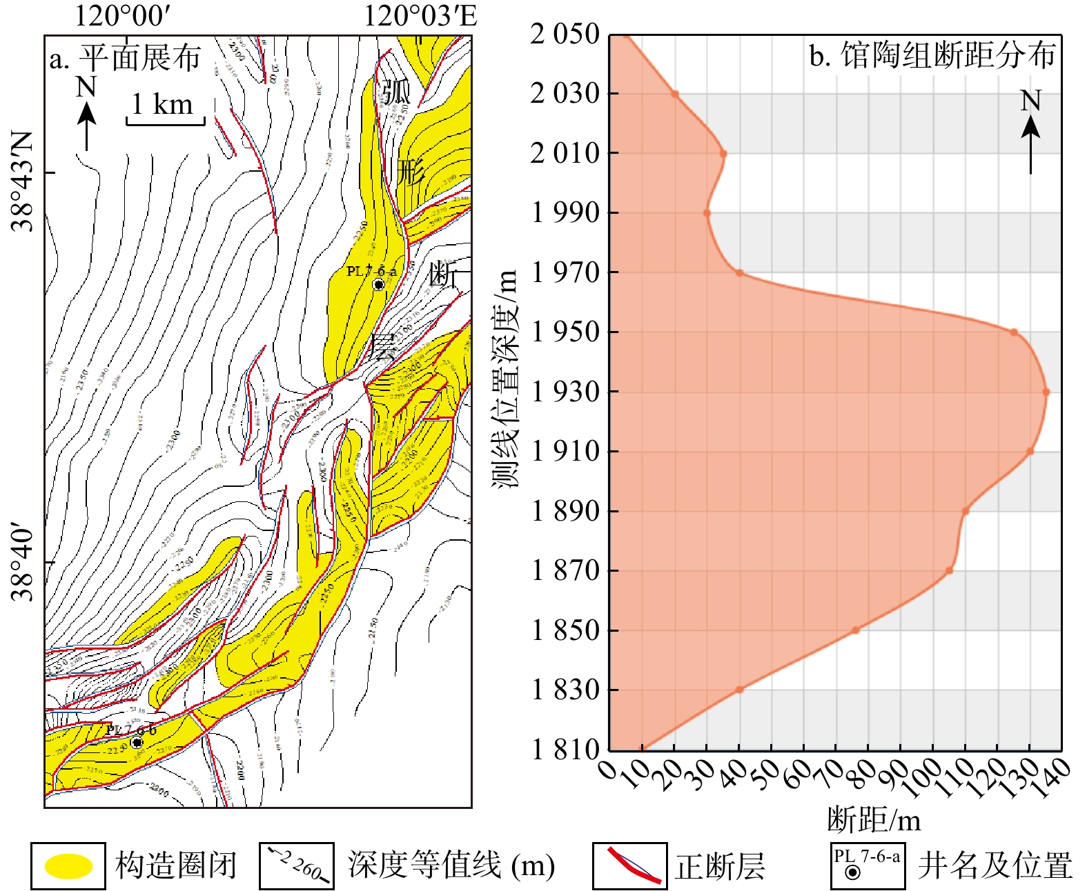
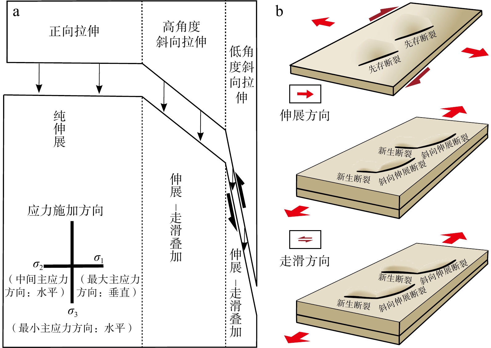
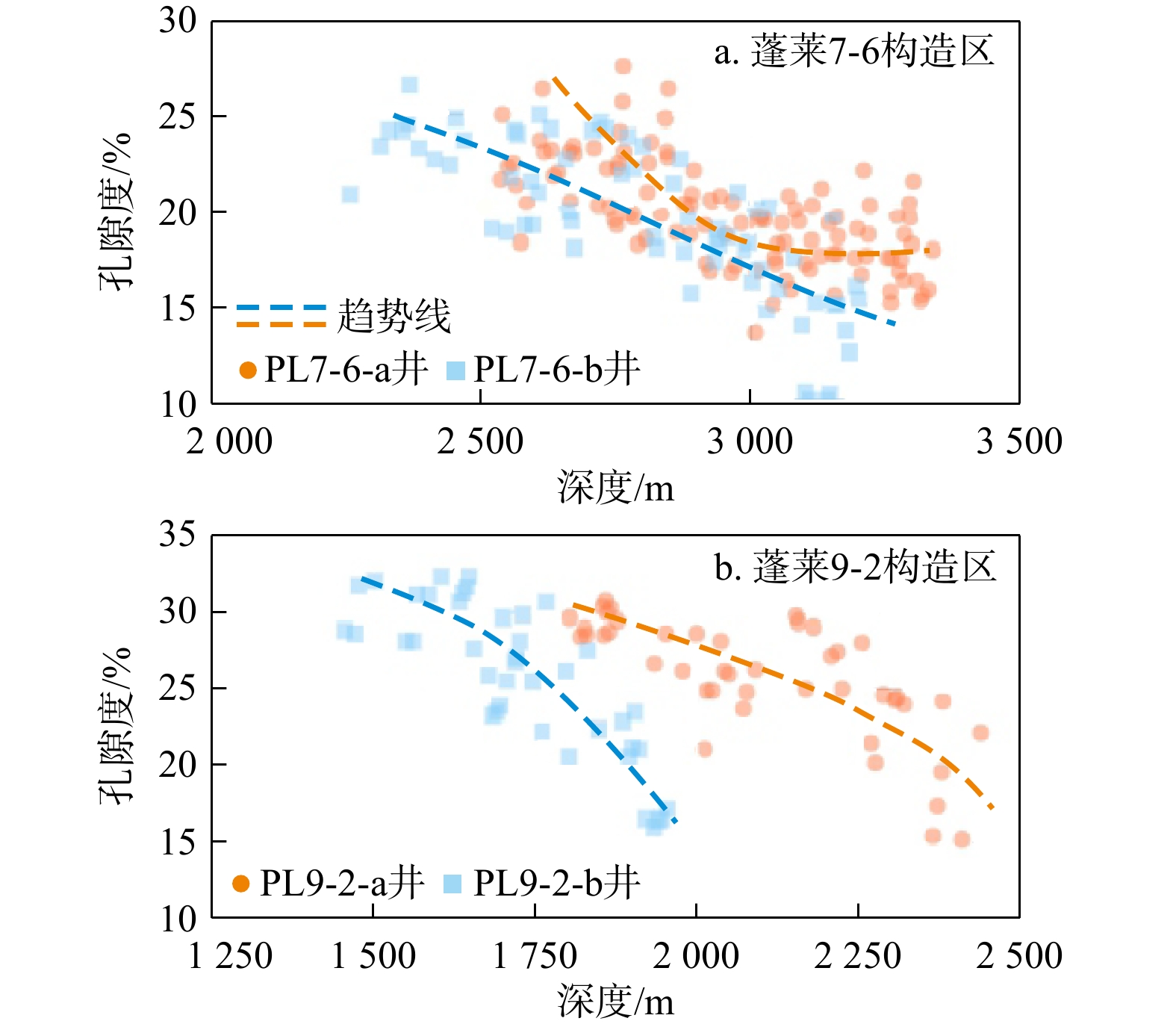
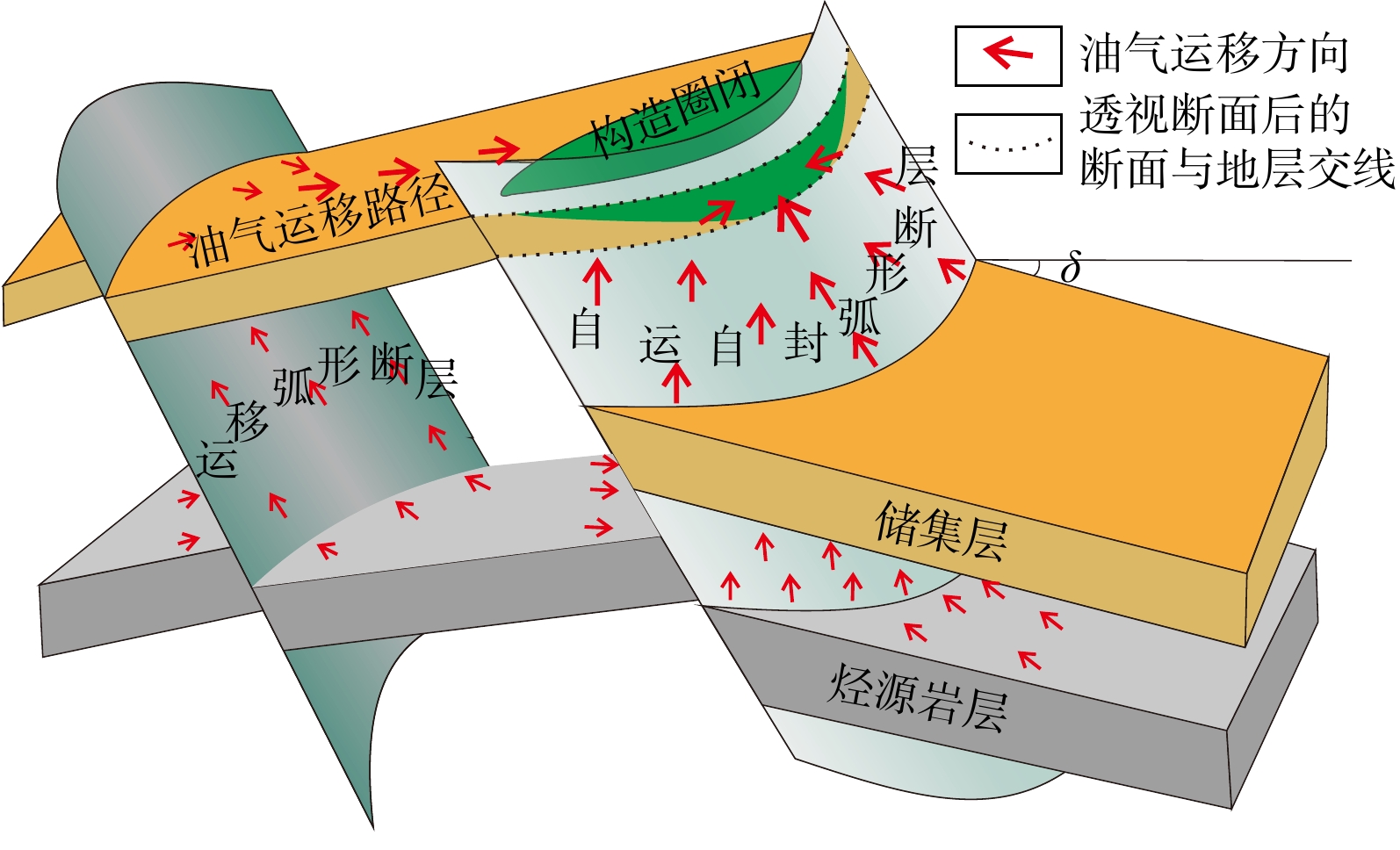
The results showed that the curved faults mainly included four types: lateral traction type, strike-connected type, oblique extensional type, and strike-slip rotating type. The lateral traction type had the largest fault displacement on the top of the arc, the oblique extensional type had the smallest fault displacement on the top of the arc, whereas the strike-connected type had the smallest fault displacement on the flank of the arc top. The large differential stress at the top of the curved faults promoted the development of microfractures and improved reservoir quality. The curved faults were usually self-migration and self-sealing faults, and the self-migration and self-sealing ability was related to the dip angle of the foot-wall strata of normal faults, the angle between the structural trap contours and the curved faults, and the curvature of the curved faults. The stronger the self-migration and self-sealing ability of the curved faults, the easier it was to form reservoirs.

Conclusion

This study clarifies the development mechanism of the curved faults in the Bohai Sea and their impact on hydrocarbon accumulation, providing important guidance for hydrocarbon exploration.

Effect of CO2 flooding on the pore structure of tight sandstones: A case study of Chang 7 Member of Triassic Yanchang Formation in Ordos Basin
WU Xiaobin, QIANG Xiaolong, ZHANG Xiaoyan, LI Gang, XIE Qiangwang, WANG Wei
2026, 45(2): 11-19. doi: 10.19509/j.cnki.dzkq.tb20240452
Abstract:
Objective

CO2 flooding is a crucial technology for enhancing oil recovery efficiency in tight oil reservoirs. CO2 injection reacts with in situ minerals in the formation, leading to changes in the pore structure of the rock. However, tight sandstones undergo complex diagenesis with significant differences in cement distribution, and it is therefore necessary to clarify the mechanisms of microstructural changes in tight sandstones with different cement characteristics during the CO2 flooding process.

Methods

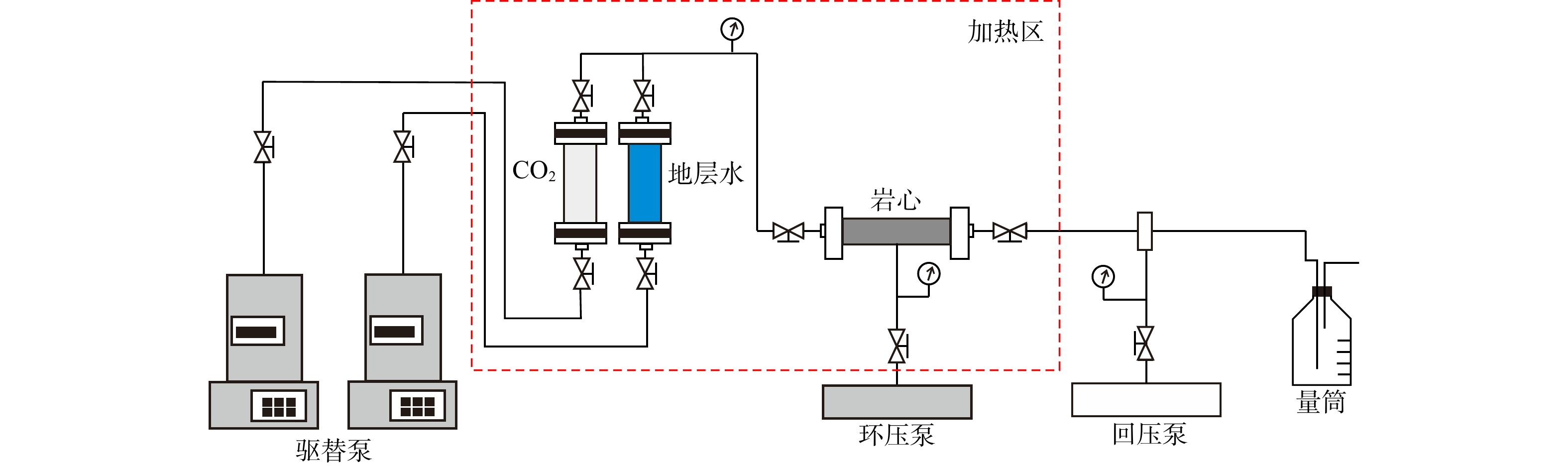
In this study, CO2 flooding simulation experiments, cast thin sections analysis, scanning electron microscopy (SEM), nuclear magnetic resonance, and X-ray diffraction were adopted to investigate the changes in mineral composition and pore structures of tight sandstones before and after CO2 flooding.

Results

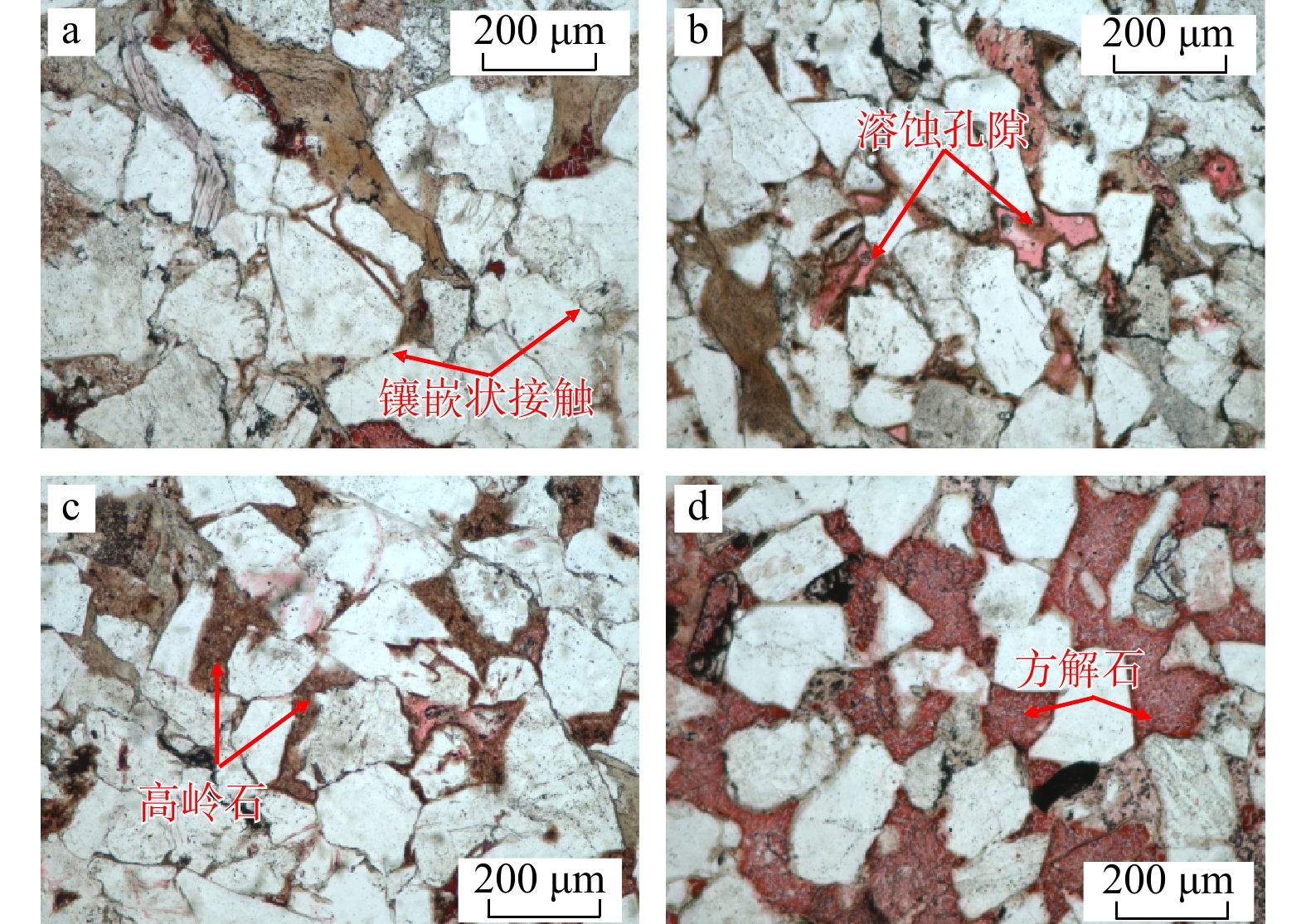
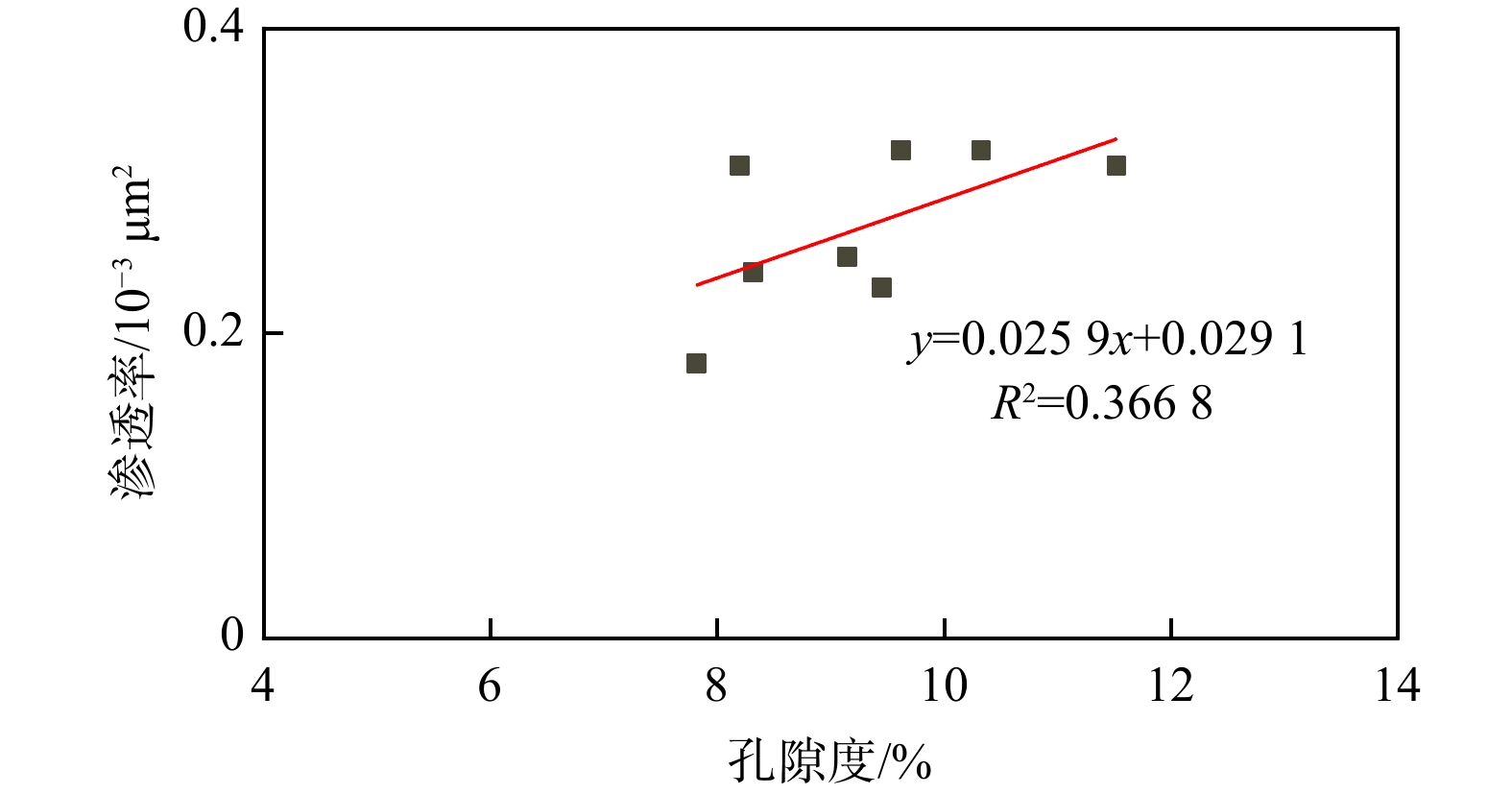
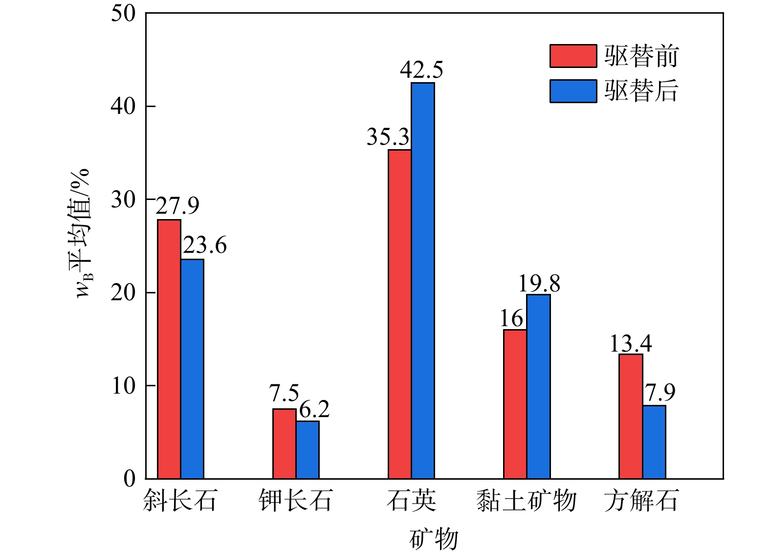
The results showed that the cements in tight sandstones were complex and diverse, mainly composed of clay minerals and calcite, with significant distribution differences among different cement types. Cements affected the mineralogical structure and pore morphology of tight sandstones. After CO2 flooding, the average porosity increment of tight sandstones reached 0.55%, the average permeability increase rate was 21.59%, and the average relative sorting coefficient decreased by only 0.01, indicating that CO2 flooding increased the porosity and permeability of the reservoir, but had a weak impact on the heterogeneity of the pore structure. During CO2 flooding, feldspar and calcite were dissolved, resulting in the precipitation of quartz and clay minerals. In tight sandstone with high clay content, CO2 dissolution was dispersed, and the newly precipitated minerals and clay detached from framework grains blocked pores, leading to minor changes in petrophysical properties. In tight sandstones with high calcite content, carbonic acid dissolved large amounts of calcite, creating new storage spaces and flow paths, significantly improving the petrophysical properties of tight sandstones. Therefore, CO2 flooding has different effects on the pore structure of tight sandstones with varying cement characteristics. CO2 flooding results in a much more significant improvement in the physical properties of tight sandstones with high calcite content than those with high clay content.

Conclusion

These results can provide new insights for the development and evaluation of tight sandstone reservoirs.

Identification and prediction of gravity flow channel interlayers under deep-water and few-well conditions
LI Da, TAO Qianqian, LIU Na, YE Rong, LI Hua
2026, 45(2): 20-32. doi: 10.19509/j.cnki.dzkq.tb20240455
Abstract:
Objective

The X gas field of Lingshui in Qiongdongnan Basin has proven natural gas reserves of 12.809 billion cubic meters. However, oil and gas exploration has been hindered by challenges such as the large water depths of the offshore basin, limited well data, low resolution of seismic data, and unclear identification of interlayers, thereby failing to meet the requirements of oil and gas exploration. This study aims to address these challenges by establishing identification criteria for interlayers and optimizing the oil and gas development plan of the X gas field of Lingshui.

Methods

This research utilized core samples, well logging data, and seismic data, which were used to create a set of criteria for identifying interlayers in the Huangliu Formation's gravity flow channels. Additionally, frequency extension and seismic inversion techniques were employed to reveal the distribution patterns of interlayers with different genetic origins in the gravity flow channels of the Huangliu Formation, thus providing a basis for the optimization of oil and gas exploration and development deployment.

Results

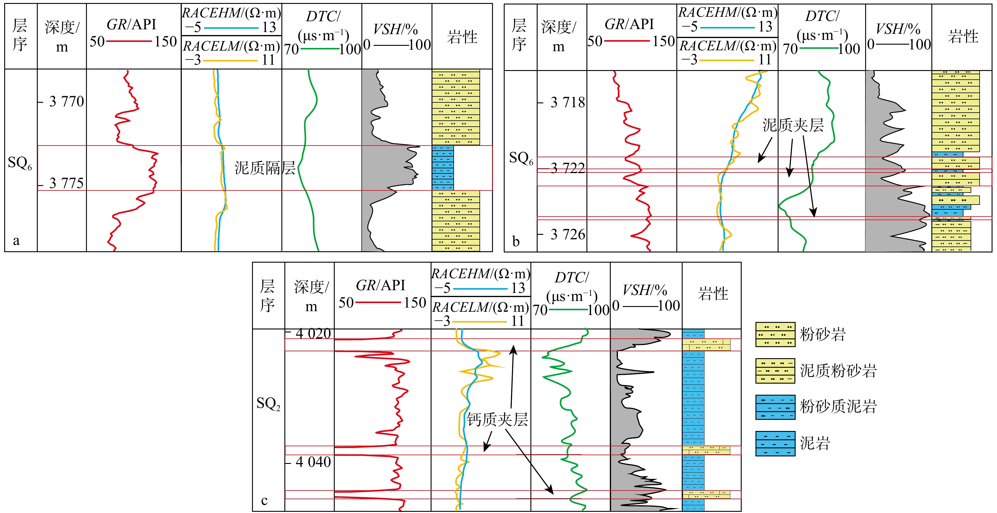
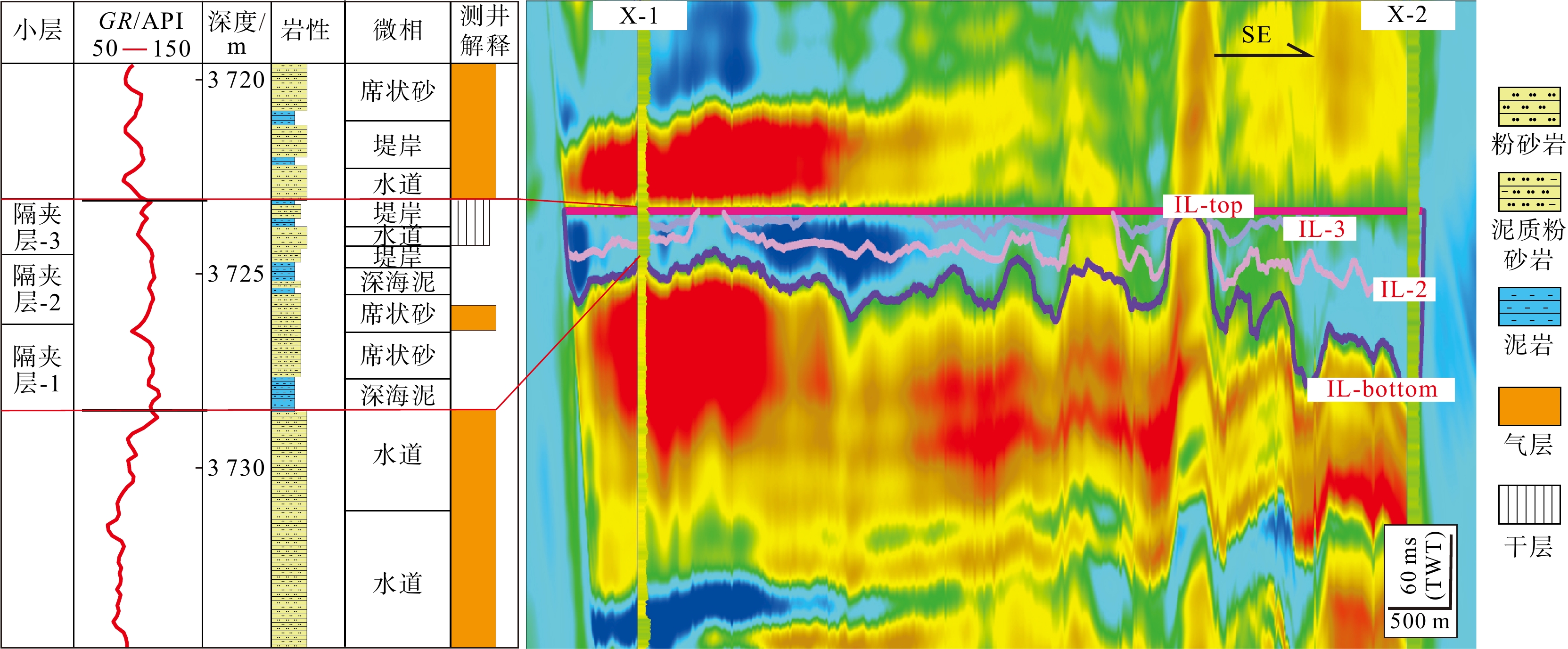
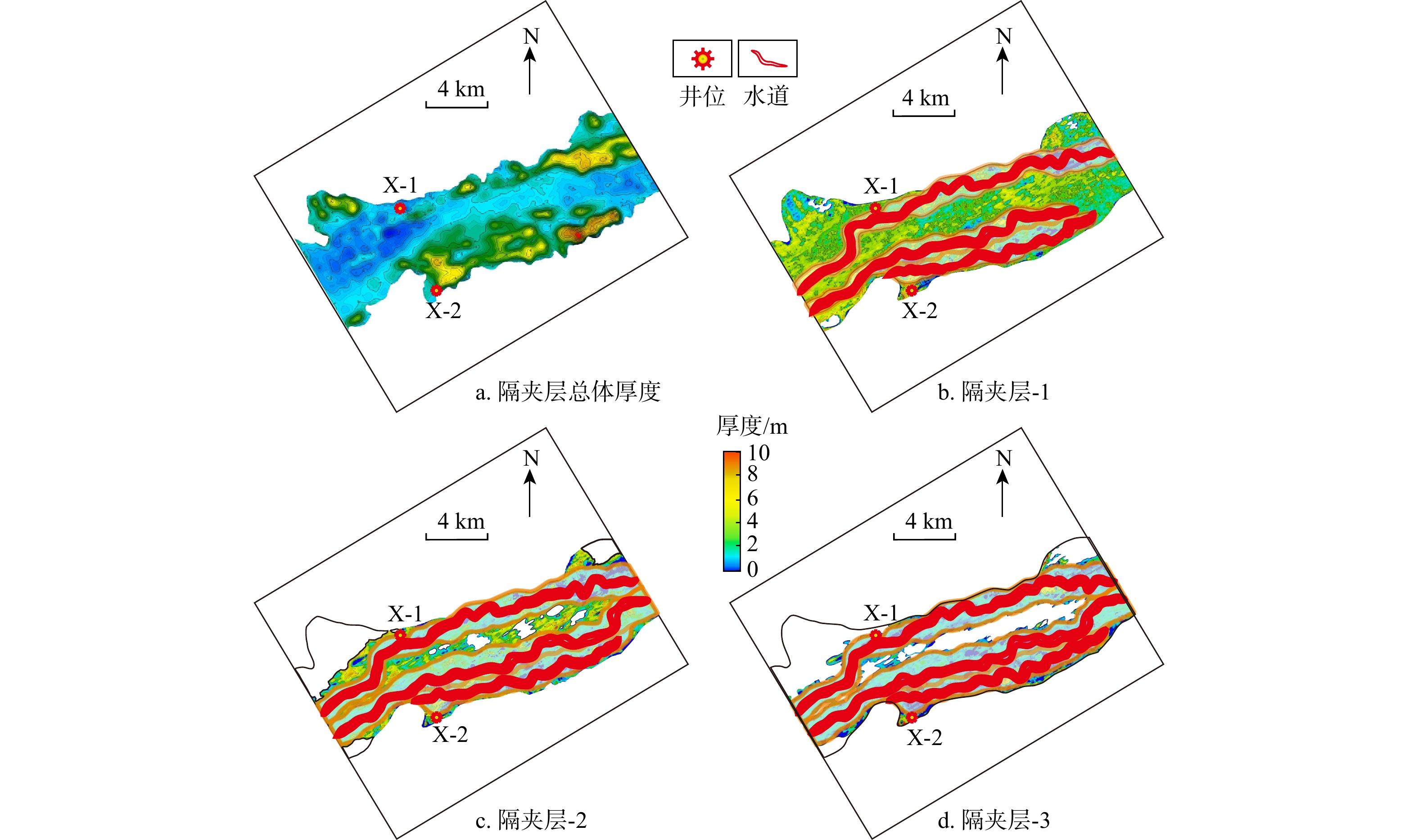
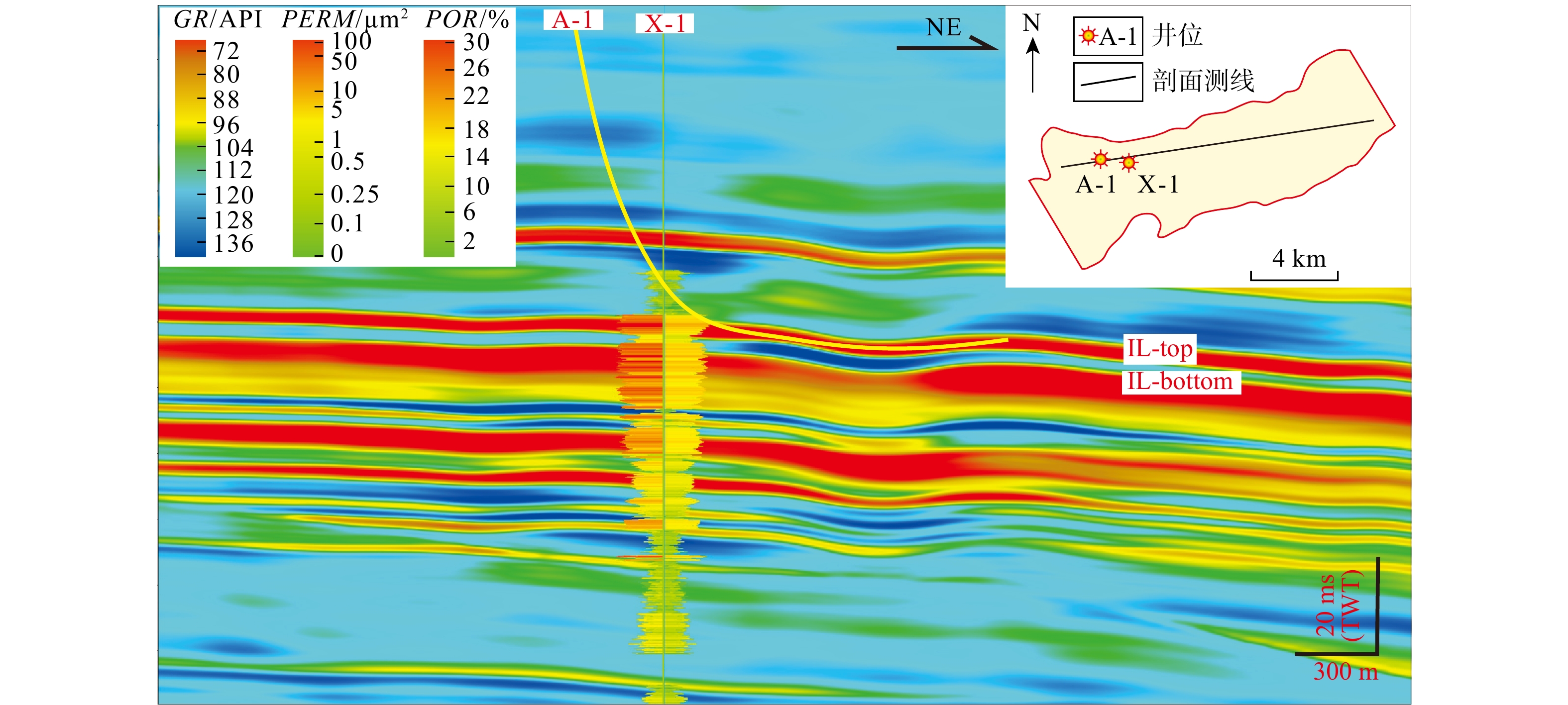
The results indicated that: (1) The overall sedimentary system in the study area was a canyon-channel system, characterized by the development of five distinct microfacies: Gravity flow channels, channel-levee complexes, sheet sands, slump deposits, and deep-sea mud. (2) The Huangliu Formation contained mudstone interlayers, mudstone interbeds, and calcareous interbeds. Mudstone interlayers and mudstone interbeds show the characteristics of high natural gamma ray values, high density, moderate acoustic travel time, and low resistivity, while calcareous interbeds were distinguished by low natural gamma ray values, high density, low acoustic travel time, and high resistivity. (3) Mudstone interlayers predominantly occurred in the external and marginal areas of the canyon, forming a large-scale stable distribution, while mudstone interbeds were confined to small, local areas on the flanks of the canyon channels. Calcareous interbeds have a small distribution area and poor stability. (4) The development of these interlayers was influenced by the sedimentary microfacies. When the gravity flow energy was strong, interlayers were more commonly found in the levee mud deposits along the channel sides. Conversely, when the energy was low, interlayers were dominated by deep-water in-situ deposits. (5) An optimized deployment plan and well trajectory for the newly developed Well A-1 were proposed, leading to the establishment of a semi-quantitative prediction techniques for interlayers, which improves support for subsequent oil and gas exploration and development.

Conclusion

In conclusion, the results of this study provide significant theoretical and technical support for the identification, prediction, and subsequent oil and gas development in X gas field of Lingshui and similar deep-water gas fields. The technical methodology established in this study is expected to improve the exploration efficiency and optimizing the development strategies of deep-water hydrocarbon reservoirs.

Genesis of the Naneng gold deposit in southeastern Yunnan: Evidence from in-situ trace elements and isotopes of sulfides
GUAN Jiyun, ZHANG Qidao, CAO Yi, XU Lei, LAN Kaijun, SUN Kang, ZHAO Yang
2026, 45(2): 33-47. doi: 10.19509/j.cnki.dzkq.tb20240520
Abstract:

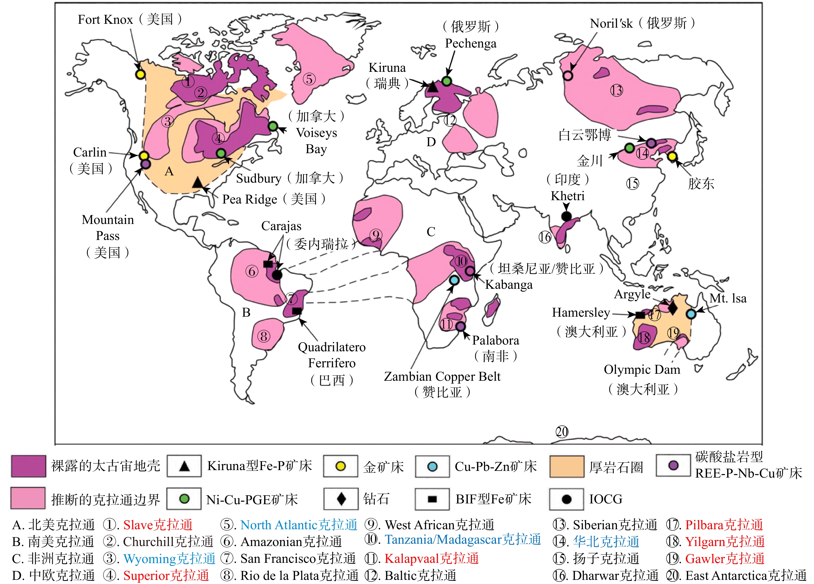
Naneng gold deposit is an important medium-sized Carlin-type gold deposit in southeastern Yunnan.

Objective and Methods

Two stages of pyrite (PyⅠ and PyⅡ) were identified to develop in the Naneng gold deposit via detailed field investigations and petrographic observations, and in-situ trace elements analyses of gold-bearing minerals (pyrite and arsenopyrite) were conducted by laser ablation inductively coupled plasma mass spectrometer (LA-ICP-MS), combined with in-situ and sulfur isotopes analyses, to constrain the source of ore-forming materials and the genetic mechanism of the deposit.

Results

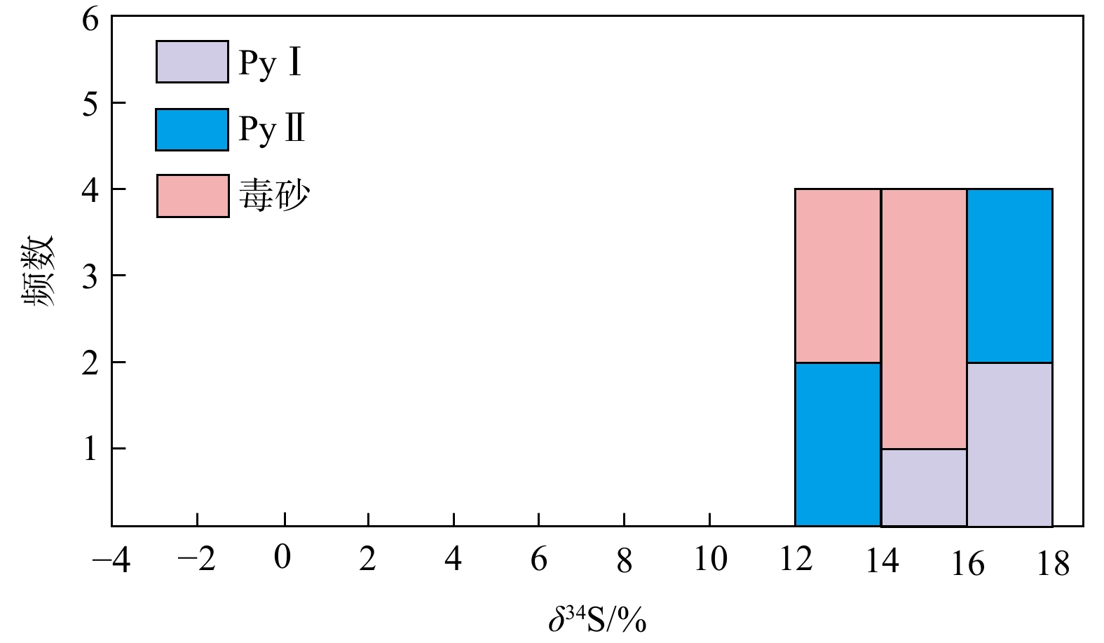
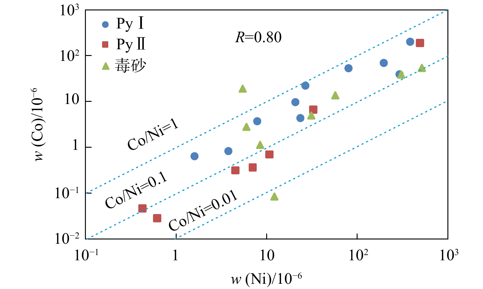
LA-ICP-MS analyses show that PyⅠ contains a certain amount of Au (mean 6.37×10⁻⁶), and is relatively enriched in Co, Ni, Se, W and other elements; The distribution characteristics of trace elements in PyⅡ and PyⅠ are similar, but the content of Au (mean 68.02×10⁻⁶) is relatively high, and As, Sb, Cu elements are enriched in PyⅡ; The average Au content of arsenopyrite is 36.02×10⁻⁶, and arsenopyrite is mainly enriched in elements such as As, Ni, Sb, Se, Au, whereas the contents of Zn, Ag, Hg, Tl are relatively low. In addition, the in-situ δ34S values of gold-bearing minerals in the Naneng gold deposit are consistent, ranging from 13.7‰ to 16.5‰, indicating that the sulfur in these minerals mainly come from the surrounding rocks. It is preliminarily concluded that PyⅠ was formed in a relatively stable environment by medium to low temperature hydrothermal fluids from the same source rich in trace elements such as Au, As, Sb, and a small amount of Au was precipitated simultaneously with PyⅠ in the form of solid solution (Au+). In the PyⅡ stage, the intense tectonic activities in the study area caused ore-forming fluid to upswell, and after sulfidation reaction with surrounding rock strata, the concentration of H2S in the fluid decreased, causing the Au-HS complexes to become unstable. Consequently, Au was supersaturated and precipitated, and then highly enriched in PyⅡ in the form of nanoscale inclusions (Au0).

Conclusion

The research results are of great significance for the prospecting of Carlin-type gold deposits in southeastern Yunnan.

Sedimentary structural characteristics and well logging identification method for shale strata in the First Member of the Qingshankou Formation, Gulong Sag
HAN Zongyan, WANG Guiwen, WU Hongliang, FENG Zhou, TIAN Han
2026, 45(2): 48-57. doi: 10.19509/j.cnki.dzkq.tb20240641
Abstract:
Objective

In order to establish a detailed classification scheme and quantitative characterization method for the logging of shale sedimentary structure, and to support the efficient exploration and development of shale oil,

Methods

the continental shale strata of the First Member of the Qingshankou Formation (K2qn1) in the Gulong Sag, Songliao Basin were taken as an example. Based on core and thin-section observations, whole-rock mineral X-ray diffraction, and electrical imaging logging data, the sedimentary structural characteristics under lithological variations were clarified, and a quantitative well logging identification method for sedimentary structures applicable to continental shale strata was established.

Results

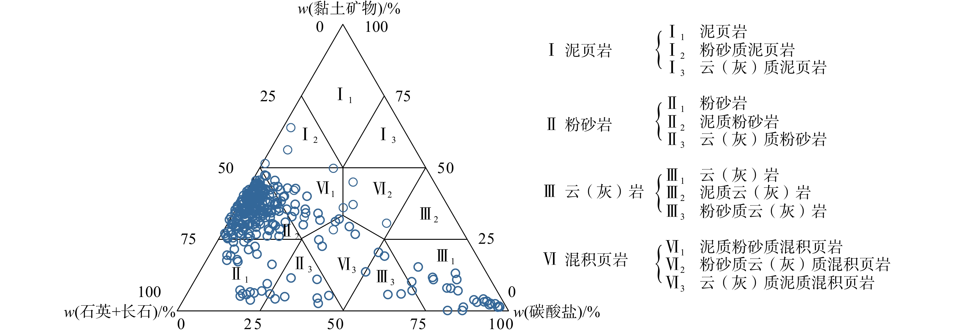
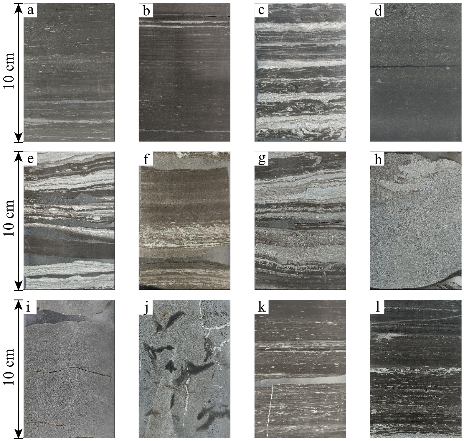
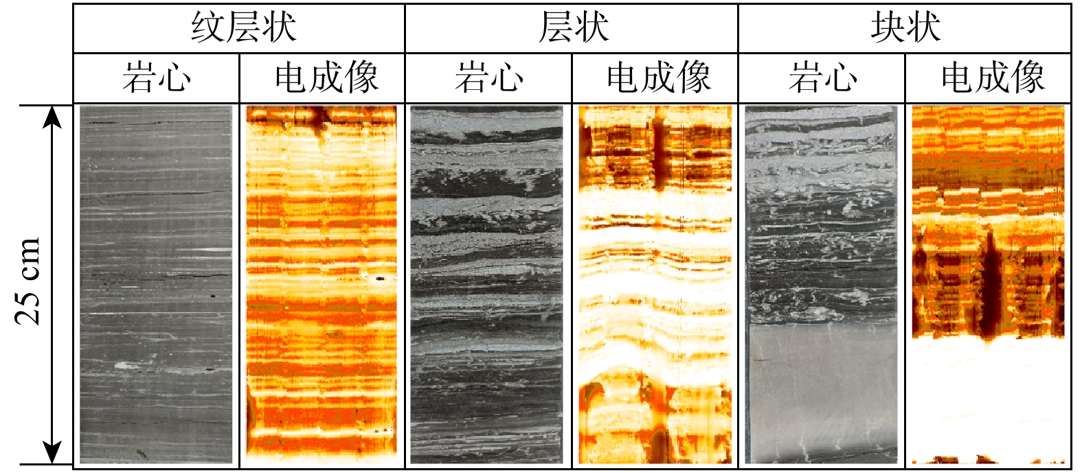
The results showed that the differences in sedimentary structural characteristics under different lithologies in K2qn1 shale strata were primarily reflected in the mineral composition of the laminae and the thickness variation of the bedding (texture). Based on the single-layer thickness, sedimentary structure types could be divided into laminated (single-layer thickness ≤ 1 cm), bedded (single-layer thickness is 1-10 cm), and massive (single-layer thickness ≥ 10 cm). Leveraging the high-resolution advantage of electrical imaging logging slice images, the layer interfaces in the slices were identified through edge detection and Hough transform. The sedimentary structure types were quantitatively classified based on layer interface thickness. This method not only overcame the challenge of insufficient characterization accuracy for millimeter-scale laminae in traditional dynamic and static imaging logging but also addressed the limitation of previous methods where laminae density could not effectively distinguish between bedded and laminated sedimentary structures within a well logging unit window length.

Conclusion

Overall, the logging identification method for sedimentary structures based on electrical imaging slices proposed in this study demonstrates high accuracy and broad applicability, providing robust support for the subsequent evaluation of continental shale reservoir effectiveness.

CO2-EOR numerical simulation in cores from the Third Member of the Funing Formation in Zhangjiaduo oilfield, Subei Basin
JI Wenyu, FU Haoyu, WANG Dexi, YANG Zhengmao, CHEN Yuhan, SHI Xiaoqing
2026, 45(2): 58-67. doi: 10.19509/j.cnki.dzkq.tb20240403
Abstract:

CO2-enhanced oil recovery (CO2-EOR) is currently one of the most widely applied technologies worldwide for oilfield production stimulation and carbon sequestration. Under the "dual carbon" goals, numerical simulation of CO2-EOR needs to consider the effect of interphase mass transfer by the non-independent water phase, so as to characterize the multiphase dissolution distribution of CO2.

Objective and Methods

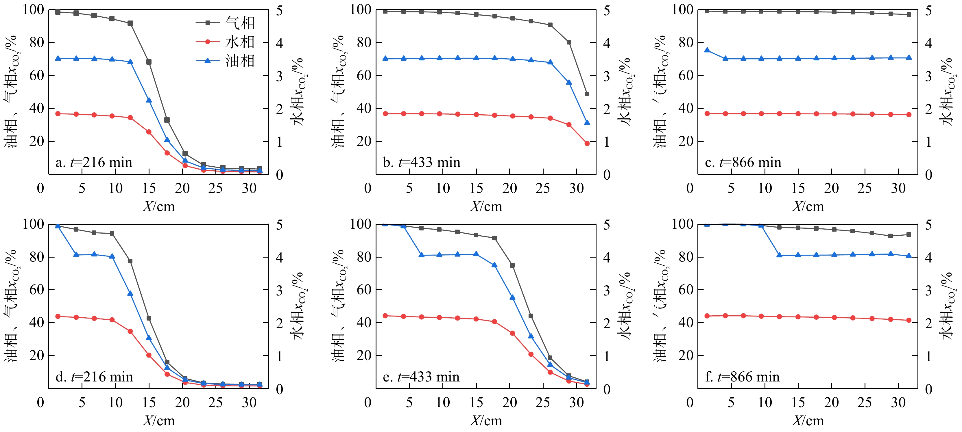
Based on actual reservoir conditions of the Third Member of the Funing Formation in Zhangjiaduo Oilfield, Subei Basin, this study used the multiphase flow numerical simulation software TOGA to establish a core displacement model, and realized the simulation of three-phase full-component miscibility. By simulating the interactions between CO2 and reservoir fluids under different confining pressures and gas injection rates, the differences in CO2 solubility in the water, gas, and oil phases under the actual reservoir conditions of the study area were characterized, revealing the miscible flooding mechanism.

Results

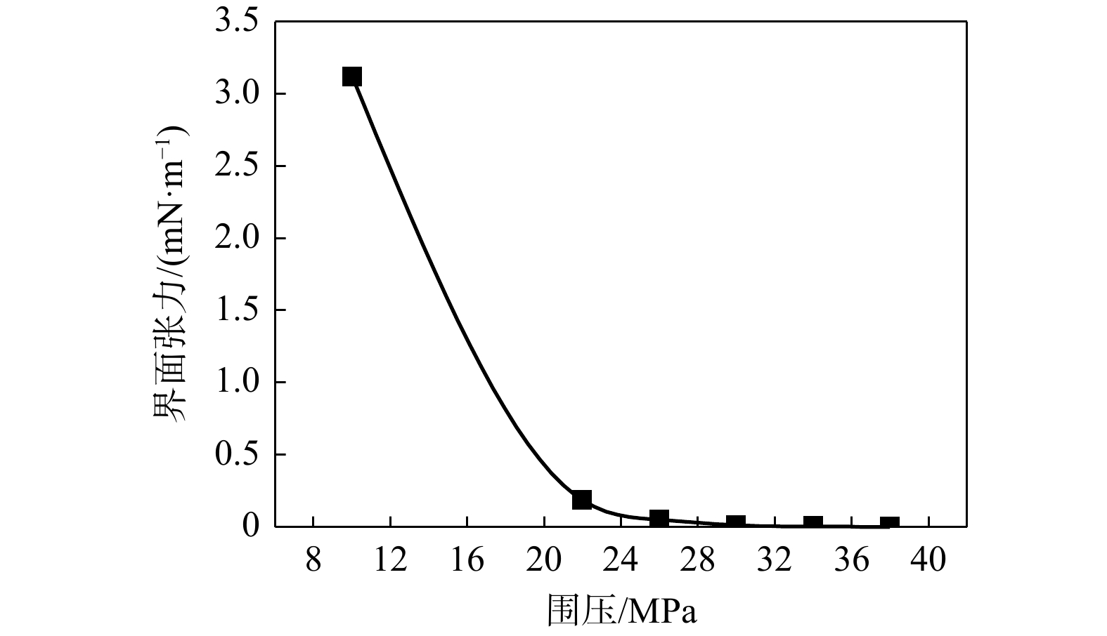
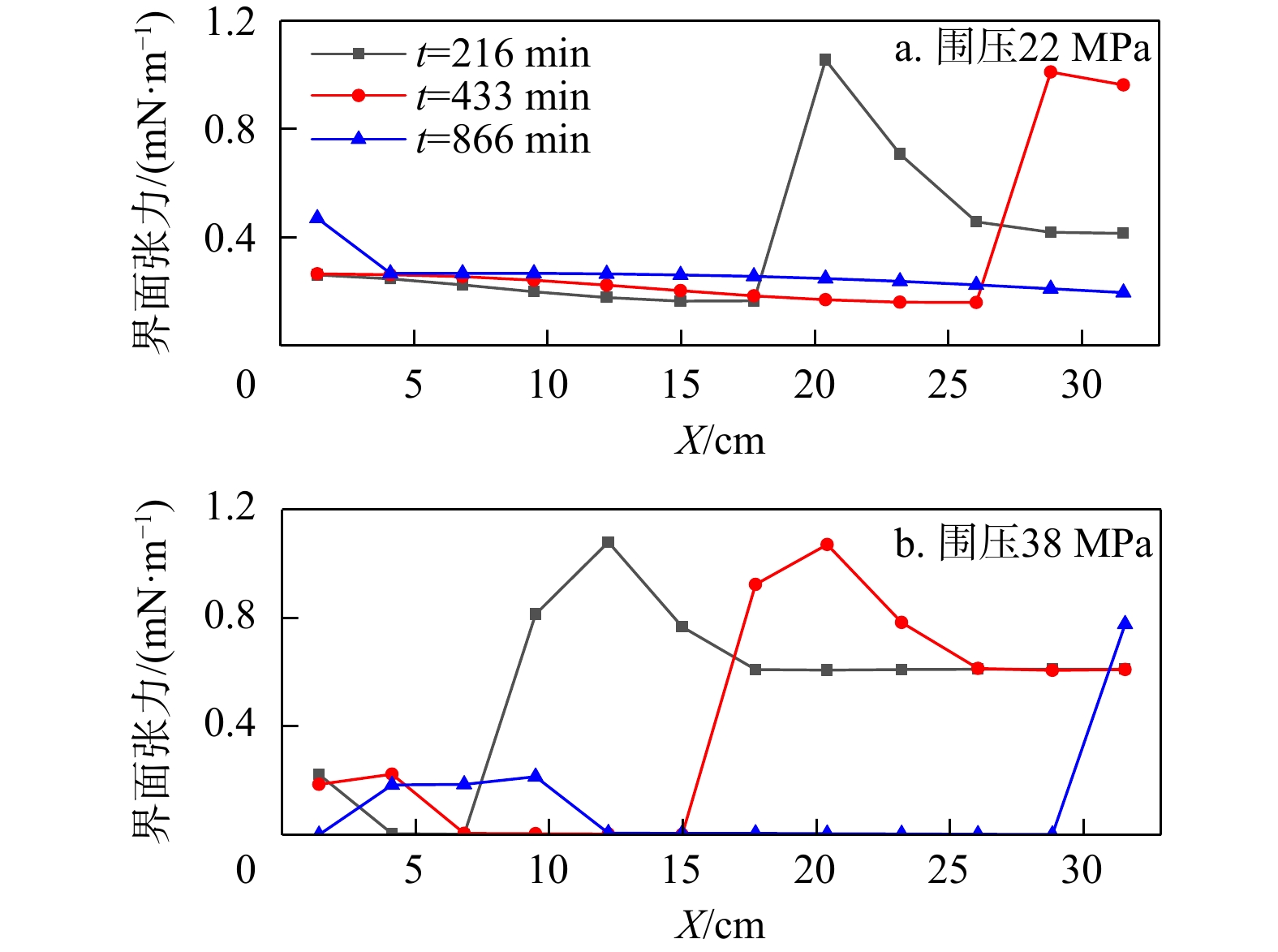
The simulation results indicated that the minimum miscible pressure for miscible flooding in the study area was 30 MPa, at which the oil-gas interfacial tension approached zero. Miscible displacement significantly improved oil recovery, with recovery rates of 85% and 52% under confining pressures of 38 MPa and 10 MPa, respectively. CO2 solubility in the oil phase was much greater than in the water phase, and with increasing confining pressure, the mole fractions of CO2 in both oil and water phases increased. At confining pressures of 22 MPa and 38 MPa, the mole fractions of CO2 migrating in the water phase were 1.8% and 2.1%, respectively, while those in the oil phase were 70% and 80%, respectively. The reservoir conditions in the study area can achieve miscible flooding, which is also conducive to carbon storage. Increasing the gas injection rate can improve production efficiency, but has a little effect on the ultimate oil recovery and CO2 sequestration capacity, while potentially increasing the risk of gas channeling.

Conclusion

This study provides technical references for field simulation and leakage risk assessment of the Third Member of the Funing Formation in Zhangjiaduo oilfield.

Quantitative characterization of reservoir heterogeneity using the AHP-CRITIC method: A case study of the 24 layer of Es4scx submember in Block Fan 151
YANG Yimeng, XU Shouyu, CHEN Maiyu, CUI Gaixia, HU Jin
2026, 45(2): 68-77. doi: 10.19509/j.cnki.dzkq.tb20240394
Abstract:

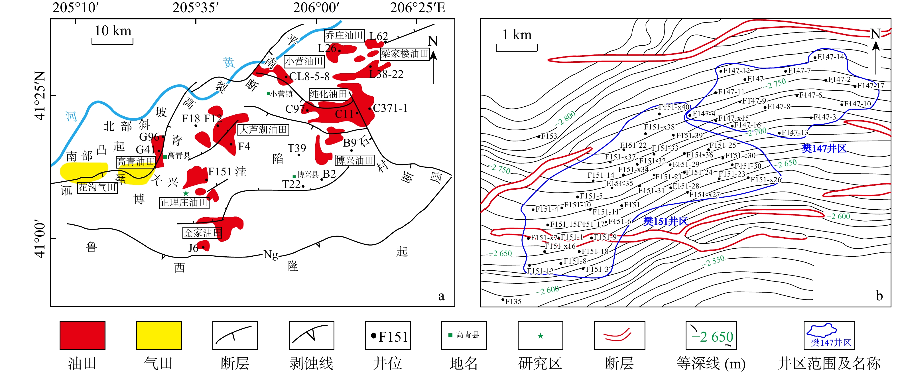
Block Fan 151 is a low-permeability beach-bar sandstone reservoir with poor overall physical properties and strong heterogeneity, resulting in low oil recovery and a large amount of residual oil during its development. It is essential to analyze the influence of reservoir heterogeneity on the distribution of residual oil and identify its enrichment areas. Furthermore, calculating the reservoir heterogeneity comprehensive index plays a crucial role in quantitatively characterizing heterogeneity. Therefore, improving the accuracy of calculating the comprehensive index can provide a basis for predicting favorable areas for oilfield development and finding residual oil.

Objective

To improve the accuracy of the comprehensive reservoir heterogeneity index calculation,

Methods

this study proposes the analytic hierarchy process (AHP)-criteria importance though intercrieria correlation (CRITIC) combined weighting method. This method determines the composite weight of evaluation indicators using both subjective and objective data, overcoming the limitations of a single weighting method.

Results

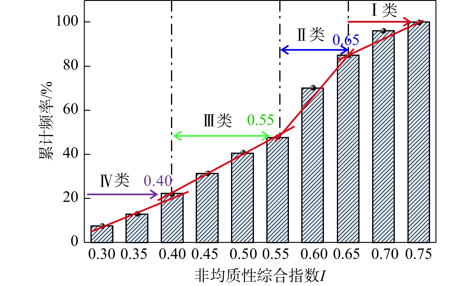
Quantitative analysis of the reservoir heterogeneity of the 24 layer of Es4scx submember in Block Fan 151 shows that the heterogeneity composite index I ranges from 0.27 to 0.73, with approximately 63% of the values ranging from 0.4 to 0.65. The target formation in the study area shows moderate to strong heterogeneity, and the distribution of high values of the anisotropy composite index I aligns closely with the high-value areas on the residual oil saturation contour map. This indicates that the AHP-CRITIC combined weighting method can reasonably assign weights to the evaluation indicators and construct a quantitative evaluation standard for the reservoir heterogeneity of this layer

Conclusion

This approach provides a new method for the quantitative characterization of reservoir heterogeneity.

Structural superimposed halo model of vein-type ore bodies and deep prospecting prediction of the Daping gold deposit in Yunnan Province
WU Di, SONG Fanyue, YOU Fuhua, LIU Jun, GONG Yongjun, SUN Huashan
2026, 45(2): 78-90. doi: 10.19509/j.cnki.dzkq.tb20240495
Abstract:
Objective

The Daping gold deposit is an economically significant vein-type gold deposit in the Ailaoshan metallogenic belt, with cumulative gold reserves exceeding 55 t. Due to years of mining, the recoverable reserves of the mine have been decreasing continously, making it essential to conduct in-depth prospecting research in the mining area to guide future exploration efforts.

Methods

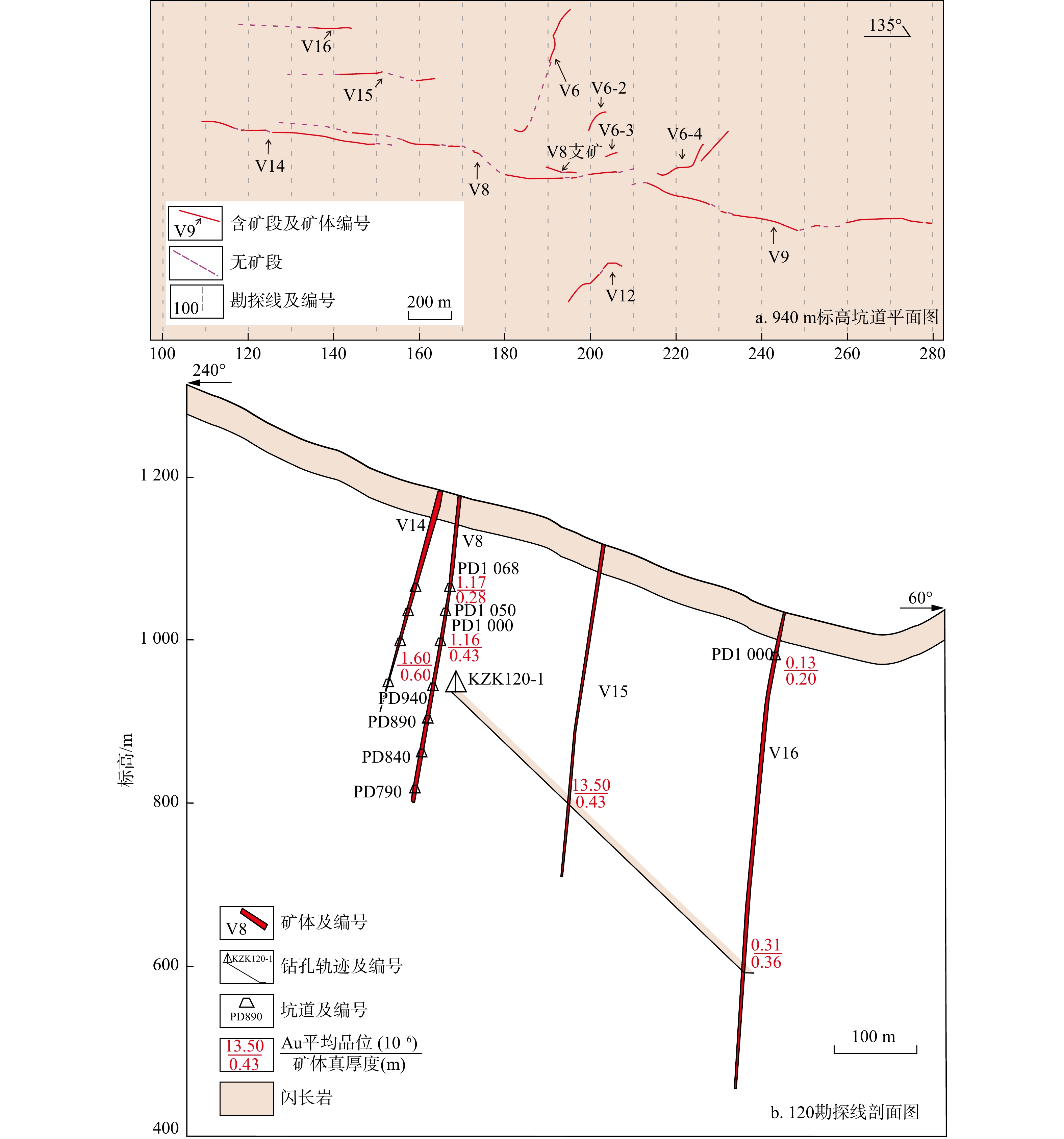
To investigate the deep metallogenic potential of the Daping gold deposit, research on the structural superimposed halo was conducted on the main ore body of the V8 vein-type ore body in Baishapo mining area.

Results

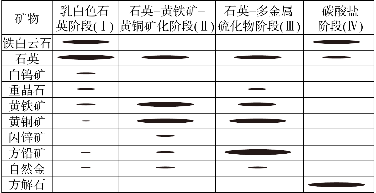
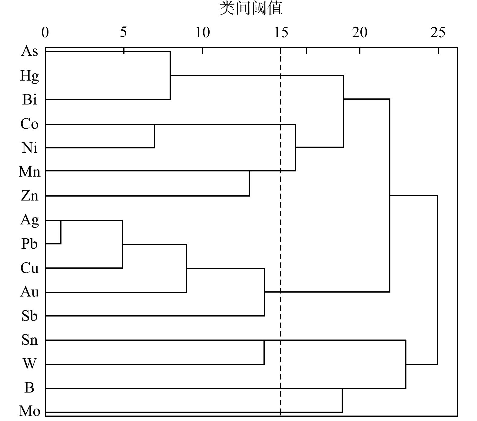
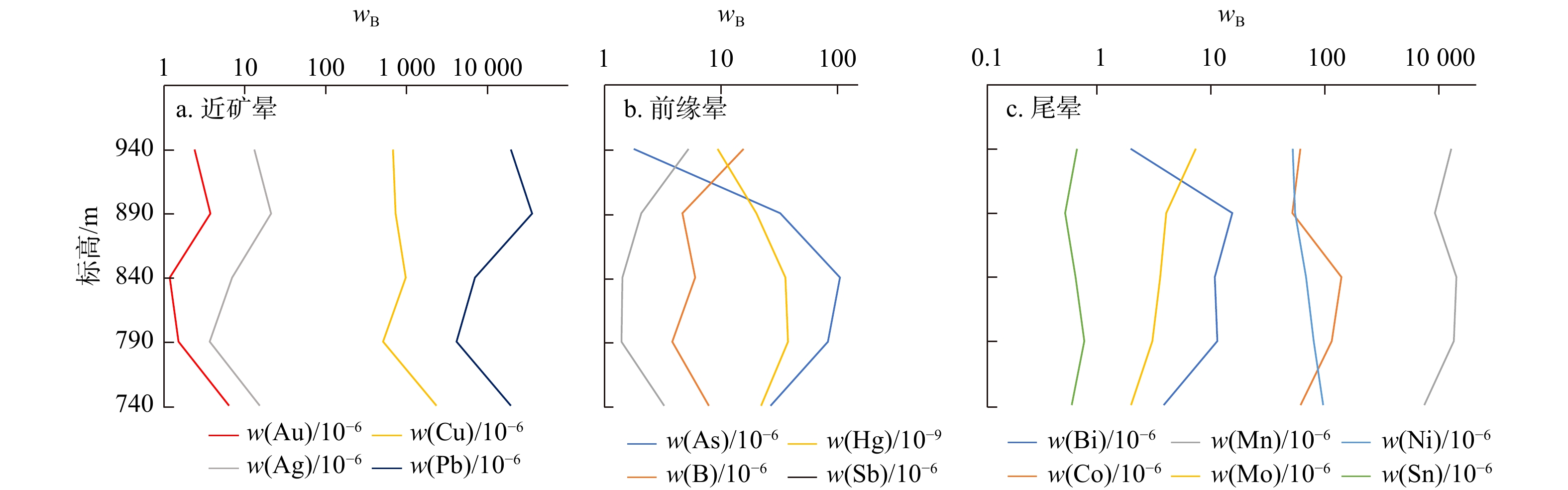
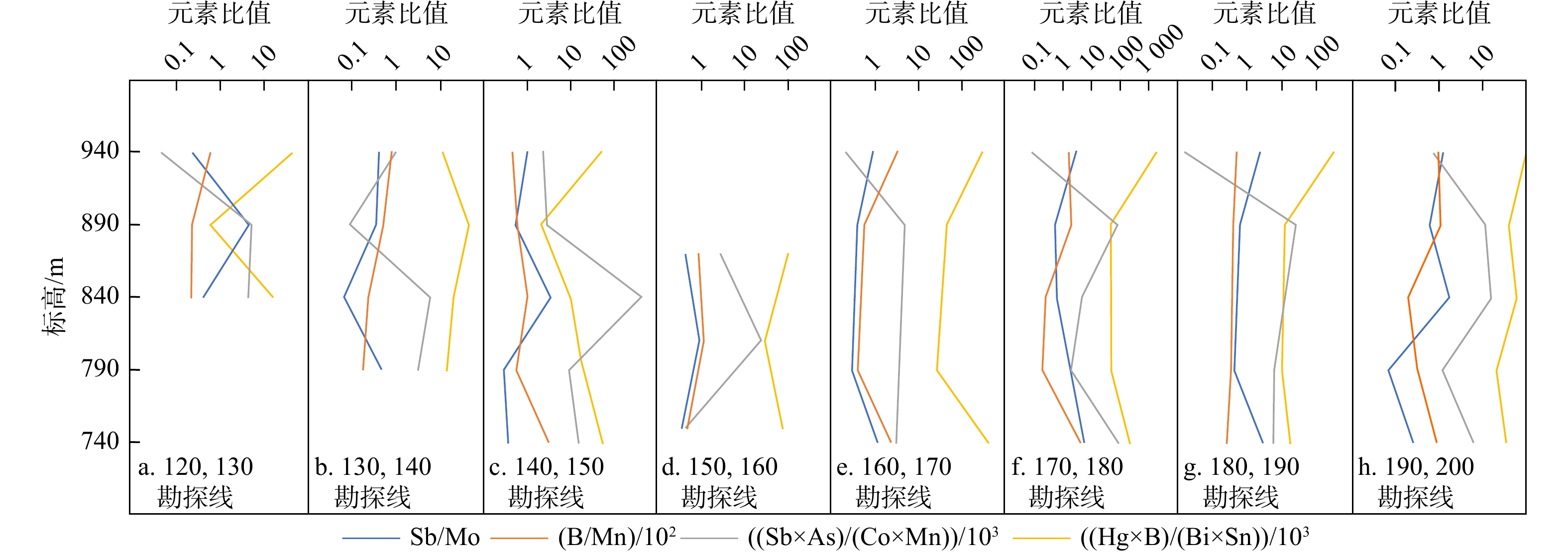
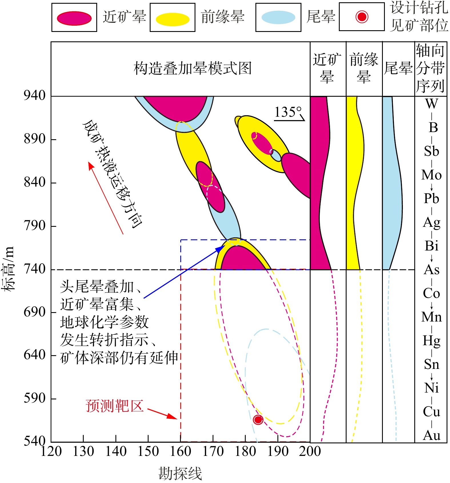
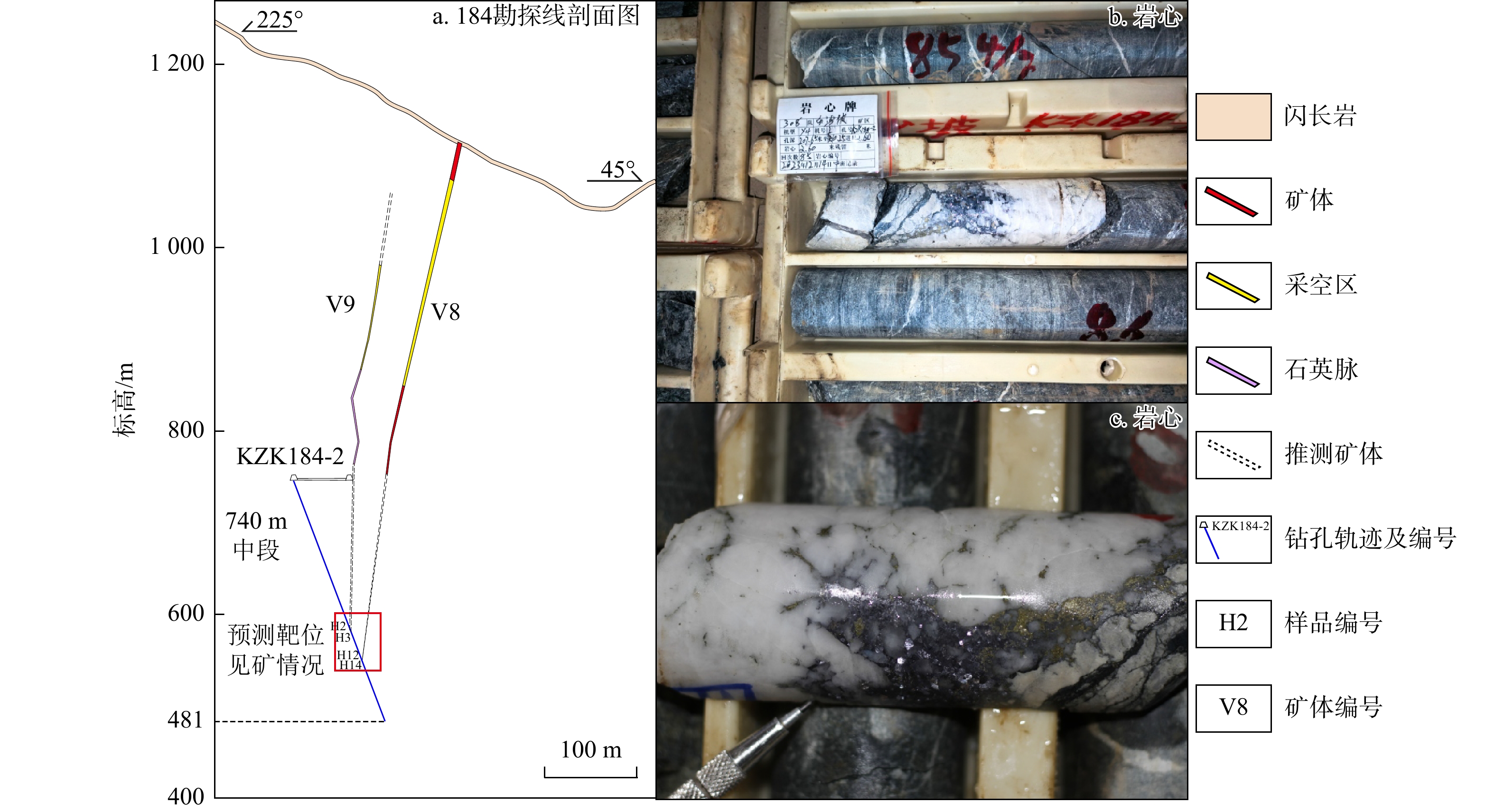
The results showed a close association between Ag, Cu, Pb, and Au mineralization in the Daping gold deposit. These elements (Au, Ag, Cu, Pb) served as the characteristic indicators for the near-ore halo of the Daping gold deposit. By applying an improved Grigoryan zoning index method, the axial zoning sequences of each exploration line were obtained. It was observed that the axial zoning sequences of each exploration line exhibited "reverse zoning" characteristics, indicating multi-period and multi-stage superimposed mineralization. Combined with the axial variation of trace elements and geochemical parameters, it was found that the deep part of the 160−200 exploration lines in the southeast direction demonstrated a head-tail halo superposition feature, suggesting possible deep ore body extensions in this region. A contrast halo zoning map generated through Kriging interpolation indicated that the ore body plunges towards the deep southeastern direction. Based on the spatial distribution of ore bodies, geochemical properties, and element spatial distribution patterns, a structural superimposed halo exploration model for the vein-type ore bodies in the Daping gold deposit is established. This model suggests that favorable metallogenic spaces exist in the deep part of the 160−200 exploration lines. Prospecting targets are delineated accordingly, and subsequent drilling verification successfully intersects ore.

Conclusion

Thus, the successful application of this approach demonstrates that the structural superimposed halo method remains an effective tool for current deep prospecting in vein-type gold deposits, thereby providing a reference for deep prospecting prediction in mining areas.

Influence of pore structure of tight sandstone reservoirs on fluid mobility and comprehensive characterization
CHEN Qiquan, LI Chao, CHENG Youyou, TAN Xiqun, LUO Xiang, ZHAO Zixuan, YAN Chenhui, TAN Chengqian
2026, 45(2): 91-105. doi: 10.19509/j.cnki.dzkq.tb20240683
Abstract:
Objective

Reservoir fluid mobility is significantly influenced by the combined effects of reservoir physical properties and pore structure, and cannot be accurately characterized by a single parameter. This study aims to apply a comprehensive pore structure characterization to evaluation tight sandstone reservoirs.

Methods

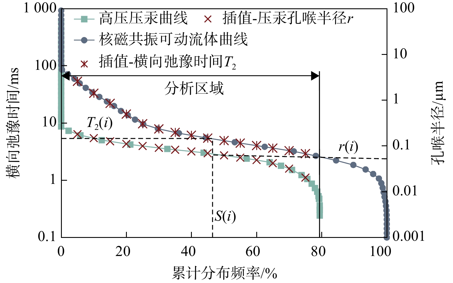
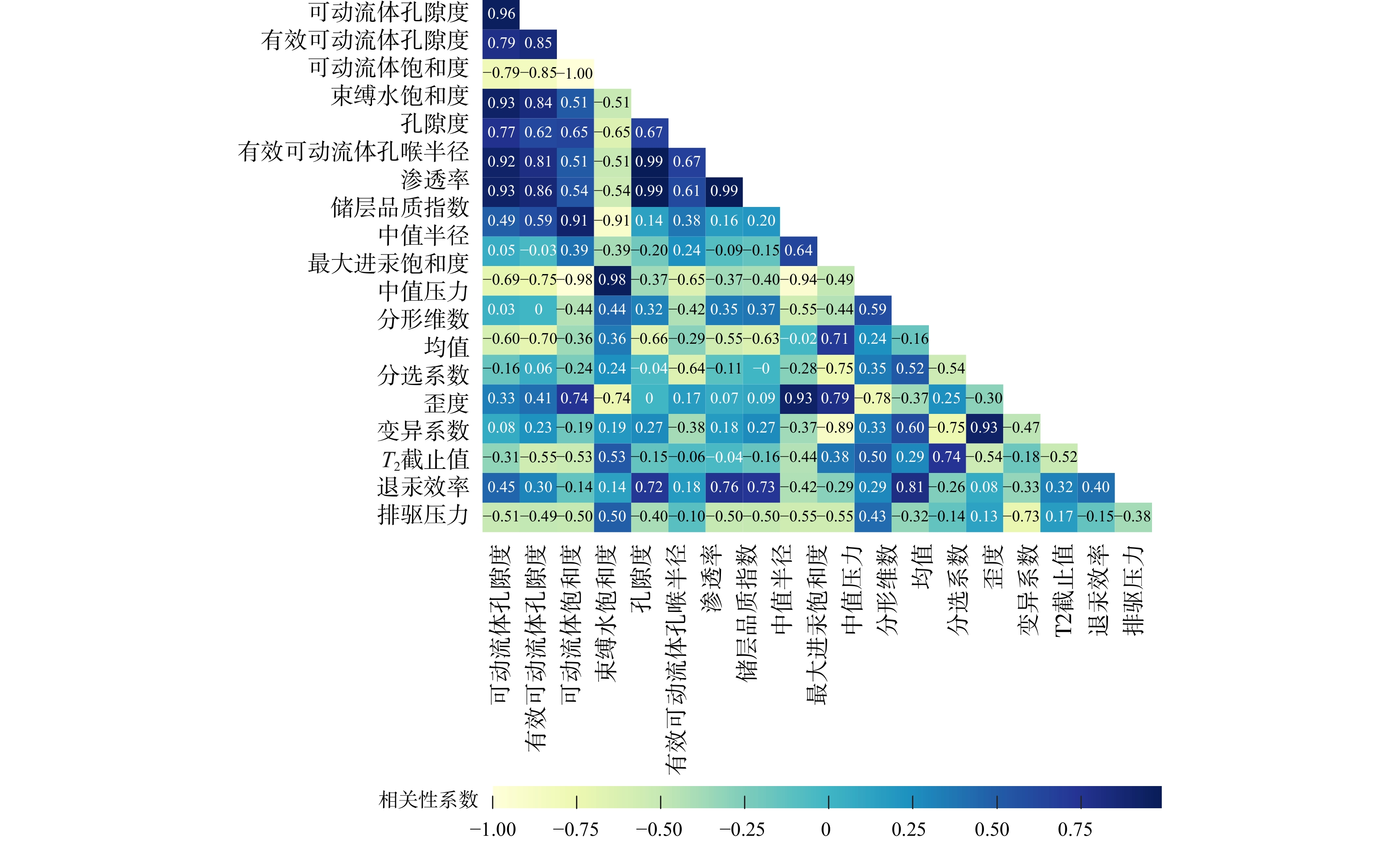
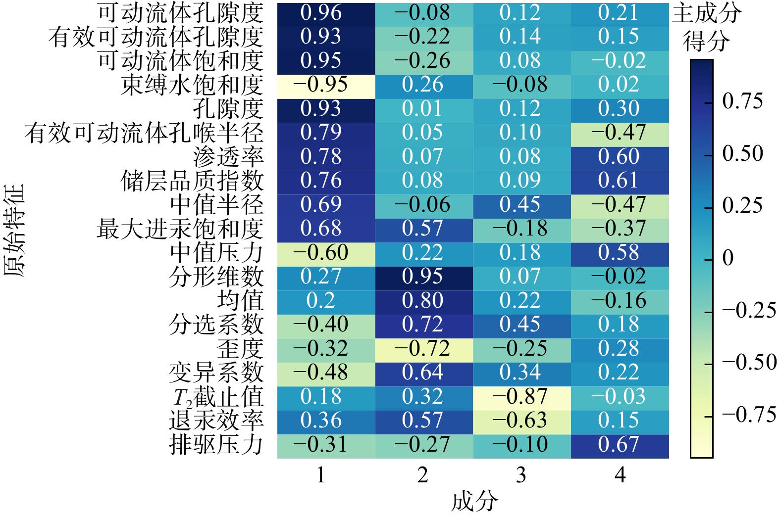
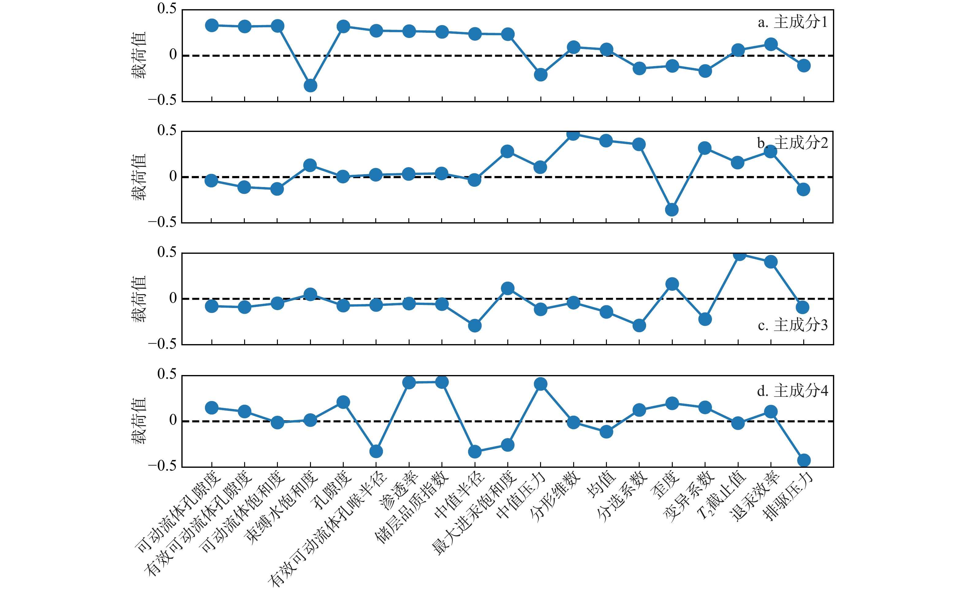
In this study, the effective movable fluid porosity $(\varphi_{\mathrm{cutoff}}) $ and effective movable fluid pore throat radius $(r_{\mathrm{cutoff}}) $ were calculated by integrating nuclear magnetic resonance (NMR) and high-pressure mercury intrusion (HPMI) with fractal theory for the Triassic Chang 82 tight sandstone reservoir in the Heshui area of the Ordos Basin. To explore the relationship between pore structure parameters and the degree of fluid mobility in the reservoir, principal component analysis (PCA) was employed to extract factors, and k-means clustering was introduced to establish a comprehensive evaluation approach for fluid mobility of tight sandstones.

Results

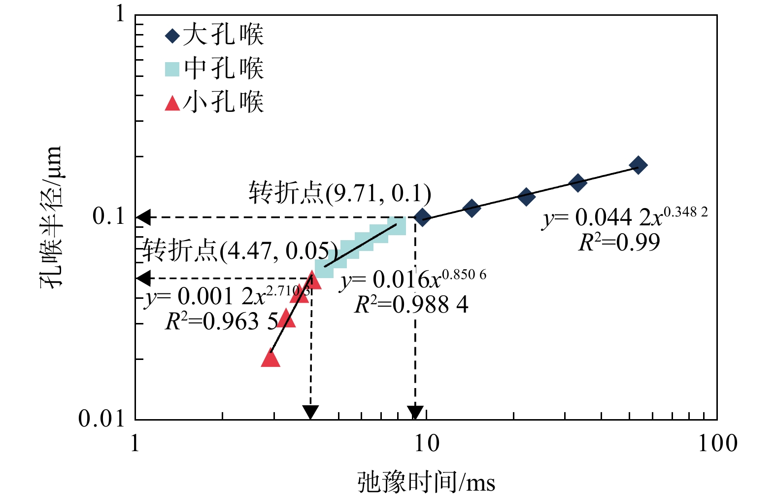
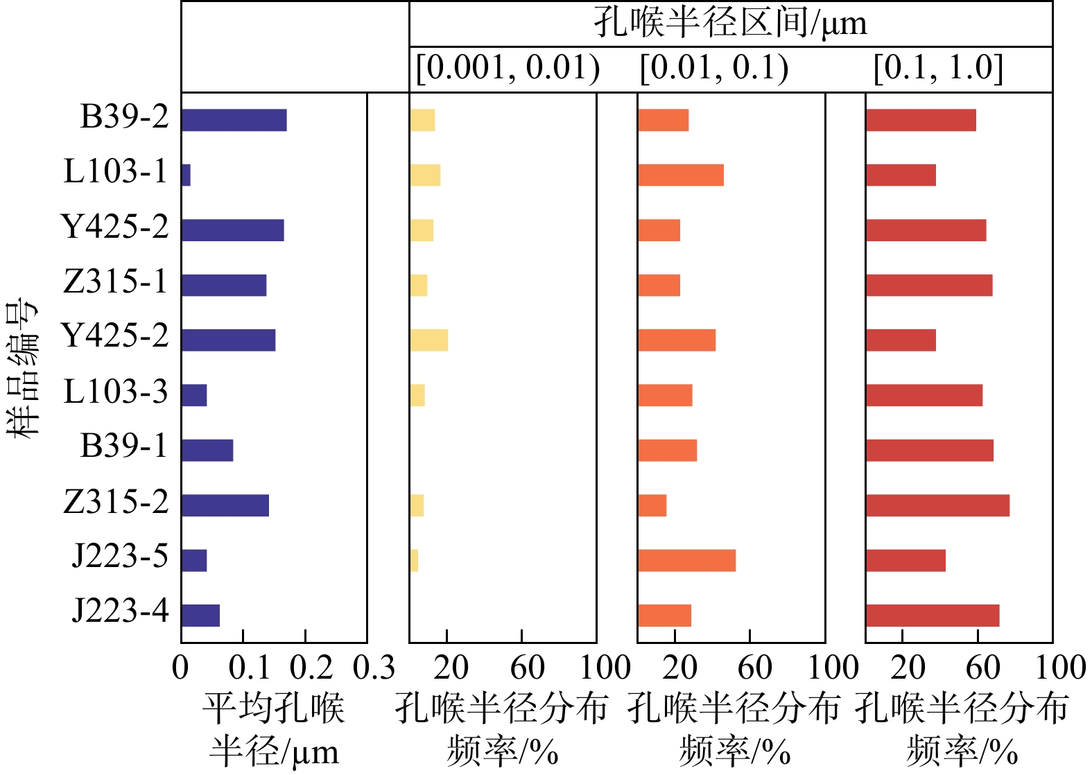
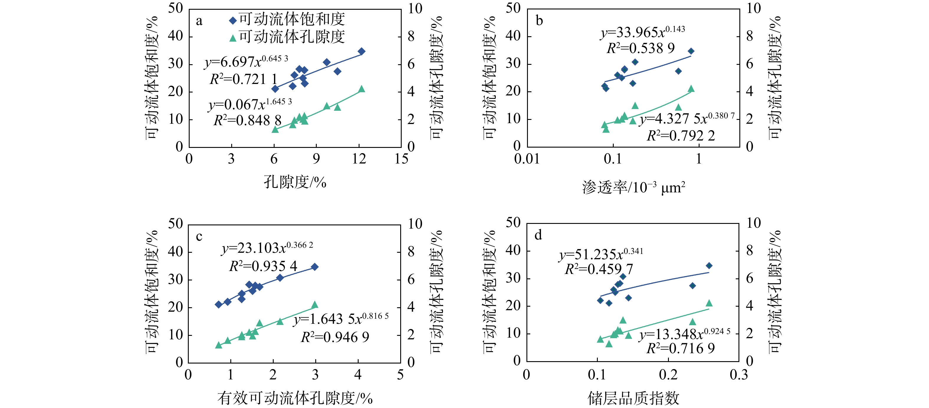
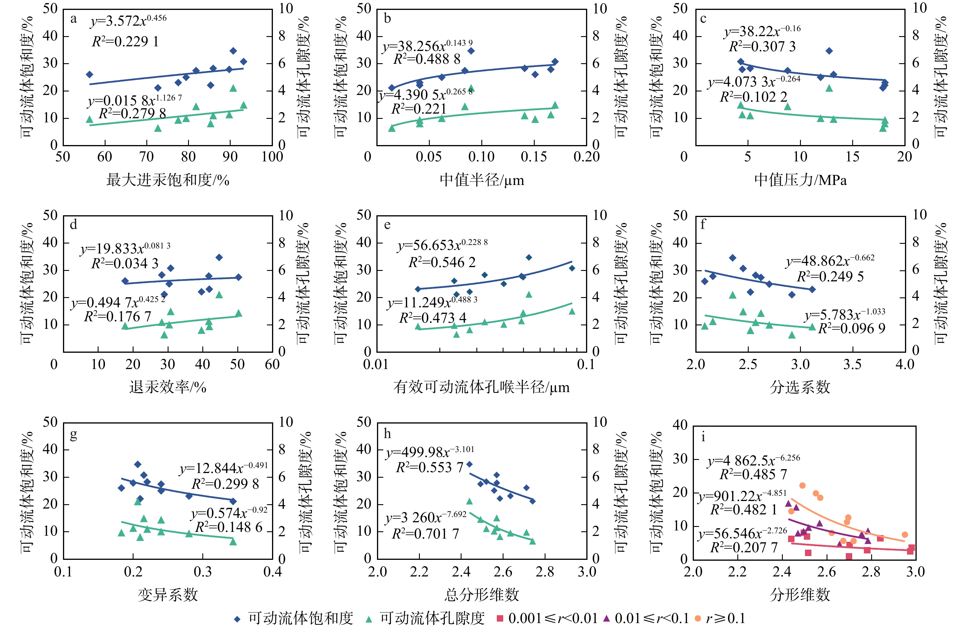
The results showed that the pore throat types of the target layer in the study area were predominantly medium-small pores and medium-fine throats, and movable fluid mainly resided in pores with pore sizes of 0.01-1.0 μm. The fractal dimension ranged from 2.4400 to 2.7412, with an average of 2.55. The effective movable fluid pore throat radius ranged from 0.016 to 0.095 μm, with an average value of 0.049 μm. The effective movable fluid porosity ranged from 0.716% to 2.980%, with an average value of 1.598%. By integrating parameters of fluid mobility, physical properties, and pore structure, four principal components were extracted to evaluate reservoir permeability and storage capacity, microscopic heterogeneity, production capacity, and the proportion of large pore throats. Based on the clustering results from the first three principal components, the samples were classified into Class Ⅰ, Ⅱ, and Ⅲ.

Conclusion

The comprehensive evaluation results of fluid mobility can provide a basis for reservoir evaluation and efficient development of similar tight sandstone oil reservoirs.

Fine characterization of internal structure of typical fault-fracture reservoir outcrops in Xunyi area, Ordos Basin
REN Chuan, LIU Chuanxi, LYU Zhaoyu, QIN Xuejie, XIA Dongdong, HE Weiling, LIU Hongping, FENG Wenjie
2026, 45(2): 106-117. doi: 10.19509/j.cnki.dzkq.tb20240522
Abstract:

The fault-fracture reservoirs in southern Ordos Basin are characterized by large reserves, high oil abundance, and promising development prospects. However, their internal structures are complex and variable, and existing research cannot adequately support fine characterization of these fault-fracture reservoirs.

Objective

To clarify the variation rules of the internal structural characteristics of fault-fracture reservoirs and construct a detailed model of fault-fracture reservoir development,

Methods

this study employed unmanned aerial vehicle (UAV) oblique photography technology for high-precision sampling and modeling of typical fault-fracture reservoir outcrops in Xunyi area. The self-developed software was used to collect and analyze the three-dimensional data from fault-fracture reservoirs, enabling a deeper investigation into their internal structural characteristics and fault-fracture development rules.

Results

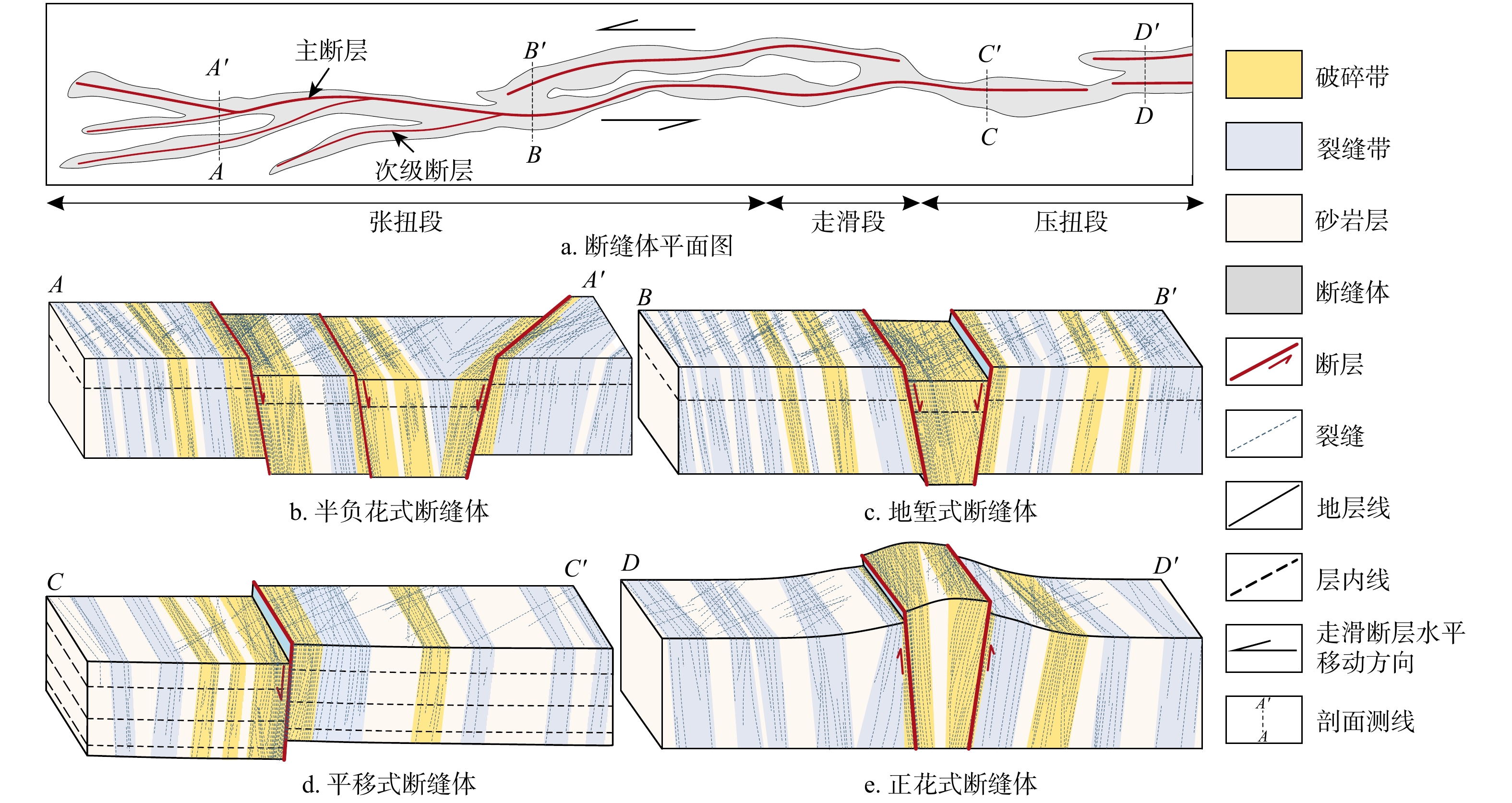
The results showed that: (1) Three types of fault-fracture reservoirs were developed in Xunyi area, namely transtensional type (half-negative flower pattern, graben pattern), pure strike-slip type (closed translational pattern), and compressional-transpressional type (horst pattern). (2) Based on comprehensive parameters such as fault development, rock stratum morphology, and fracture development characteristics of field outcrops, fault-fracture reservoirs were classified into sliding breaking zones, induced fracture zones, and substrate zones. The structural models and quantitative rules of different fault-fracture reservoirs exhibited significant differences, with only fault-fracture reservoirs with the half-negative flower pattern and graben pattern developing wide sliding breaking zones. (3) The fracture density was influenced by the fault-fracture reservoir type, fault separation, fault spacing, fault block location, and sand layer thickness. In general, the highest fracture density was observed in the fault-fracture reservoirs with graben pattern, followed by the fault-fracture reservoirs with half-negative flower pattern, while the lowest density was found in the fault-fracture reservoirs with closed translational and horst patterns. The fracture development increased with larger fault separation, smaller fault spacing, and thinner rock strata. Within the same fault-fracture reservoir, fracture density varied across different fault blocks.

Conclusion

This study identifies the models and corresponding quantitative rules of fault-fracture reservoirs with four patterns, summarizes the effects of various factors on fracture density, and provides more geologically accurate quantitative structural characteristics of fault-fracture reservoirs for underground reservoir characterization.

Apparent phenomenon and origin of "oil-cracking gas" in Kelasu structural belt of Kuqa Depression
XUE Kaiwen, XU Yaohui, WANG Huijun, ZHANG Ke, ZHAO Ya, HE Jiayi, ZENG Qianghao, HE Taohua
2026, 45(2): 118-132. doi: 10.19509/j.cnki.dzkq.tb20250384
Abstract:
Objective

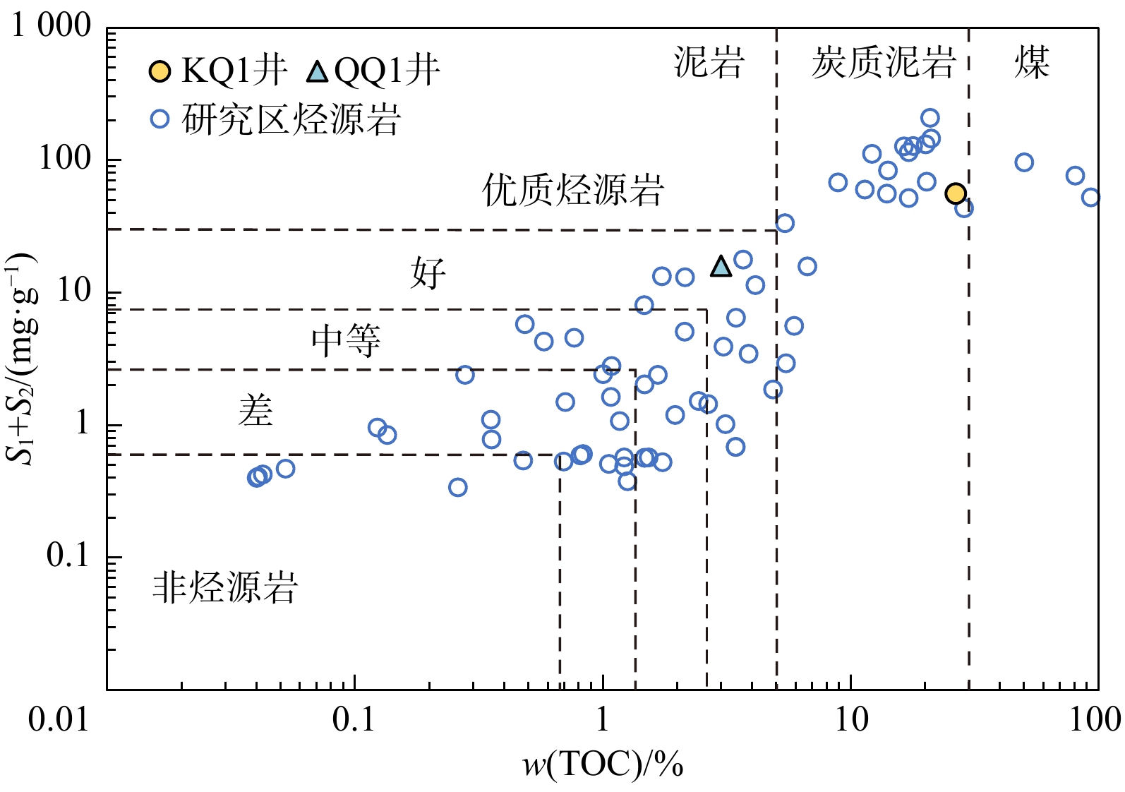
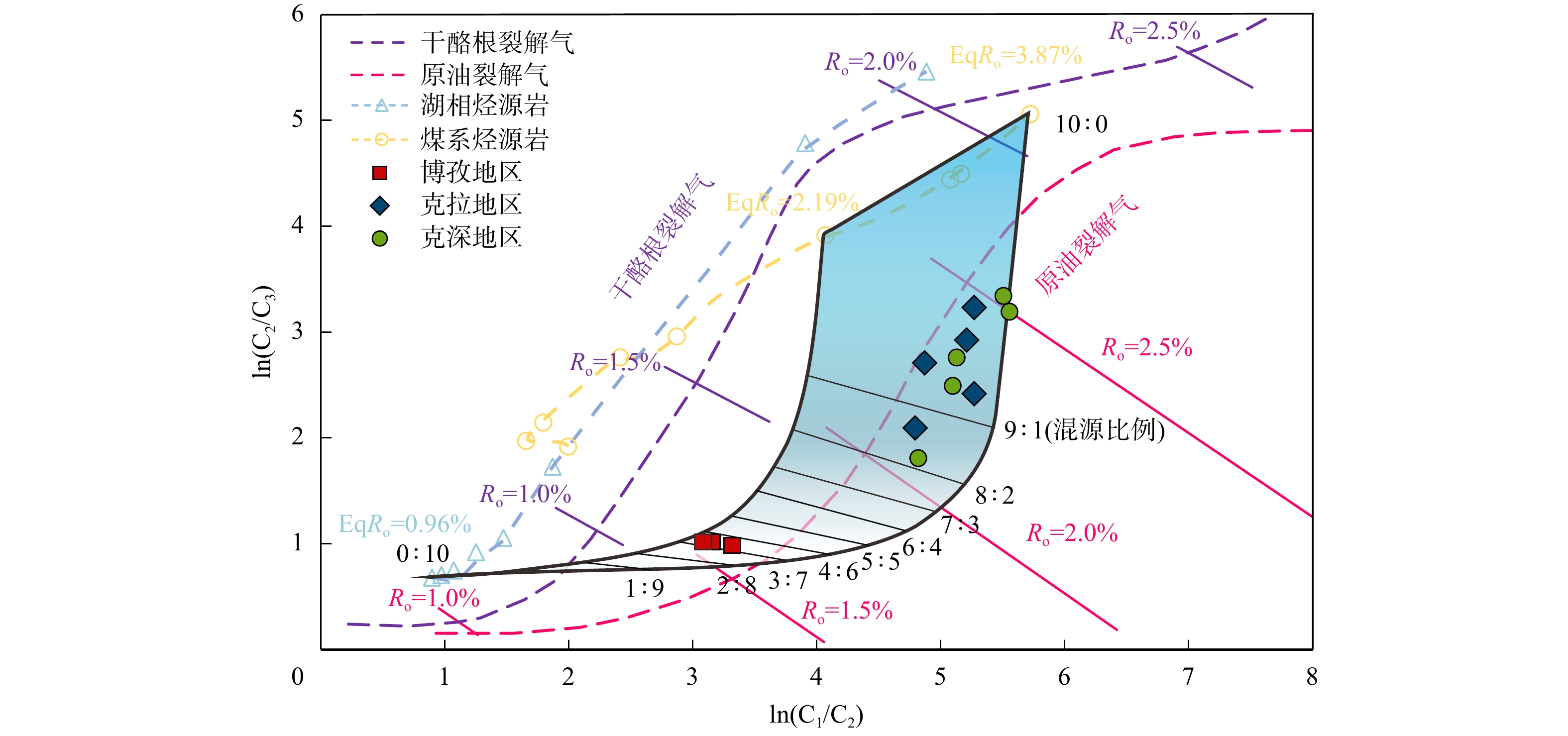
The Kelasu structural belt of the Kuqa Depression in the Tarim Basin hosts abundant deep to ultra-deep natural gas resources, and the reservoirs generally exhibit a high degree of thermal maturity. Natural gas from the Kela-Keshen area exhibits a characteristic "oil-cracking gas" signature on the conventional genetic diagram of ln(C2/C3) versus ln(C1/C2). However, this interpretation is inconsistent with the geological reality, as the area lacks effective Type Ⅰ-Ⅱ kerogen and oil sources, resulting in a discrepancy between the inferred gas origin and the actual geological conditions. To elucidate the apparent “oil-cracking gas” phenomenon and its genetic mechanism in this area, an in-depth investigation of the geochemical characteristics is required.

Methods

Two representative blocks along the East-West trend of the Kelasu structural belt (Bozi and Kela-Keshen) were selected as study areas. Gold-tube thermal simulation experiments, natural gas compositional analyses, and carbon isotope analysis of natural gas were conducted to systematically investigate the thermal evolution characteristics of natural gas derived from different source rocks. On the basis of the ln(C2/C3) versus ln(C1/C2) crossplot, a quantitative analytical model for mixed-source interpretation of natural gas in the Kelasu area of the Kuqa Depression was established.

Results

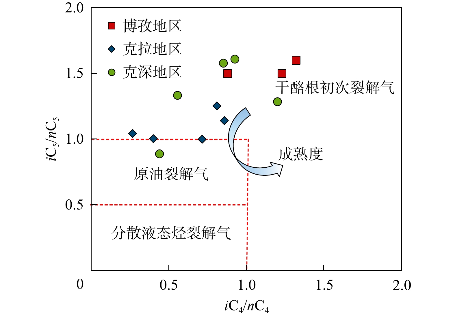
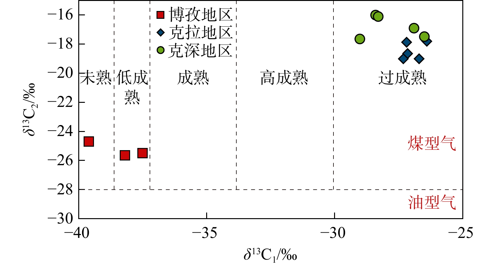
Butane and pentane isomerization parameters (iC4/nC4 >1.0 and iC5/nC5 > 1.0) indicated that natural gas in the Kelasu area was kerogen-cracking gas. Mixed-source proportion calculations revealed that natural gas in the Kela-Keshen area was primarily derived from mature coal-bearing source rocks, with contribution ratios commonly exceeding 80%. In contrast, natural gas in the Bozi area was mainly sourced from lacustrine mudstone, with coal-derived gas contributing only approximately 30%.

Conclusions

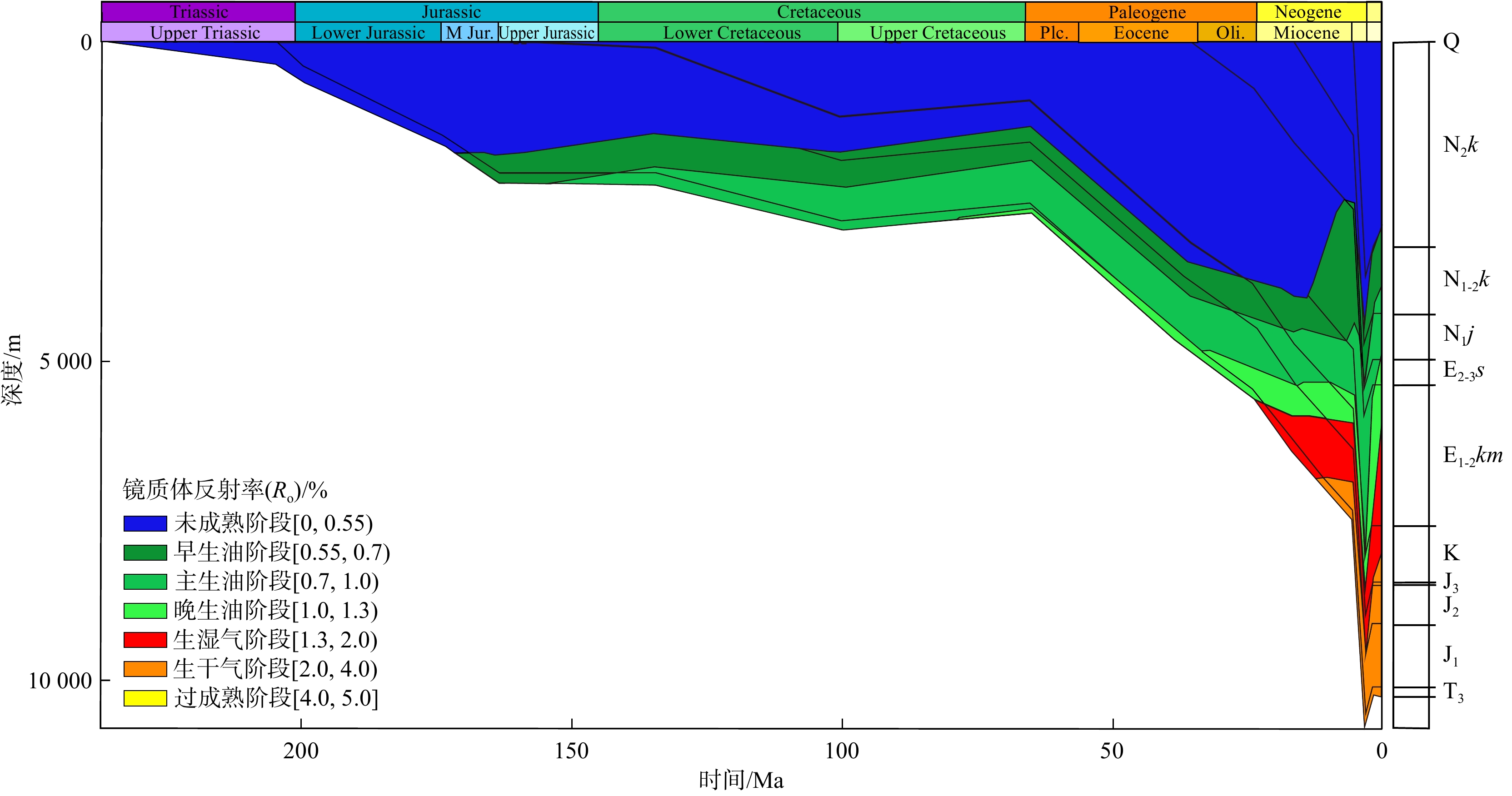
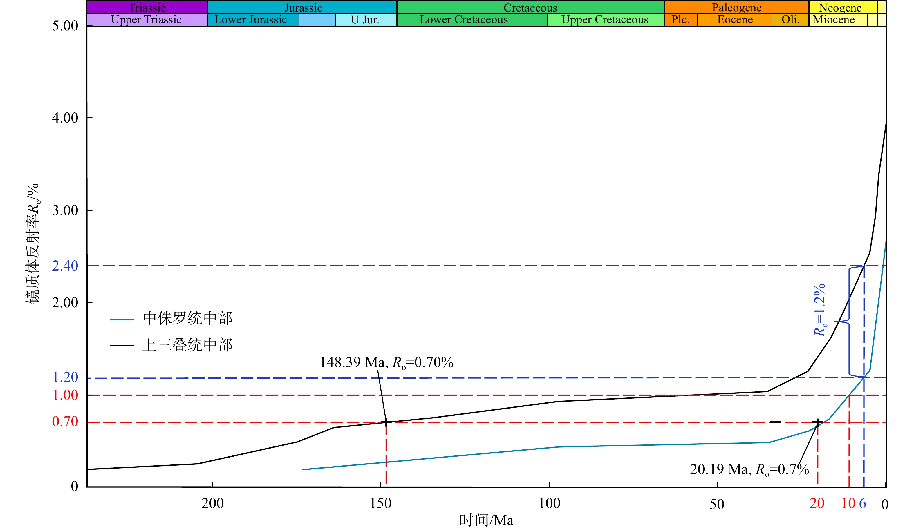
Natural gas in the Kelasu area is not oil-cracking gas, but rather represents cracking products from different kerogen types at high to over-mature stages. The apparent "oil-cracking gas" characteristics displayed on classical identification plots result from the high degree of thermal evolution. The results reveal the complexity of deep natural gas genesis under high evolution conditions, and establish the quantitative analysis method of mixed source gas, which provides a theoretical basis for deep natural gas exploration in Kuqa Depression and similar high evolution basins.

Water seal safety evaluation of multi-period adjacent underground caverns based on the discrete fracture network
WANG Jingkui, CHEN Yuan, ZHANG Bin, LIU Kangneng, PENG Yi, SUN Zhe, WANG Jinchang, PENG Zhenhua
2026, 45(2): 133-145. doi: 10.19509/j.cnki.dzkq.tb20240486
Abstract:
Objective

Many large-scale underground caverns in China are constructed in multiple phases, and the expansion of underground caverns may have a certain impact on the seepage fields of adjacent operating caverns of the same type, potentially leading to a series of safety incidents such as oil and gas leakage. Therefore, ensuring the safety of the water seal after expansion is of critical importance.

Methods

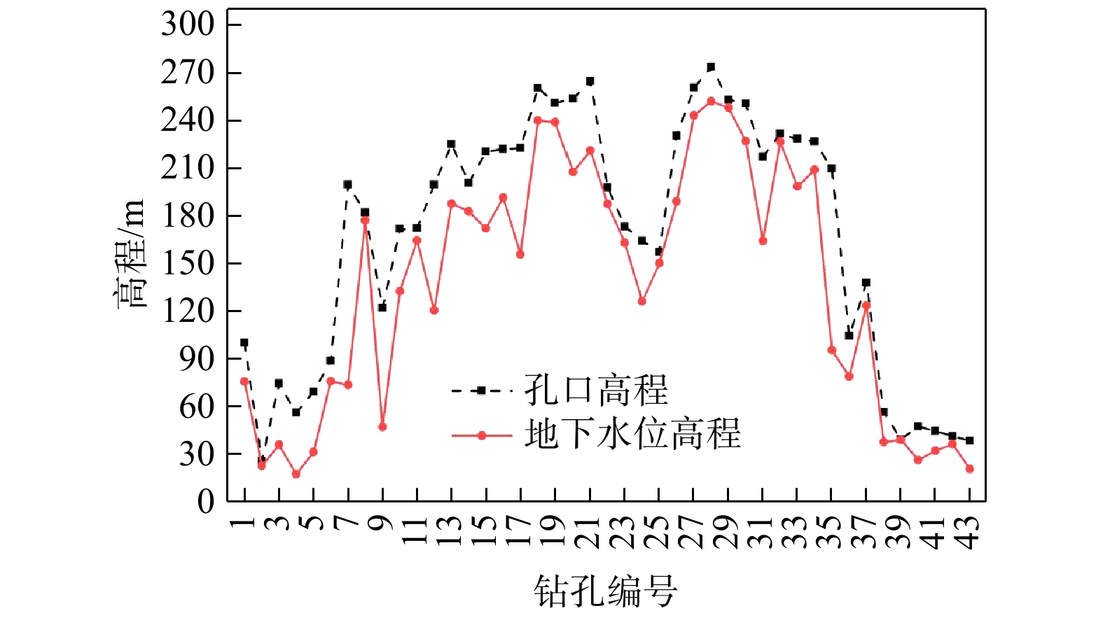
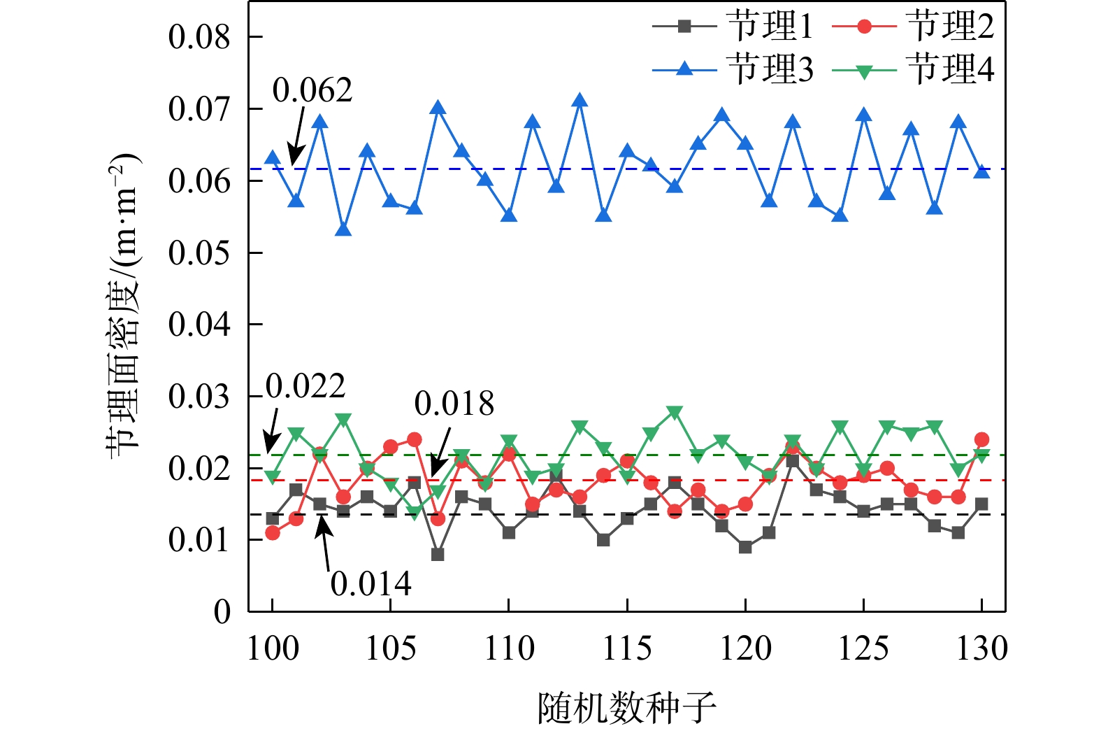
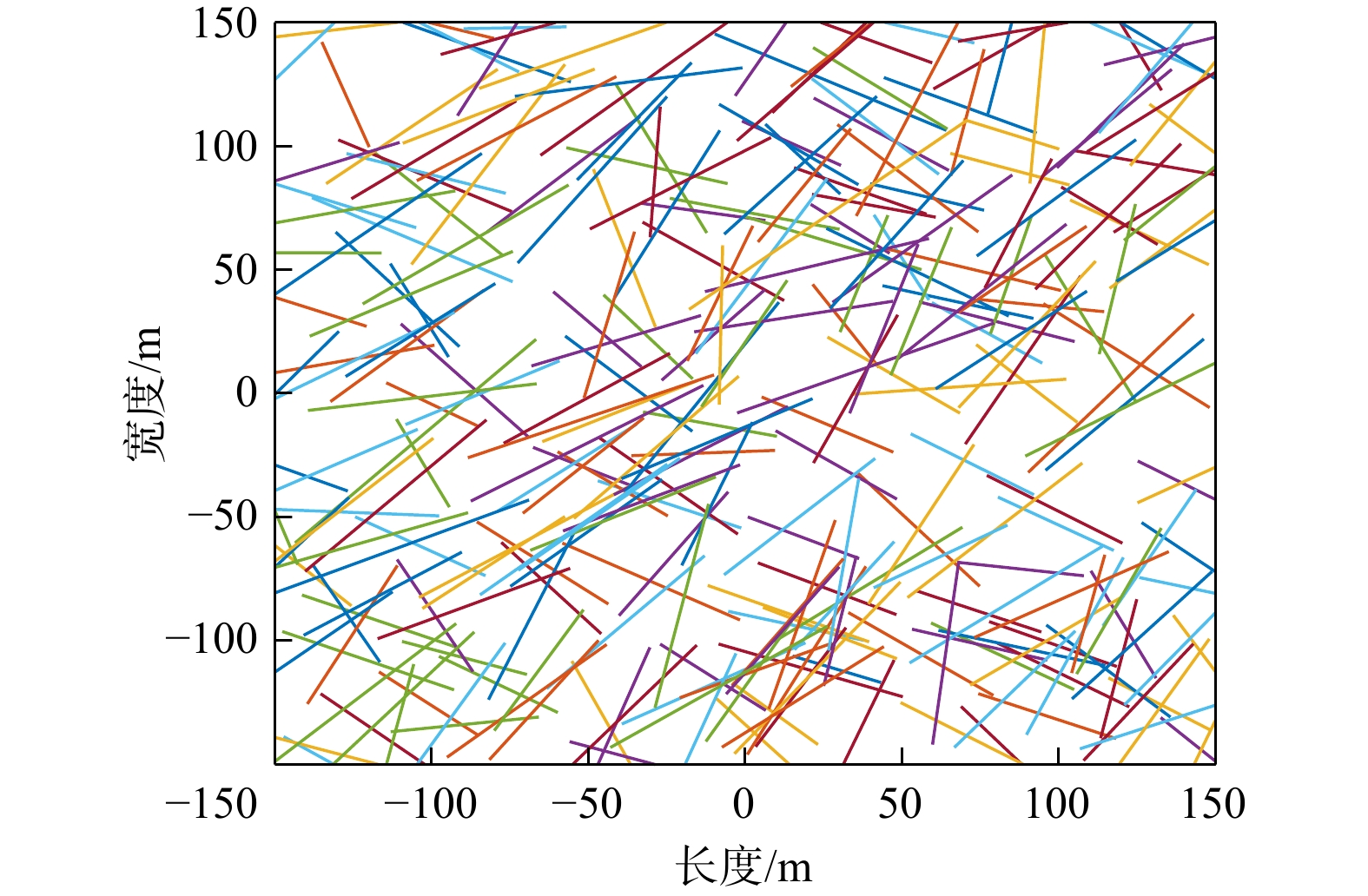
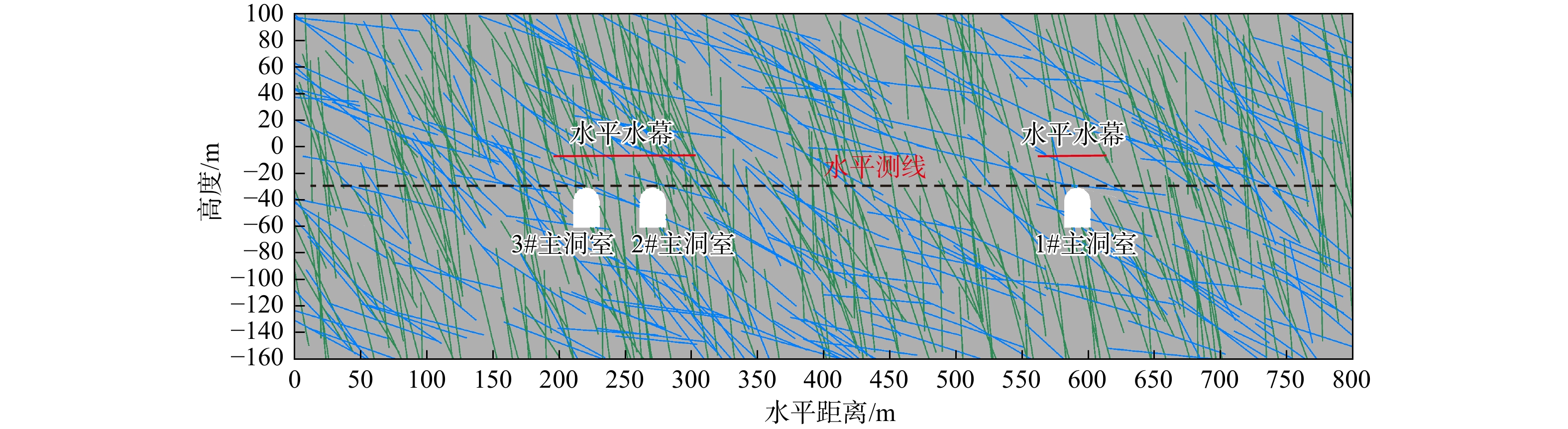
In this paper, to address this problem, the geological conditions and fracture distribution characteristics of the reservoir site area were analyzed based on a large underground cavern expansion project. Considering the joint dense zone connecting the two-stage caverns, and based on the field hydrological test results, the equivalent aperture of the fractures was inverted. A simplified model of the two-stage underground caverns was then established using the discrete fracture network (DFN) approach. The water seal safety of the expanded underground caverns was studied, along with the influence of the expanded caverns on the water seal safety of the operating caverns.

Results

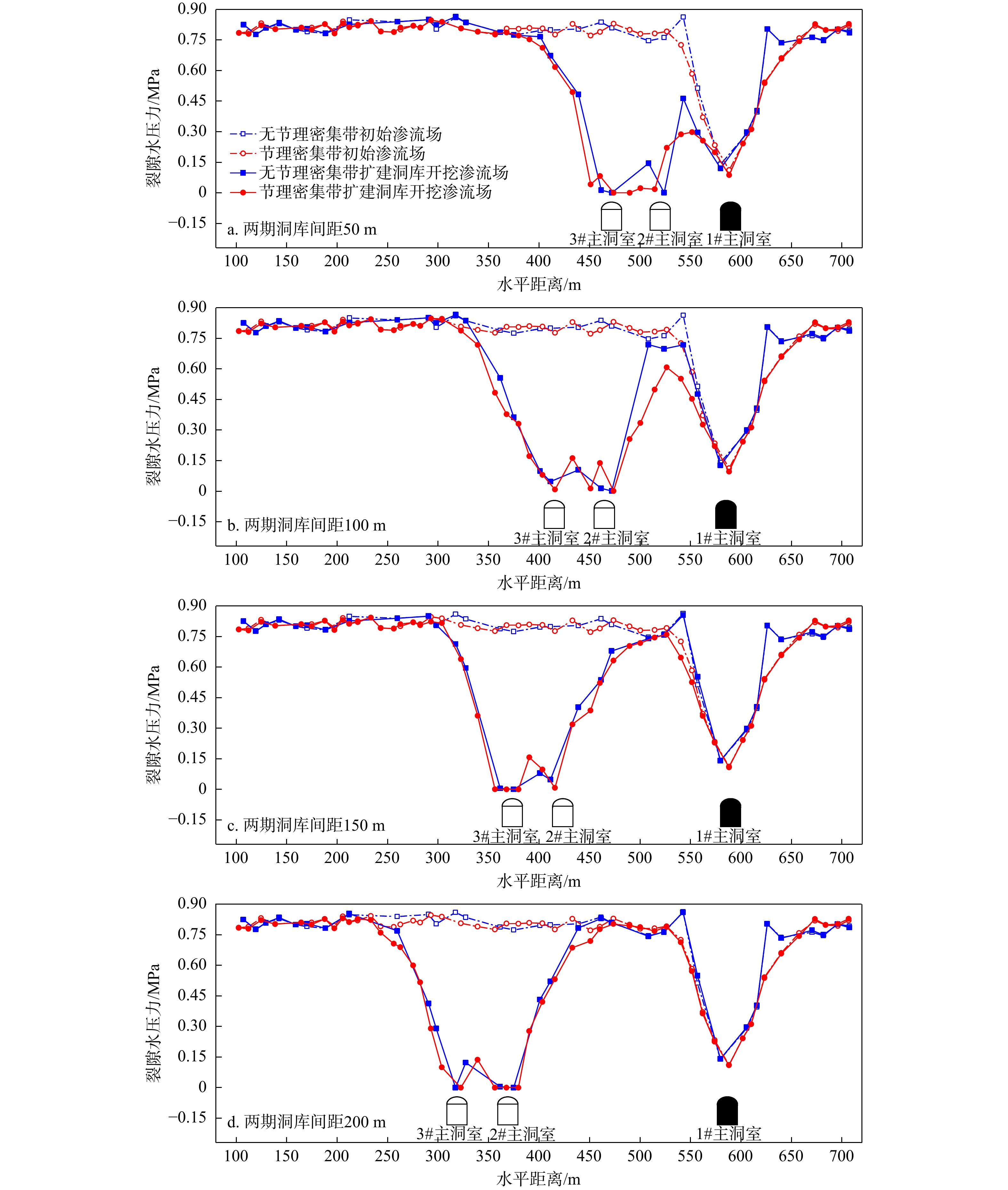
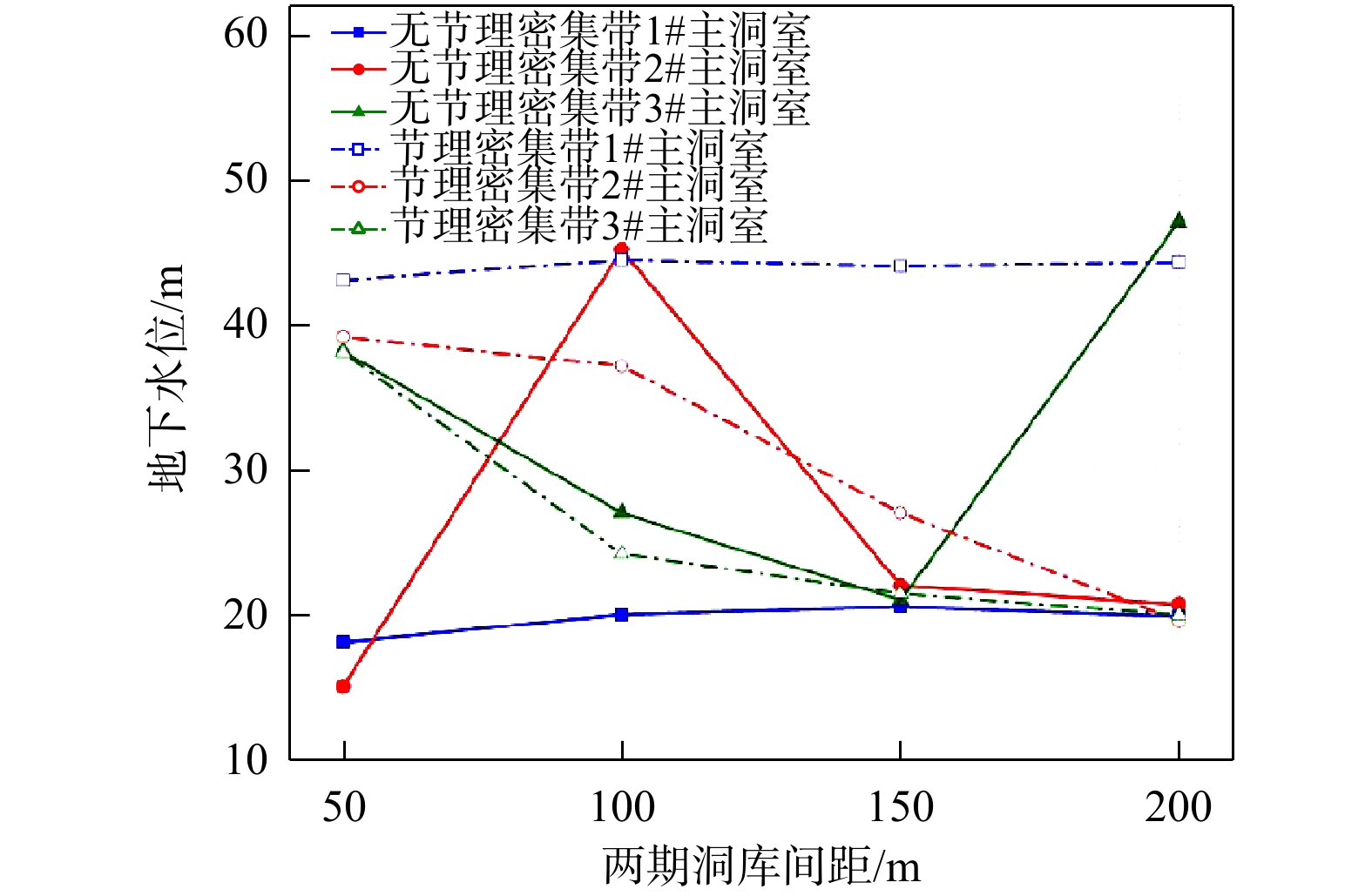
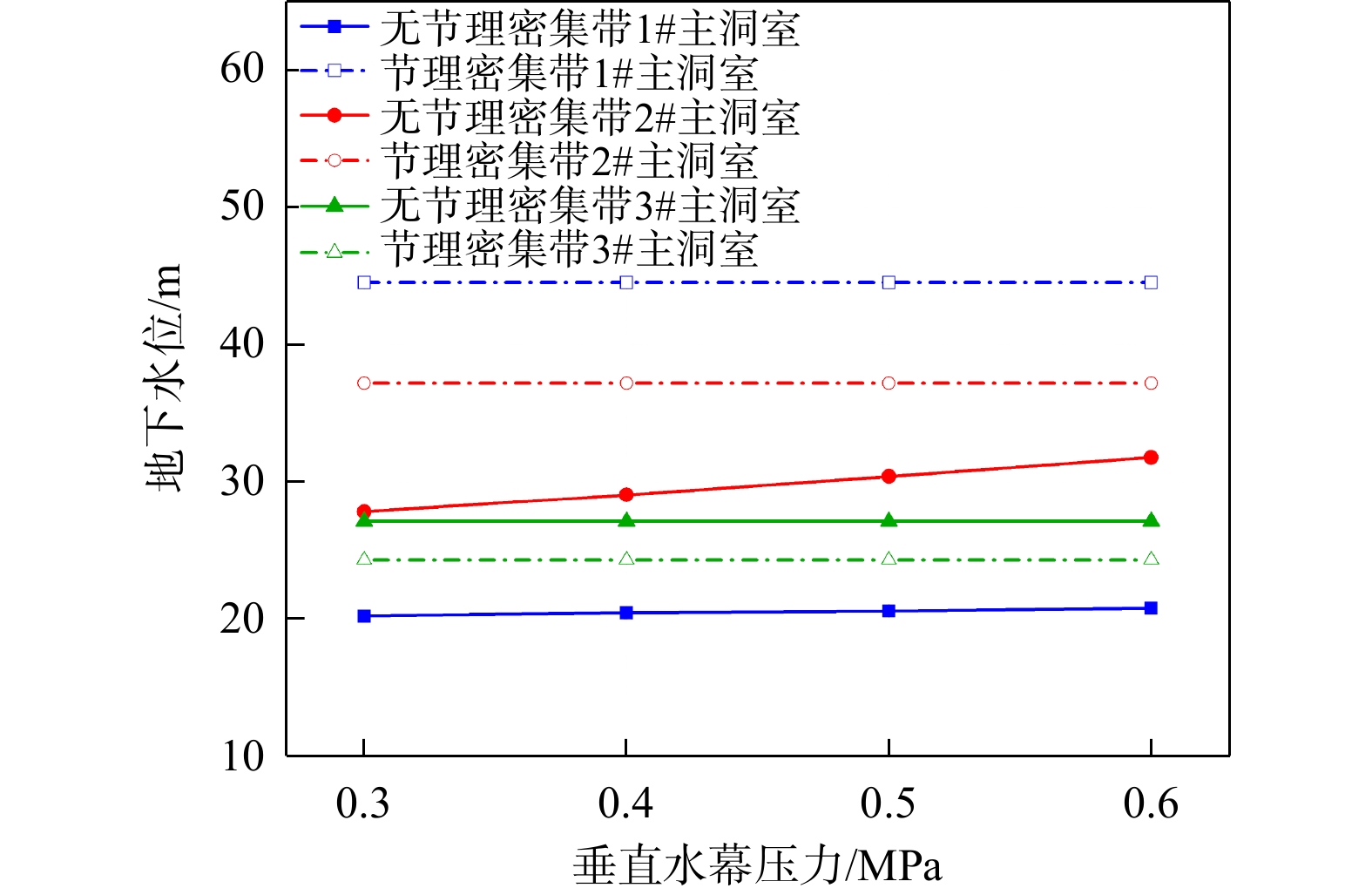
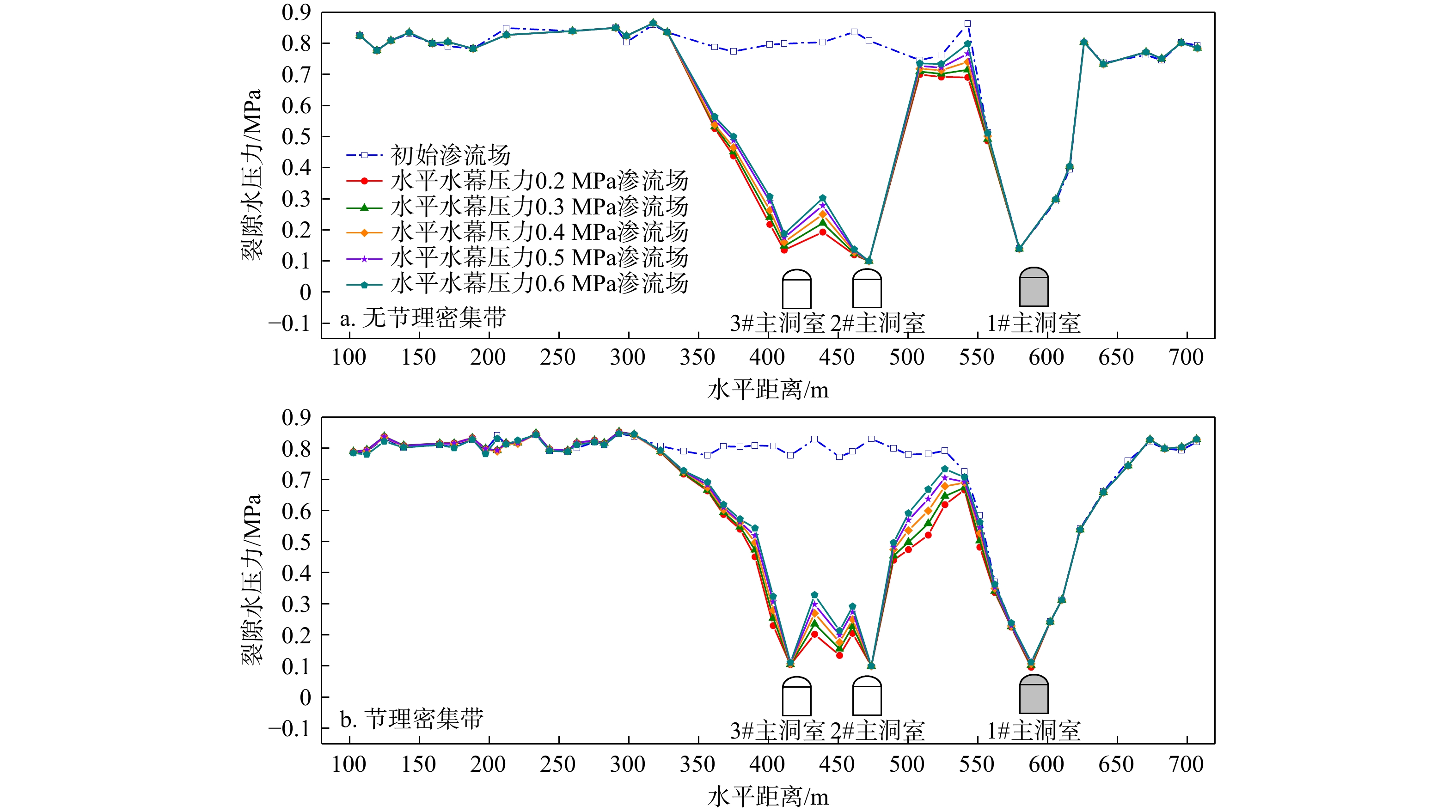
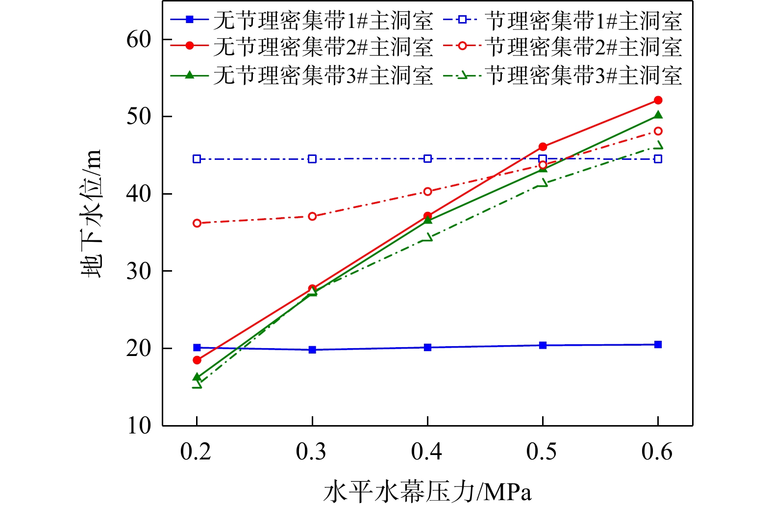
The research showed that the expanded caverns had no effect on the water seal safety of the operating caverns, but the joint dense zone seriously affected the water seal safety of the expanded caverns. Through the study of the factors influencing the water seal safety of the adjacent operating caverns caused by the cavern expansion, it was determined that the minimum safety distance between the caverns was 200 m, and when the vertical and horizontal water curtain pressures were set to 0.4 MPa, these settings guaranteed the water seal safety of both the expanded and operating caverns. Therefore, for large-scale underground cavern expansion projects, the joint dense zone is the key factor affecting water seal safety. Ensuring a minimum safety distance and appropriate water curtain pressure can effectively ensure the safety of both the expanded and operating caverns.

Conclusion

The results provide a theoretical basis for addressing water seal safety problems in the expansion of large-scale underground caverns.

Surrounding rock stability of underground water-sealed caverns based on feedback of multi-source monitoring
SONG Kun, LIU Junqi, RUAN Di, CHEN Jianxiang
2026, 45(2): 146-157. doi: 10.19509/j.cnki.dzkq.tb20240554
Abstract:
Objective

Under complex geological conditions, the mechanical properties of the surrounding rock in underground water-sealed caverns are weakened due to construction disturbances, accompanied by stress redistribution and deformation accumulation, which leads to the increased risk of local instability. The creep effect further exacerbates the deformation and plastic failure of the surrounding rock, posing a threat to the long-term stability of the caverns. Therefore, the study of surrounding rock stability should fully utilize monitoring data to assess the state of the surrounding rock and guide construction and operation.

Methods

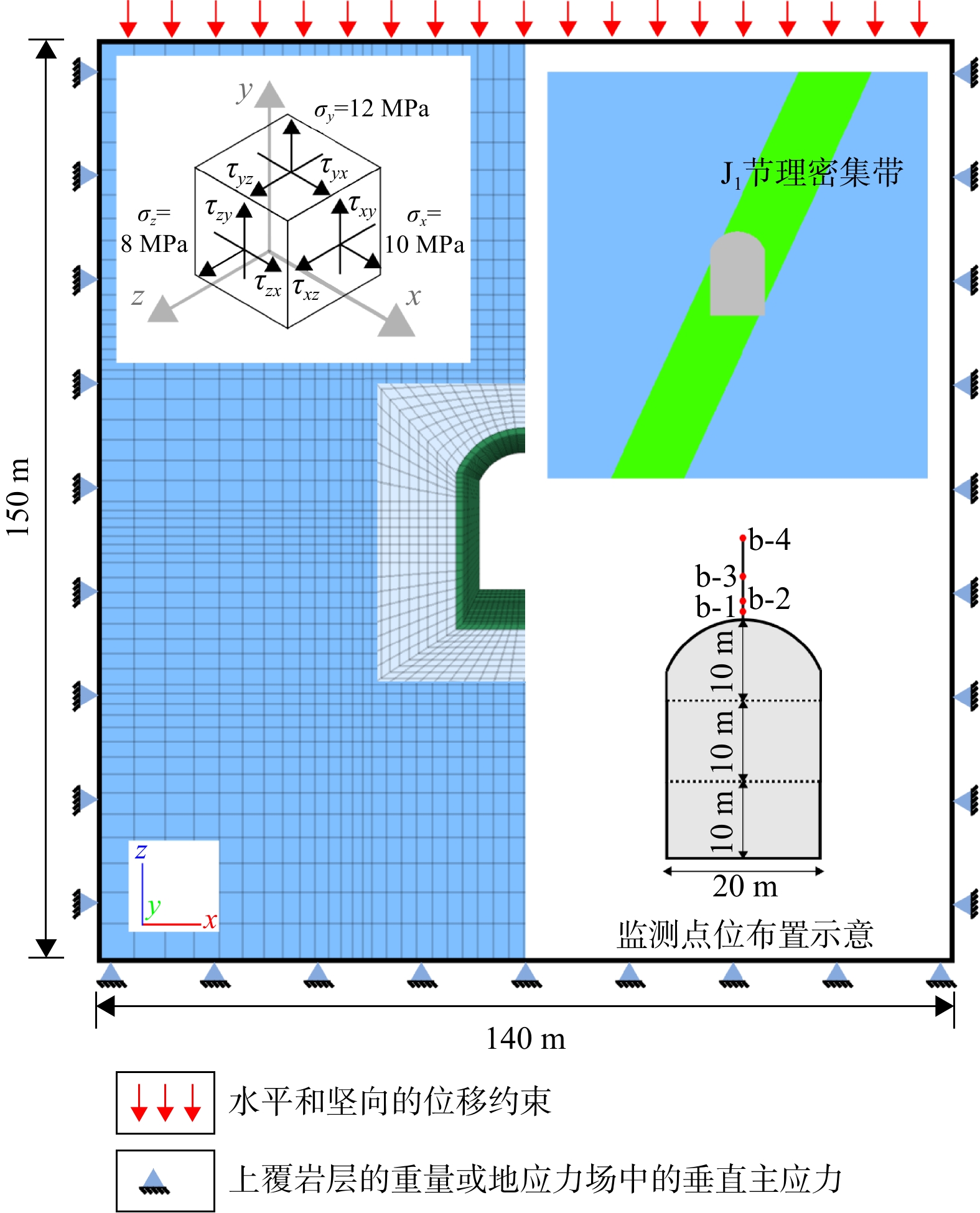
Based on the comprehensive analysis of multi-source monitoring data, including surrounding rock displacement, anchor bolt stress, and borehole wave velocity, numerical experiments with orthogonal design were adopted to invert the mechanical parameters of the rock mass. Meanwhile, the characteristics of pore water pressure, surrounding rock deformation laws, stress variation, and plastic zone distribution characteristics under layered excavation of the cavern during construction were analyzed. Finally, the stability characteristics of the underground water-sealed storage cavern under long-term water-sealing conditions were evaluated using a creep model of the underground cavern group.

Results

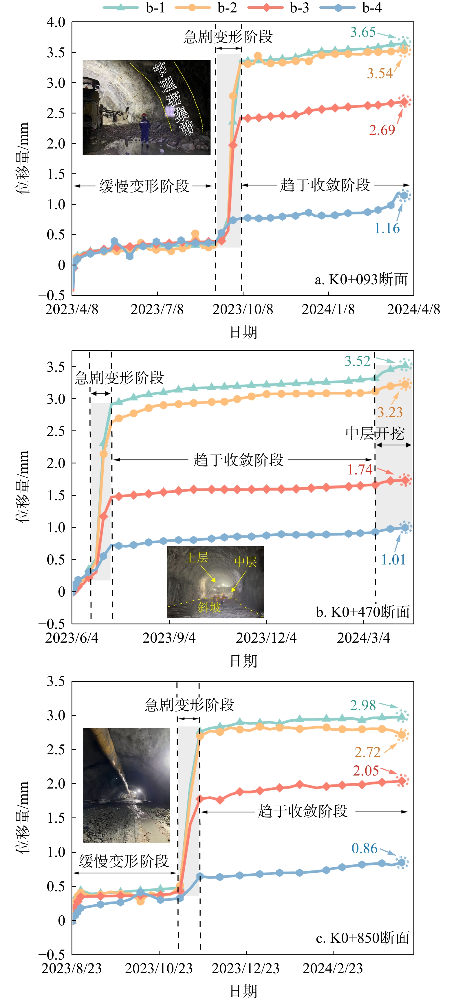
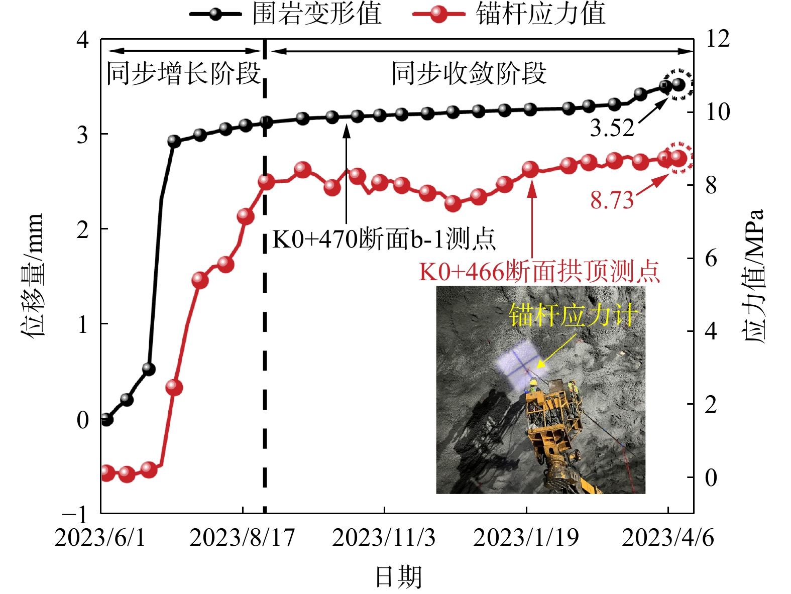
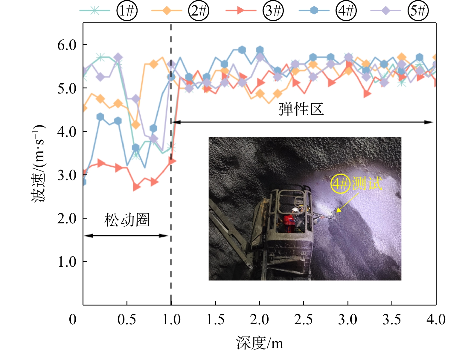
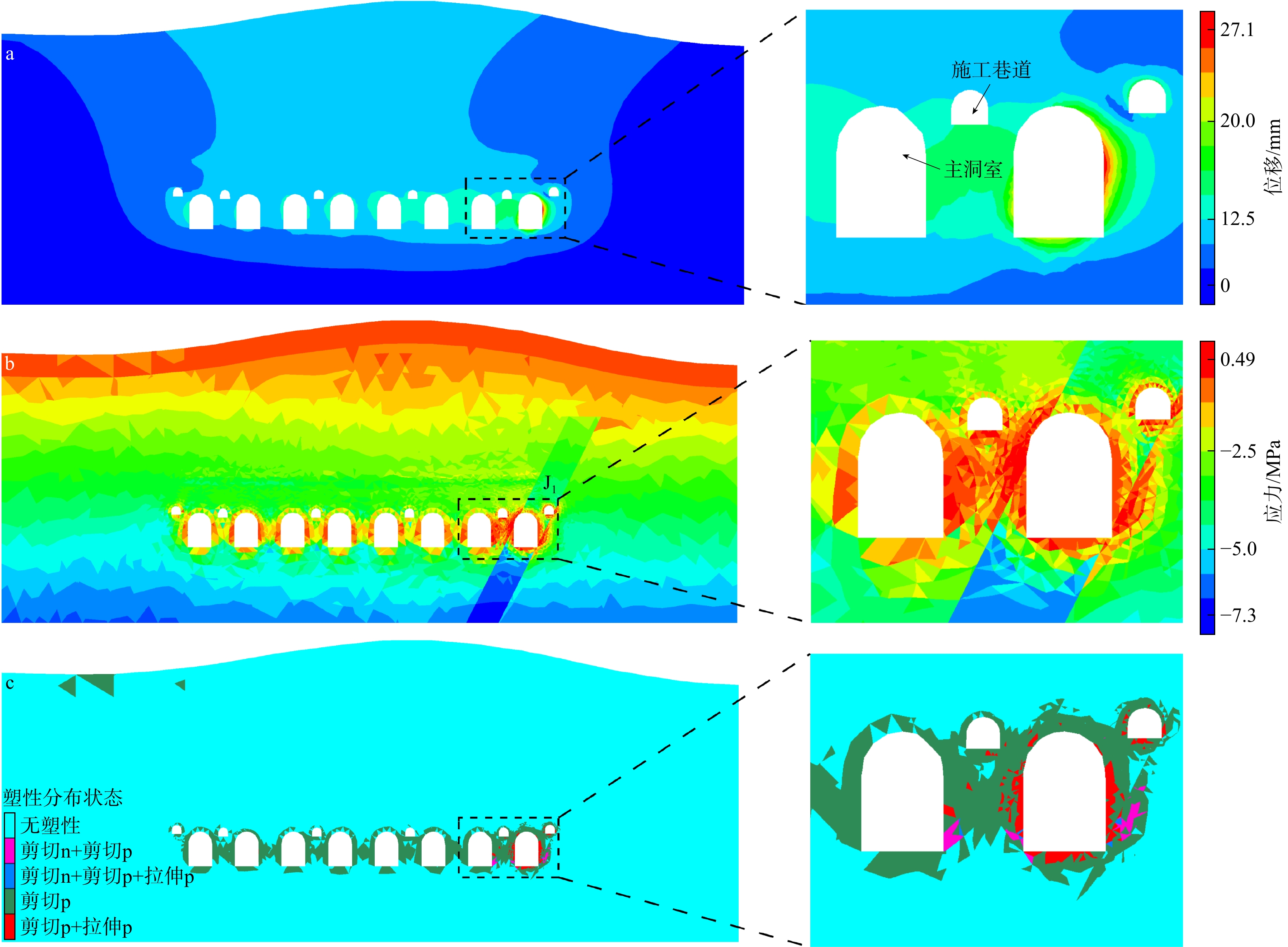
The results show that the deformation of the surrounding rock sharply increases when passing through the monitored section during excavation, with a maximum increment of approximately 3 mm, and then tends to converge. The area affected by the J1 jointed dense zone has a higher displacement value. The overall stress of the anchor rod system is relatively low, and the anchor bolt stress changes synchronously with the surrounding rock deformation. The depth of the loosening zone of the surrounding rock is approximately 1.0 m. During construction period, the pore water pressure in the excavation area approaches 0 MPa, and the seepage flow of caverns and deformation of surrounding rock are densely distributed along the J1 jointed exhibits zone. The excavation of the middle and lower layers causes the displacement at the intersection of J1 and the arch line to increase by 90.4% and 28.7%, respectively. The plastic zone in the sidewalls deepens layer by layer, with a maximum depth of 9.2 m. The long-term deformation characteristics of the surrounding rock are manifested as sidewall convergence > floor uplift > crown settlement. The cumulative deformation at the intersection of the J1 and the arch line during the first year accounts for 92% of the total deformation over 30 years, with a maximum cumulative deformation of 27.1 mm. Under the creep effect, stress is gradually released, and the stress distribution tends to become more uniform. The plastic zone near the J1 expands significantly, while the plastic range in the intact granite area is relatively small, indicating higher long-term stability, indicating that the geological structure-affected zone is the main instability risk zone of the surrounding rock in underground water-sealed caverns.
Conclusion

This study provides engineering significance and reference value for stability evaluation during both the construction and operational phases of underground water-sealed caverns.

Elements, types, and risk zoning of marine geohazards in the sea area of the Qizhou Islands
ZHANG Lin, WANG Chang, SHEN Ao, LI Sihong, SUN Qiliang
2026, 45(2): 158-166. doi: 10.19509/j.cnki.dzkq.tb20240395
Abstract:
Objective

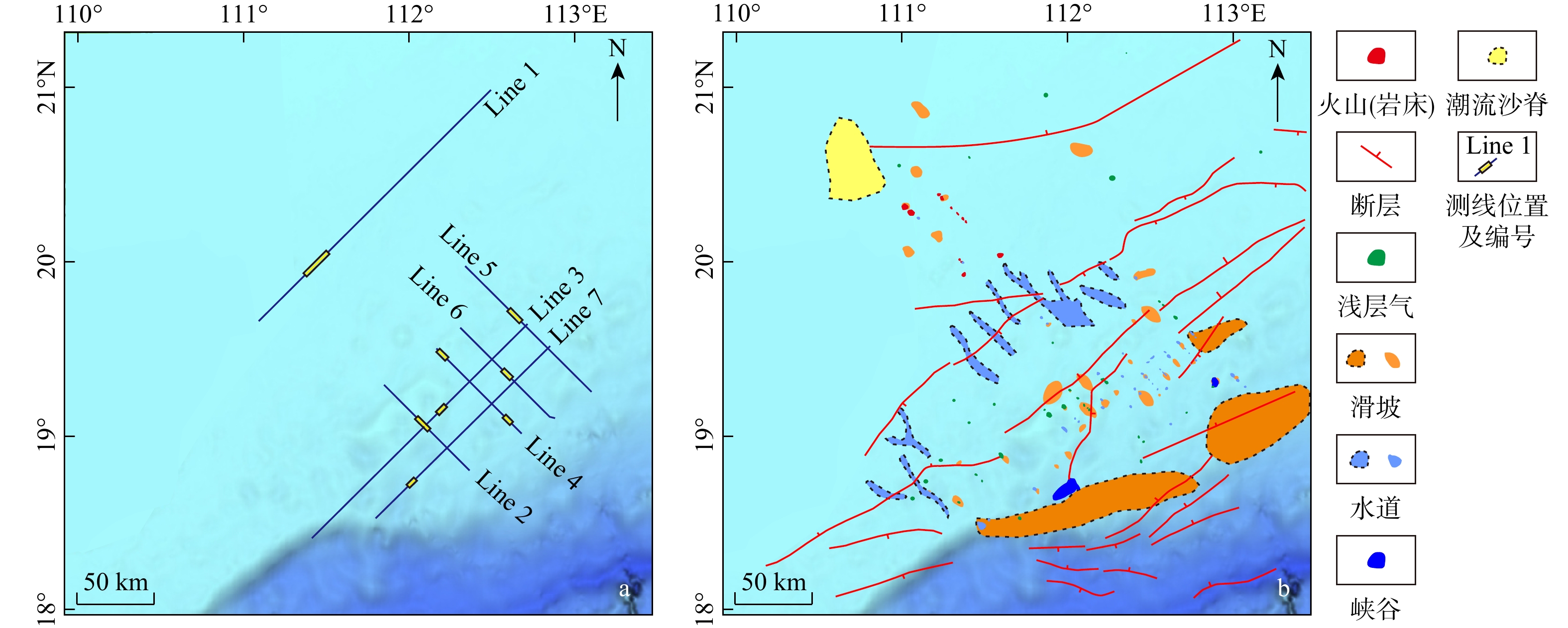
The sea area of the Qizhou Islands, located to the east of Hainan Island, is prone to frequent earthquakes due to the tectonic processes including active fault zones and the Hainan mantle plume. The southern part of the Qizhou Islands is close to the continental shelf break, with well-developed canyons and channels, making it prone to seabed instability and threatening the safety of engineering facilities in this area. However, research on marine geohazards in this sea area is scarce, and the development characteristics of geohazard elements remain unclear. Therefore, it is of great significance to conduct an in-depth study on marine geohazards for disaster prevention and mitigation in this area.

Methods

In this study, 2D seismic data were used to clarify the potential risks of marine geohazards in the sea area of Qizhou Islands.

Results

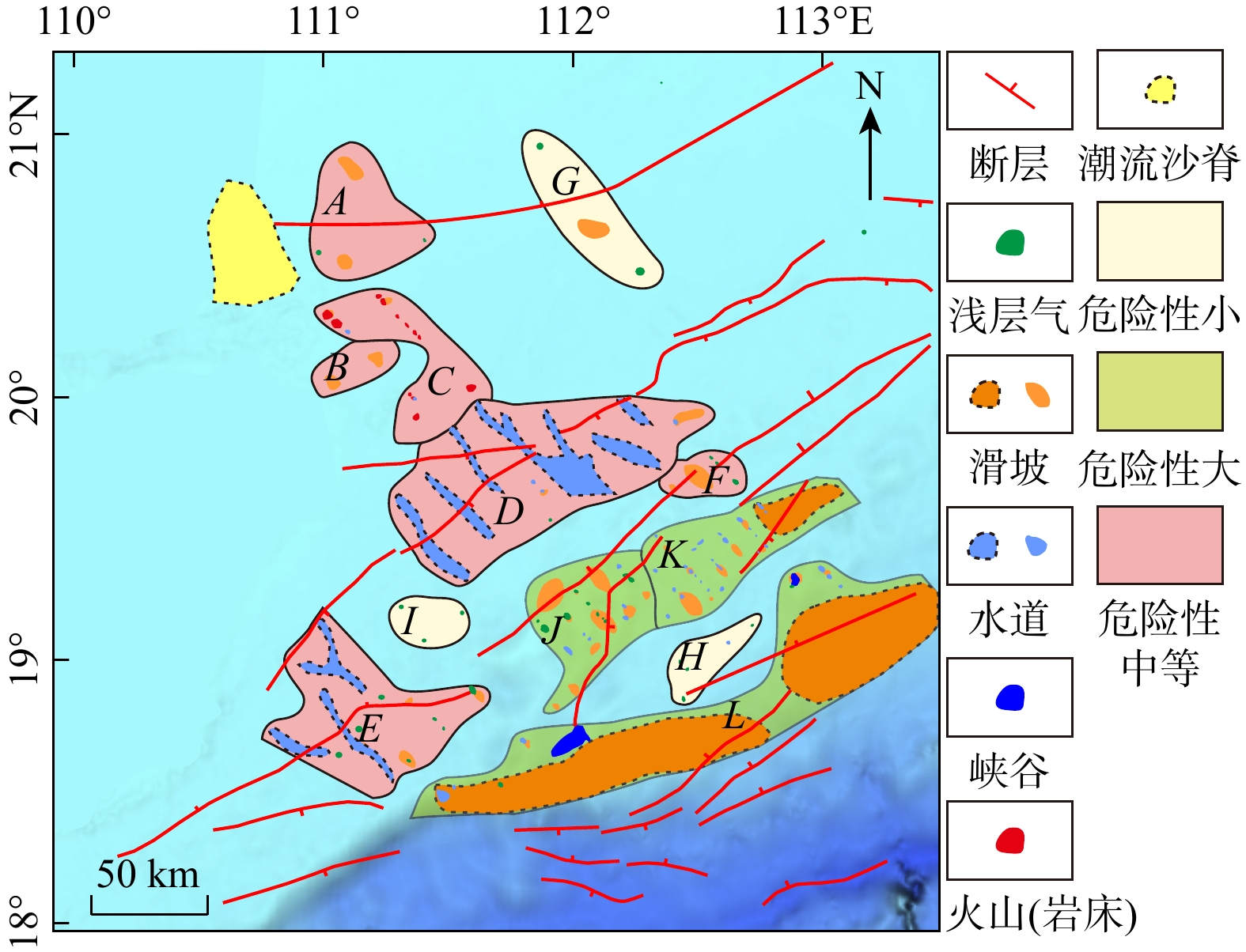
Six geohazard elements were identified in the sea area of the Qizhou Islands: Volcanoes, faults, shallow gas, mass transport deposits (MTDs), channels, and canyons. According to their quantity, scale, and distribution characteristics, the study area was divided into 12 blocks with three risk levels (low, medium and high risk). Based on the topographic, geomorphological, and tectonic activity characteristics of different blocks, targeted recommendations for the prevention and control of marine geohazards in the sea area of the Qizhou Islands are proposed.

Conclusion

The research results provide a scientific basis for disaster prevention and mitigation as well as the construction of marine engineering facilities in the sea area of the Qizhou Islands.

Formation process and connectivity of sliding zone soil of Huangtupo landslide in the Three Gorges Reservoir area
REN Xinglong, PING Xianquan, ZHENG Guodong, GONG Songlin, WANG Qiuxia, HAO Kaixiang, LI Xin
2026, 45(2): 167-179. doi: 10.19509/j.cnki.dzkq.tb20240503
Abstract:
Objective

The characteristics of sliding zone soil play an important role in landslide stability and activity, and are also essential factors for effective landslide prevention and control. Existing research on sliding zone soil primarily focuses on physical stability assessments, including monitoring of sliding mass displacement, whereas limited studies explore the chemical characteristics of sliding zone soil, especially sliding zone clay.

Methods

To address this gap, a comprehensive analysis of sliding zone soil samples from the Huangtupo landslide was conducted using X-ray powder diffraction (XRD), X-ray fluorescence spectroscopy (XRF), Mössbauer spectroscopy, and magnetic susceptibility.

Results

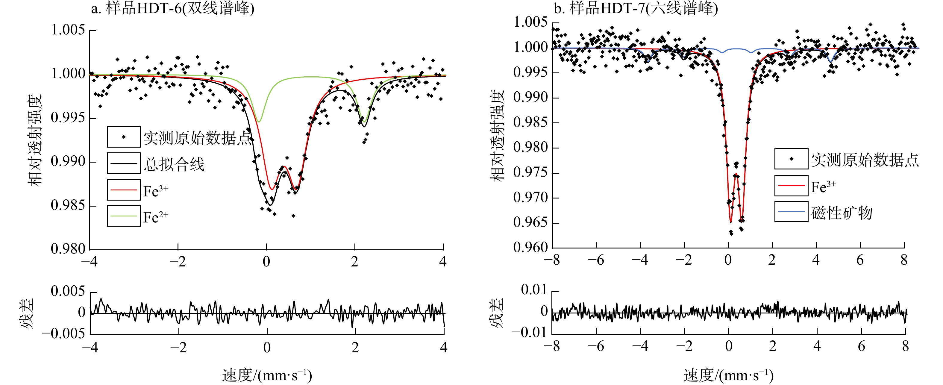
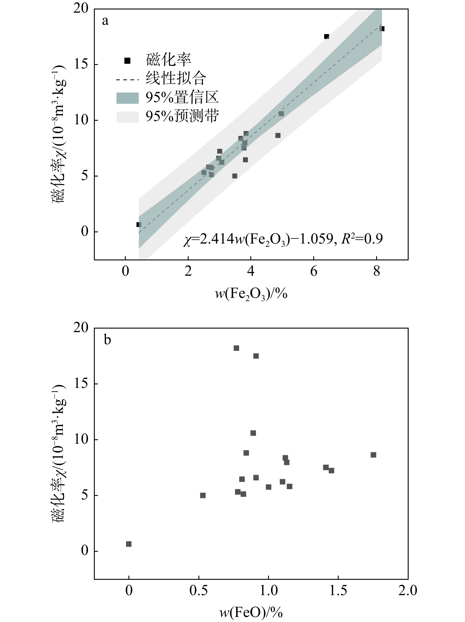
The results revealed that intense water-rock interactions in the sliding zone led to the dissolution of calcite and the formation of clay minerals. These processes caused a loss of Ca and the relative enrichment of Si, Al, and Fe, resulting in continuous deposition and aggregation of clay minerals in the sliding zone, and formed a typical strip-shaped or nest-like sliding zone soil. The sliding zone soil was enriched in Fe3+ but depleted in Fe2+, indicating a relatively strong oxidation environment. This suggested that the sliding zone had good connectivity with the surroundings, and the water in the sliding zone and the external water (especially the infiltration of surface water) might be in a relatively smooth and stable circulation state. Therefore, the ${\rm{Fe}}^{{3+}}/\Sigma {\mathrm{Fe}} $ ratio of sliding zone soil can be used to indicate the connectivity and chemical stability of the sliding zone. The higher the magnetic susceptibility of the sliding zone soil, the higher the corresponding Fe3+ content, and the better the connectivity of the landslide, indicating that the landslide is more stable. Based on the results of magnetic susceptibility and total iron content of the samples, an empirical formula $ {\text{Fe}}^{\text{3+}}/\Sigma{\text{Fe}}=(\chi +1.059)/{\text{2.414}}w(\text{T}{\text{Fe}}_{\text{2}}{\text{O}}_{\text{3}} $) is proposed. This formula enables a quick calculation of the ${\rm{Fe}}^{{3+}}/\Sigma {\mathrm{Fe}} $ ratio of the sliding zone soil to identify the redox environment and evaluate the connectivity and stability between the sliding zone and the surrounding environment. This approach enhances the timeliness of landslide risk assessments.

Conclusion

The research results provide a new basis for landslide stability evaluation.

Experimental study on the effects of different rainfall patterns on deformation and failure of bedding rock slopes with weak interlayers
SHEN Yanshen, ZENG Xin, CHEN Feifei, LI Xi, CHEN Mengyuan, ZHANG Guangcheng
2026, 45(2): 180-195. doi: 10.19509/j.cnki.dzkq.tb20240494
Abstract:
Objective

The Three Gorges Reservoir area, a region prone to heavy rainfall, is one of the most landslide-prone areas in China. Under the influence of rainfall, bedding rock slopes are particularly susceptible to landslides. Statistics indicate that 64% of the massive and large landslides occur in such structural rock slopes, especially bedding rock slopes with weak interlayers, posing severe threats to the safety of people and property. Therefore, understanding the deformation characteristics of these bedding rock slopes and their response to rainfall patterns is of great significance for the construction and operation of the reservoir area.

Methods

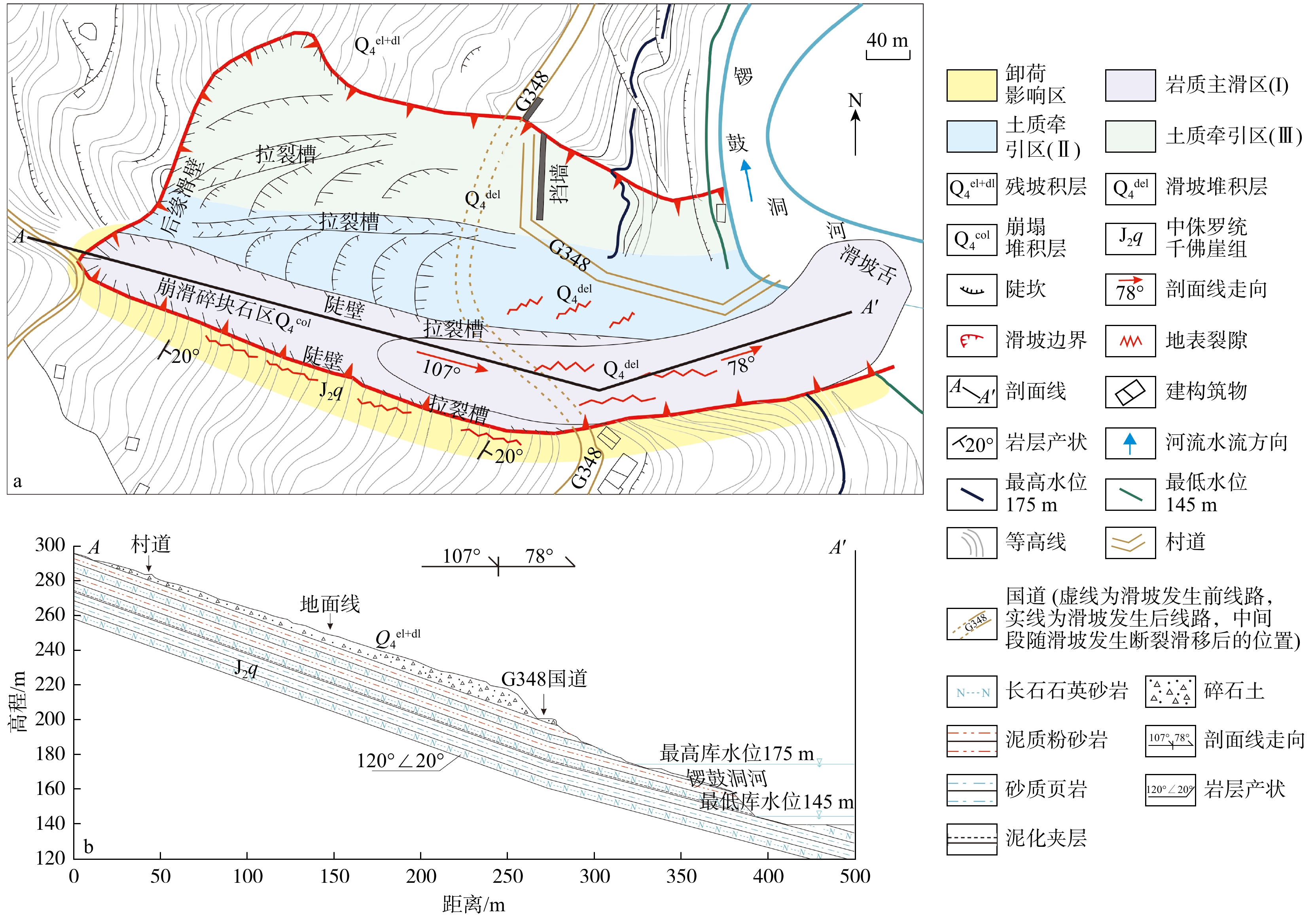
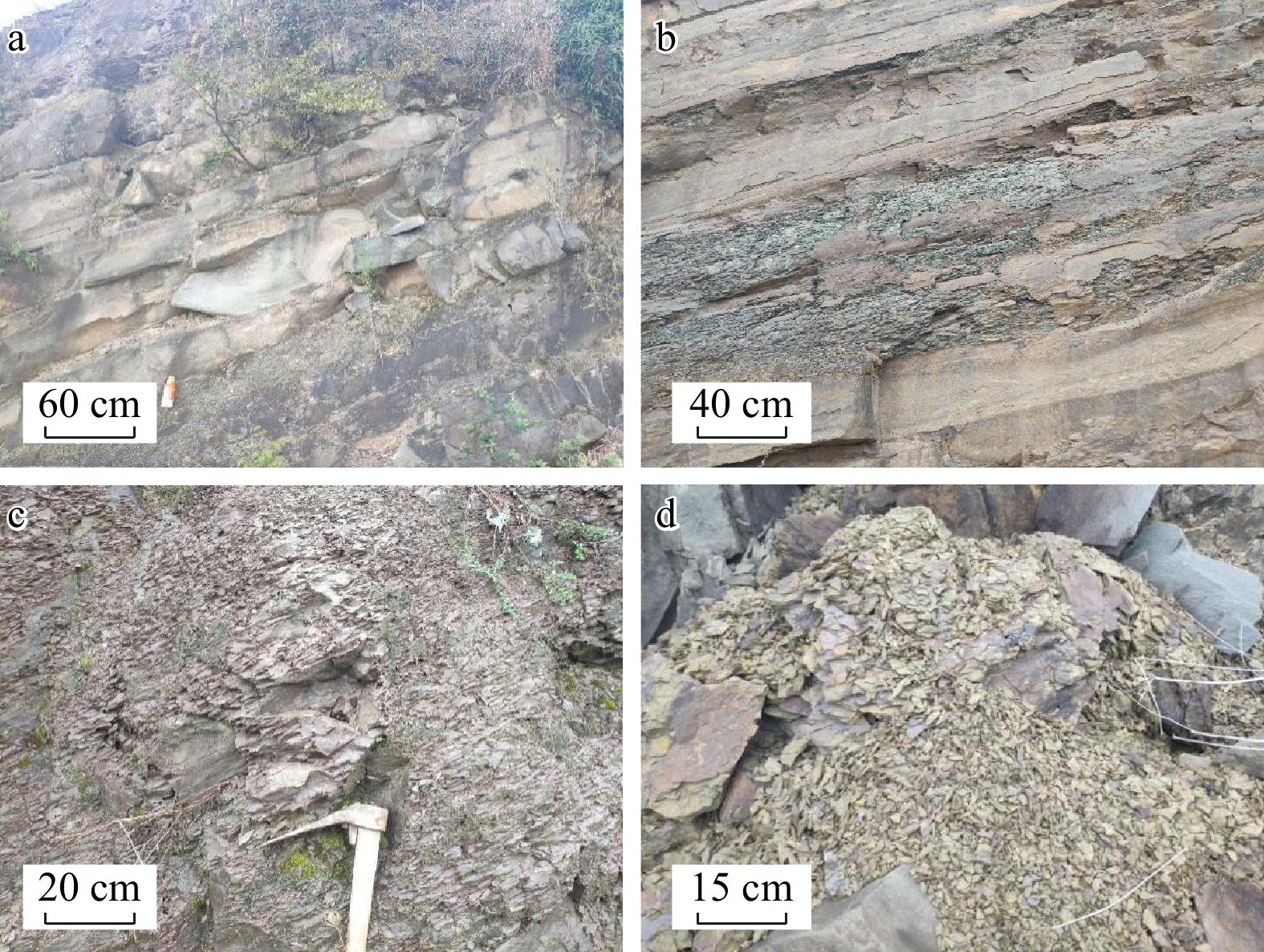
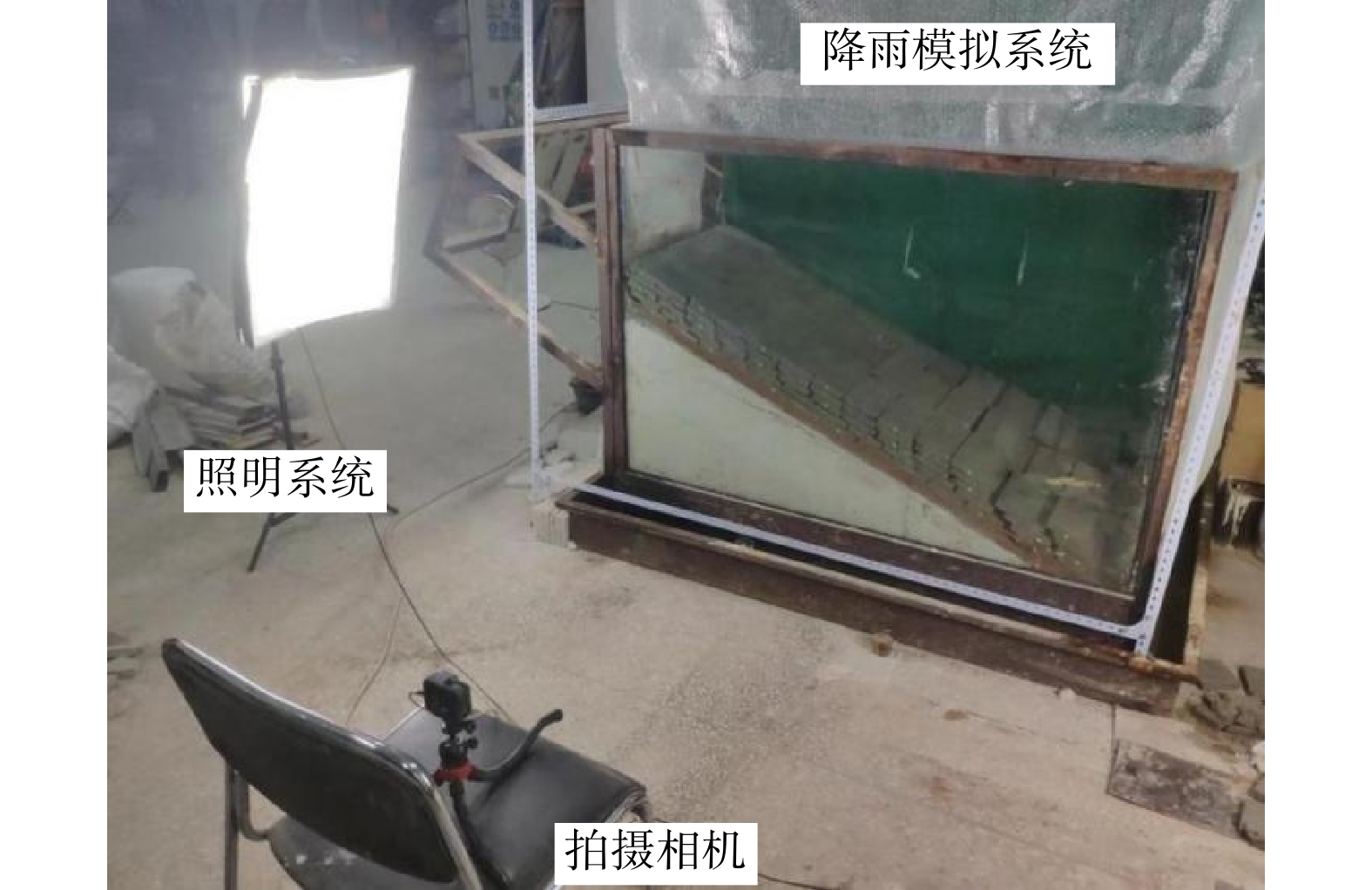
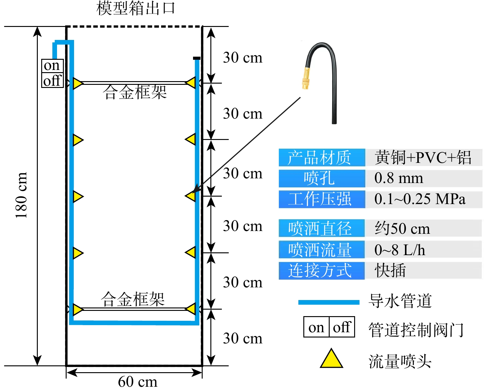
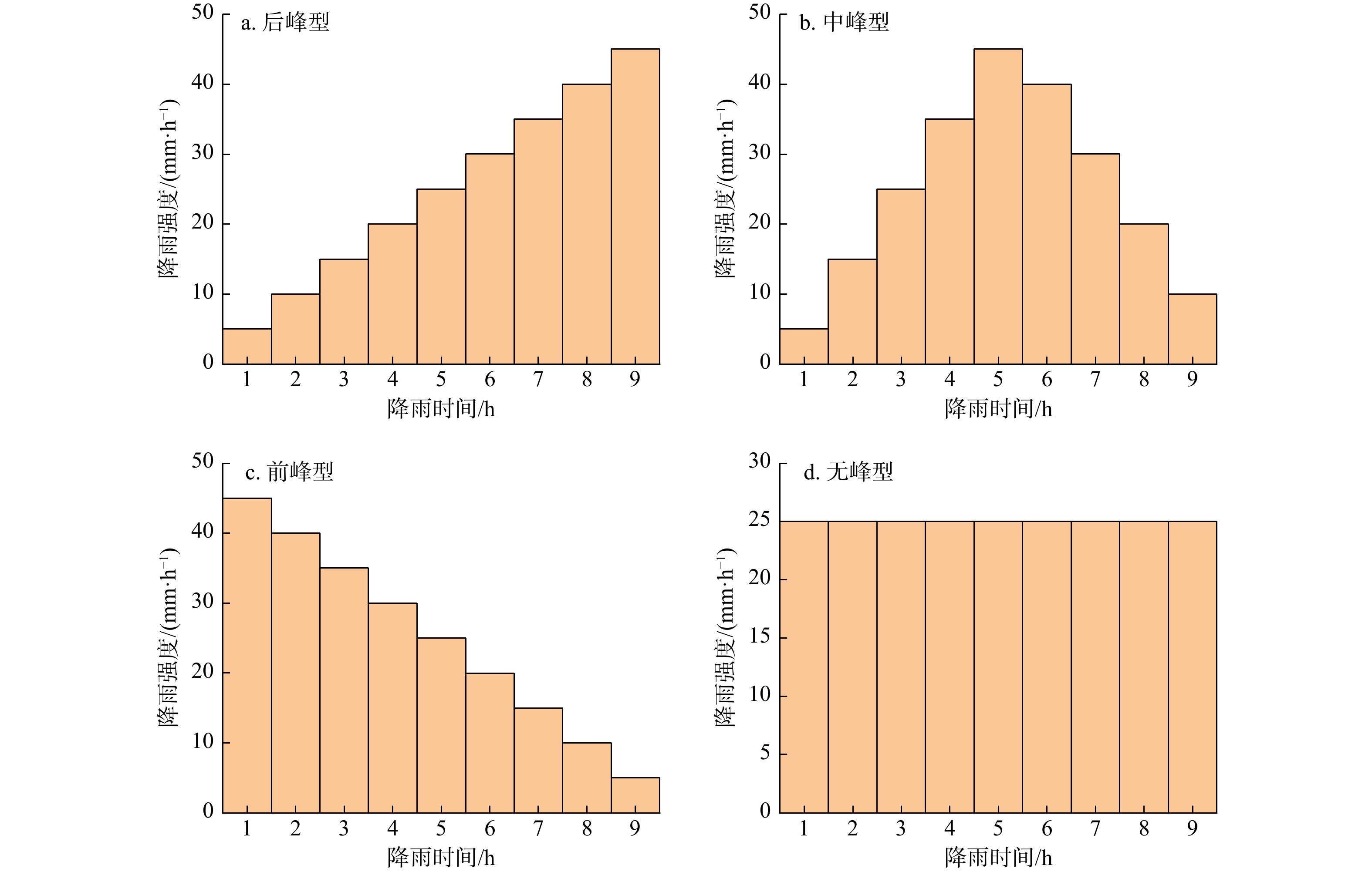
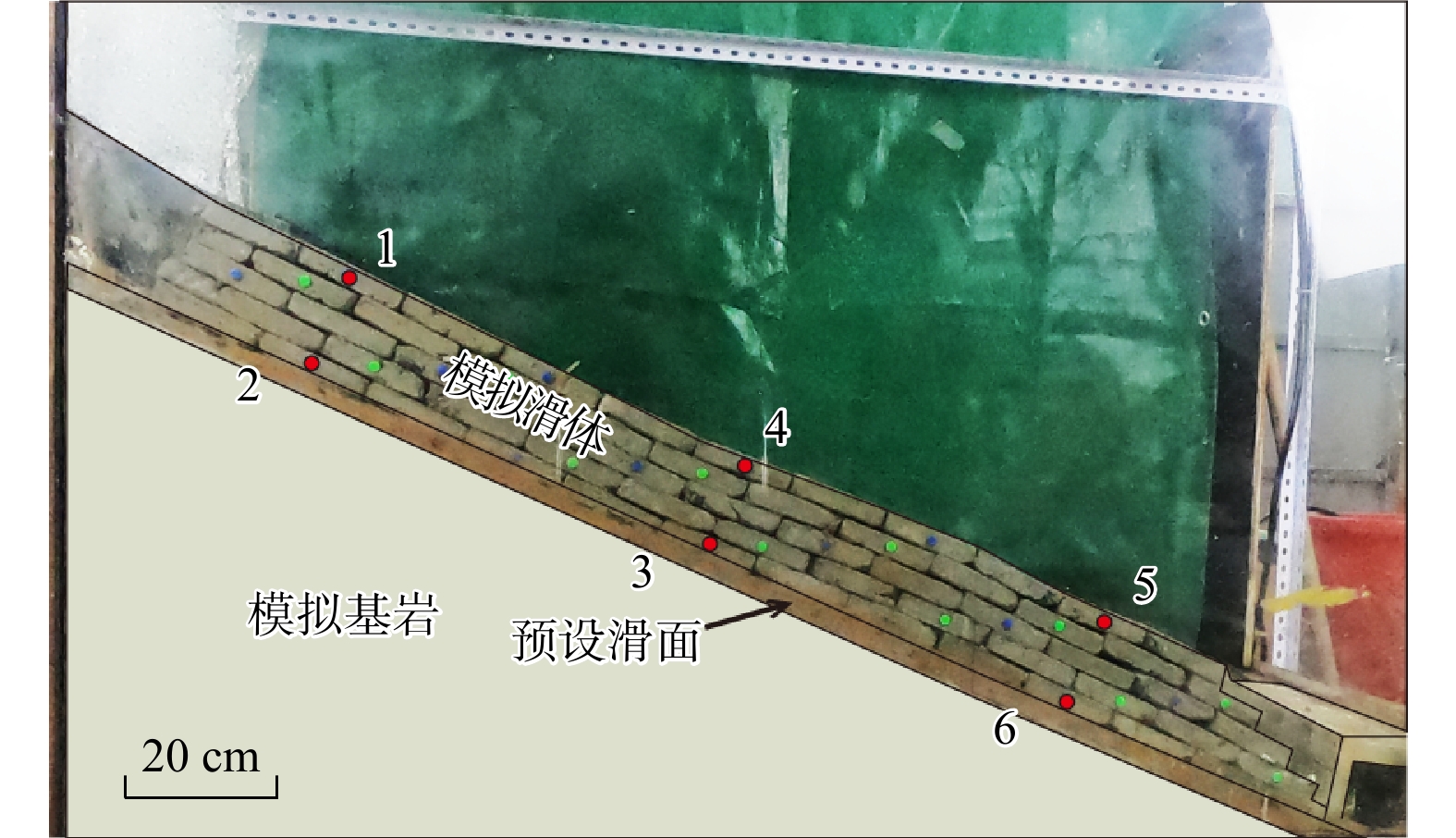
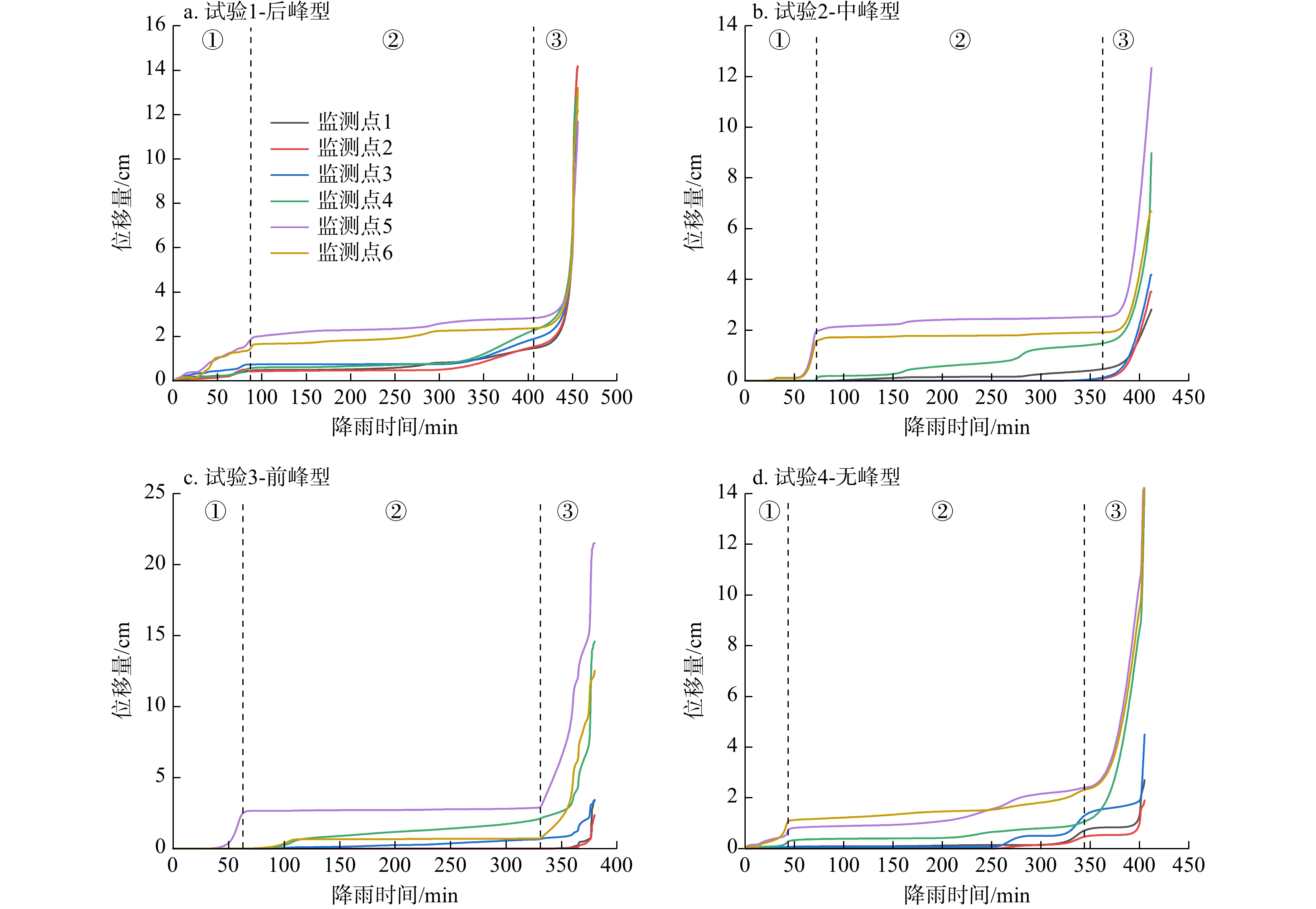
This study used the Shanshucao bedding rock slope as a prototype and conducted scaled physical model tests to simulate the entire deformation and failure process of bedding rock slopes with weak interlayers under four different rainfall patterns: Front-peak, middle-peak, rear-peak, and no-peak. The tests were designed to analyze the evolution characteristics of the stress field and seepage field within the slope and to identify the stages of slope deformation and failure.

Results

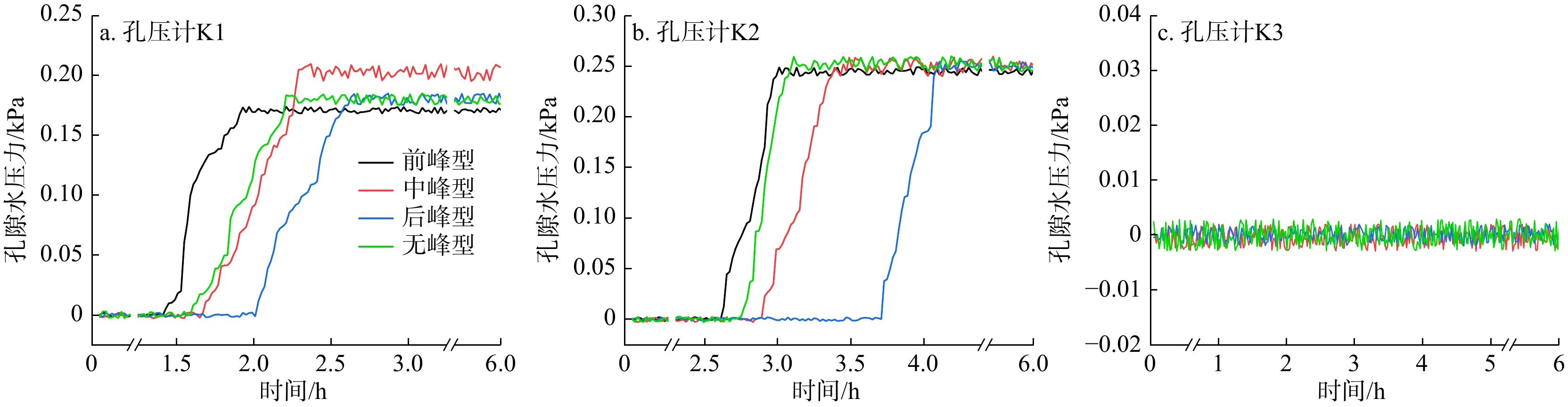
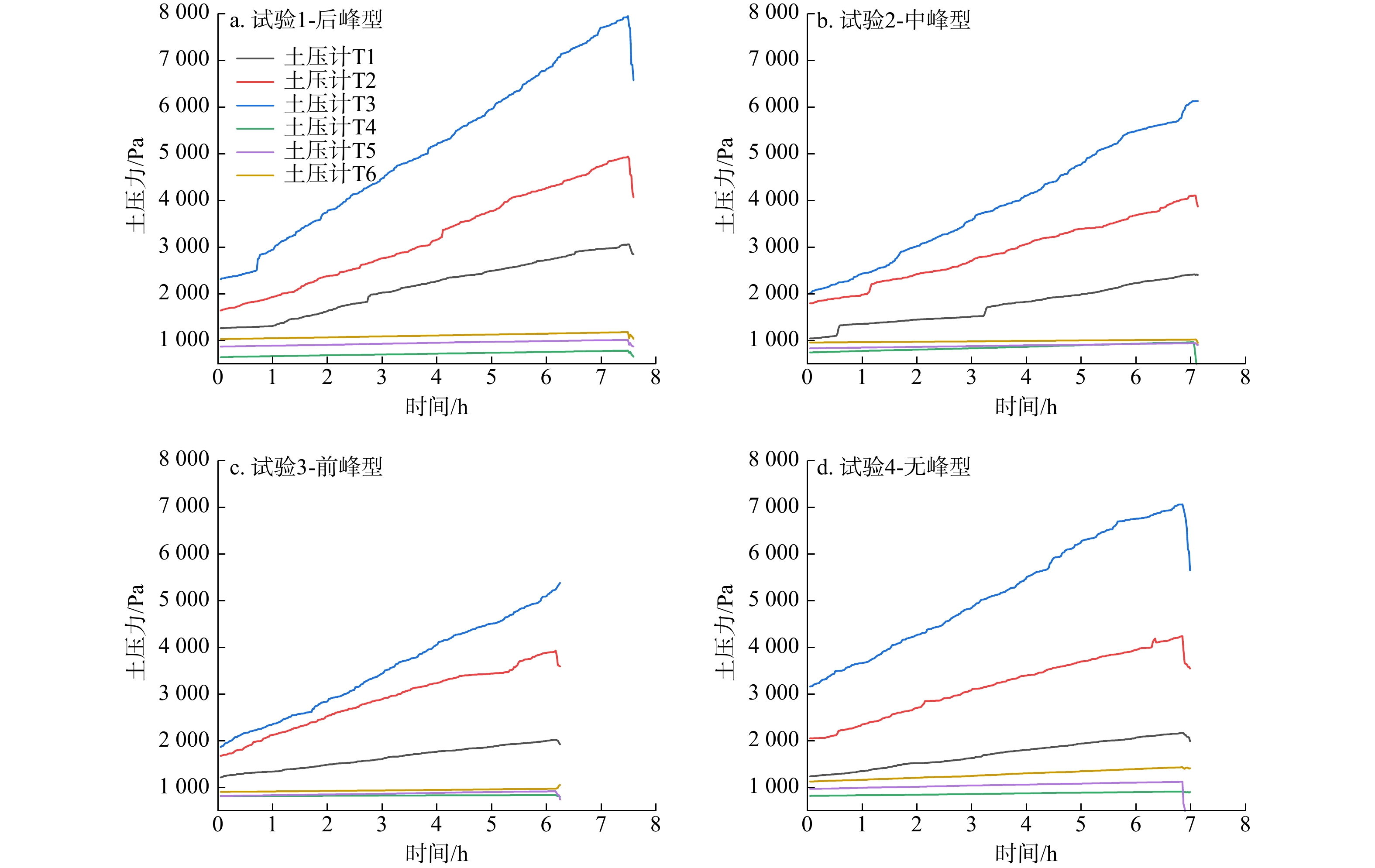
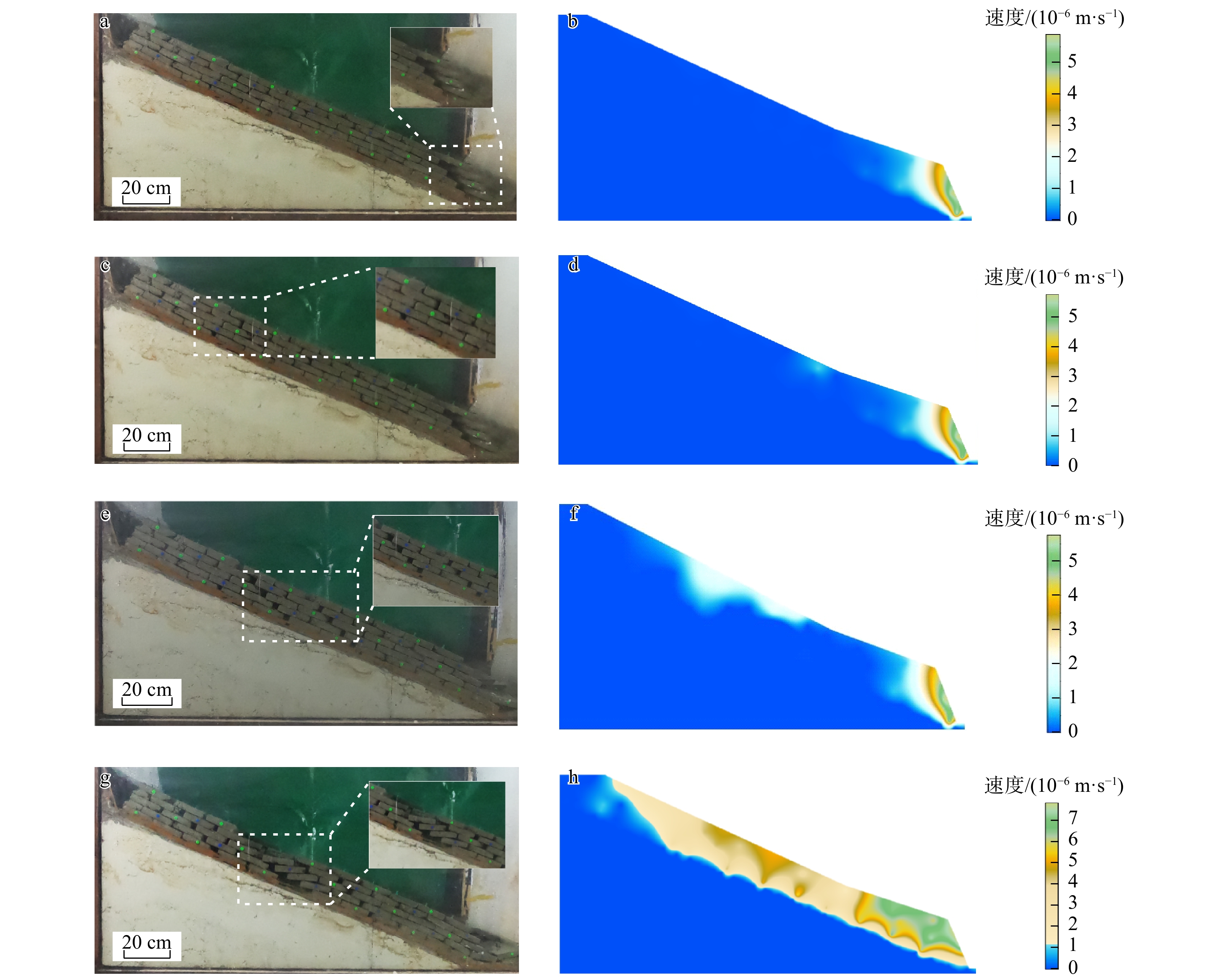
The research findings indicated that: (1) Different rainfall patterns primarily affected the response time of stress and seepage in the weak interlayer, with minimal impact on the interaction forces within the rock mass. (2) The stress redistribution caused by bedding rock slopes with weak interlayer was mainly concentrated in the weak interlayer, with the stress variation being most significant at the toe of the slope. Although the trends of pore water pressure and displacement changes in the weak interlayer were generally similar under different rainfall patterns, there were significant differences in the initial response time of pore water pressure. (3) Under different rainfall patterns, the landslide failure modes were mainly characterized by overall sliding failure and local sliding-tensile cracking failure. As the rainfall peak position shifted forward, the traction-type failure became more pronounced, which manifested by a forward shift in the location of the rear edge cracks of the landslide. (4) Based on the macroscopic deformation characteristics of the slope observed in the physical model tests and multi-field monitoring data, the deformation and failure process of the bedding rock slope could be divided into three stages: Deformation at the leading edge, the strain accumulation and development stage, and the overall accelerated deformation stage.

Conclusion

These findings reveal the response patterns of the deformation characteristics and evolutionary processes of bedding rock slopes to rainfall patterns, which provides important insights for landslide hazard prevention and the safe operation of resevoir areas.

Microstructure and mechanical characteristics of sandstone under long-term water immersion
LI Shuai, YANG Yongkang
2026, 45(2): 196-205. doi: 10.19509/j.cnki.dzkq.tb20240594
Abstract:
Objective

In the process of reservoir storage, some rock mass on the reservoir bank is in a state of long-term water immersion. In addition, the rock mass in this area is also subjected to frequent blasting dynamic loads, thereby inducing landslide instability. Based on this, this study aims to reveal the effects of dynamic loading and long-term water immersion on the microstructure and mechanical behavior of sandstone.

Methods

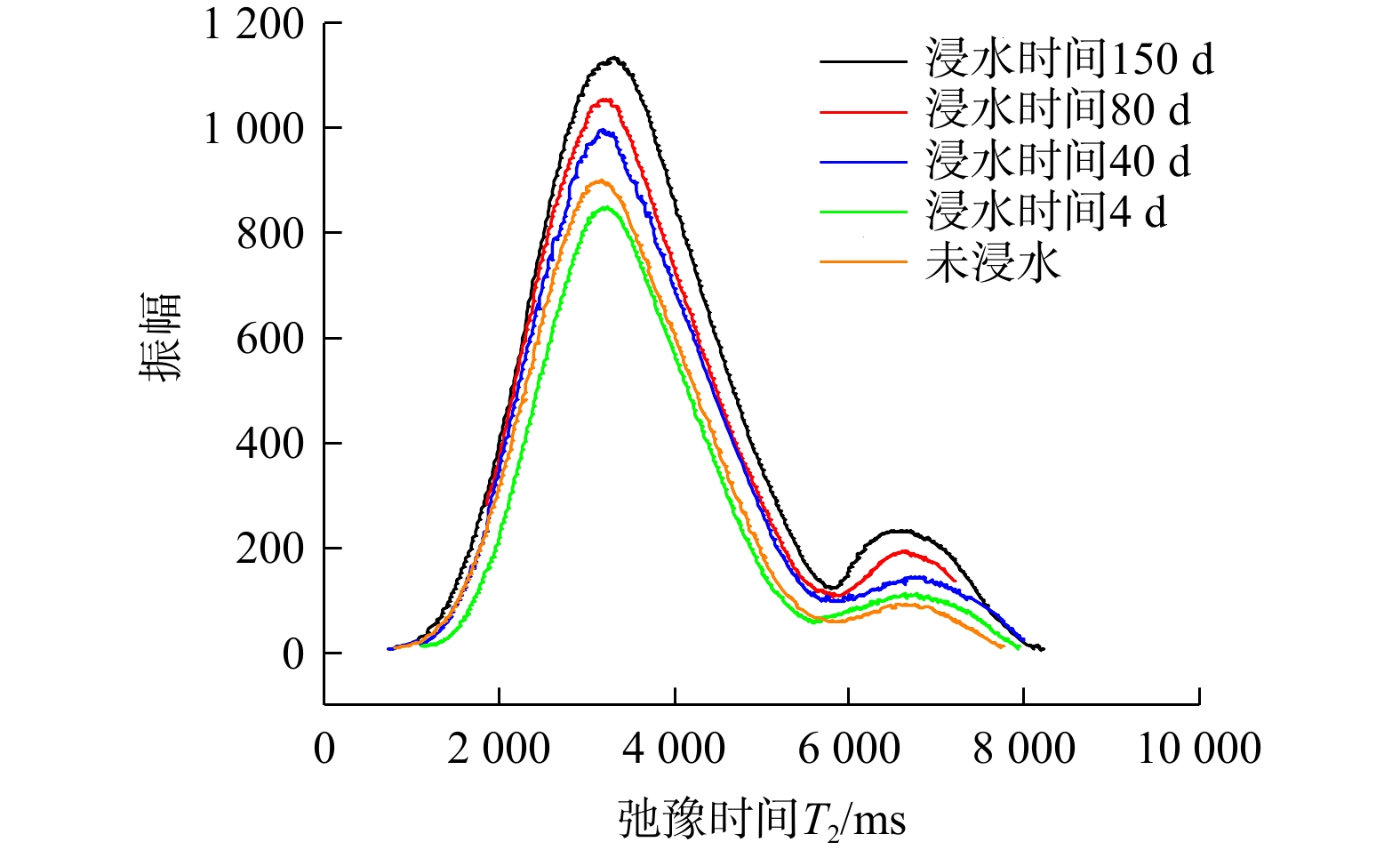
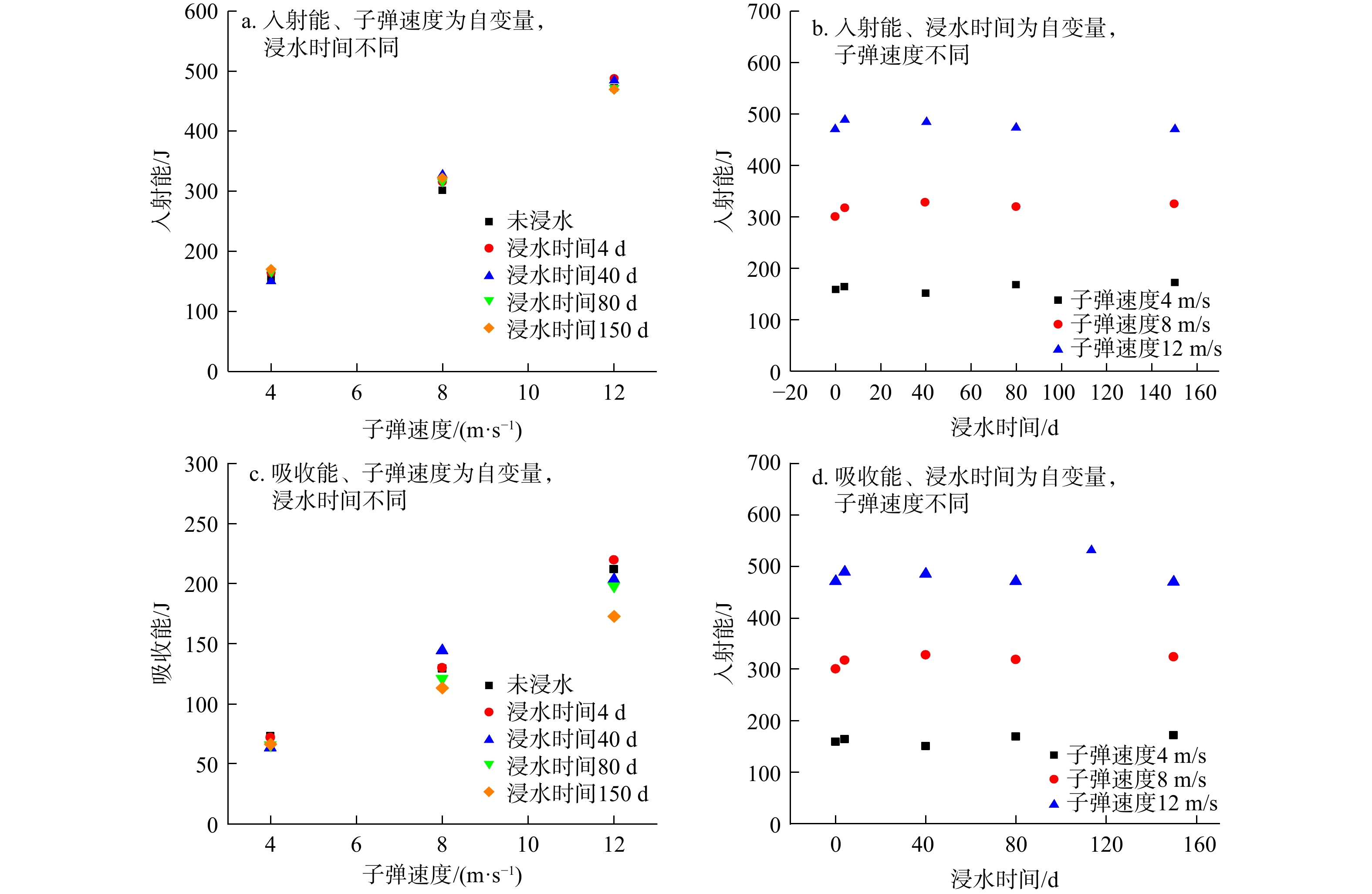
This study first immersed sandstone in water for 0, 4, 40, 80, and 150 days, and then carried out microscopic and impact tests on sandstone using nuclear magnetic resonance (NMR), scanning electron microscope, and an improved Hopkinson pressure bar test system. The microscopic changes of sandstone under dynamic loading and long-term water immersion were investigated, and the strength degradation mechanism of sandstone under long-term water immersion was explored.

Results

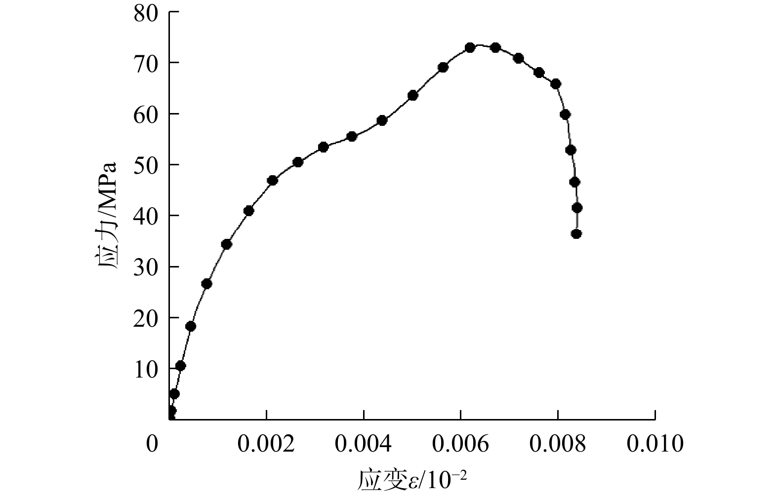
The results showed that the pore distribution ratio of micropores decreased with the increase of soaking time, while the pore distribution ratio of mesopores and macropores increased gradually, and the total signal amplitude of the samples decreased first and then increased. The soaking time was proportional to the total dissolved solid content in the soaking solution, which indicated that the minerals in the sandstone continued to dissolve and a series of physical and chemical reactions occurred during the soaking process. With the extension of soaking time, the pH value of the soaking solution increased first and then decreased. The greater the dynamic load, the greater the peak stress of sandstone, whereas the longer the soaking time, the smaller the peak stress of sandstone. The dynamic load is positively correlated with the incident energy and absorbed energy of sandstone, whereas the soaking time had little effect on the incident energy of sandstone.

Conclusion

This study can provide a theoretical basis for the stability rating of reservoir landslides and the construction of underground reservoirs.

Response patterns of dynamic water pressure-induced landslides in the Three Gorges Reservoir area to rainfall: A case study of the Bazimen landslide
LIU Kaixin, DENG Maolin, FEI Peiyan, YI Qinglin, WANG Biao
2026, 45(2): 206-217. doi: 10.19509/j.cnki.dzkq.tb20240697
Abstract:
Objective

This study aims to explore the response patterns of dynamic water pressure-induced landslides to rainfall.

Methods

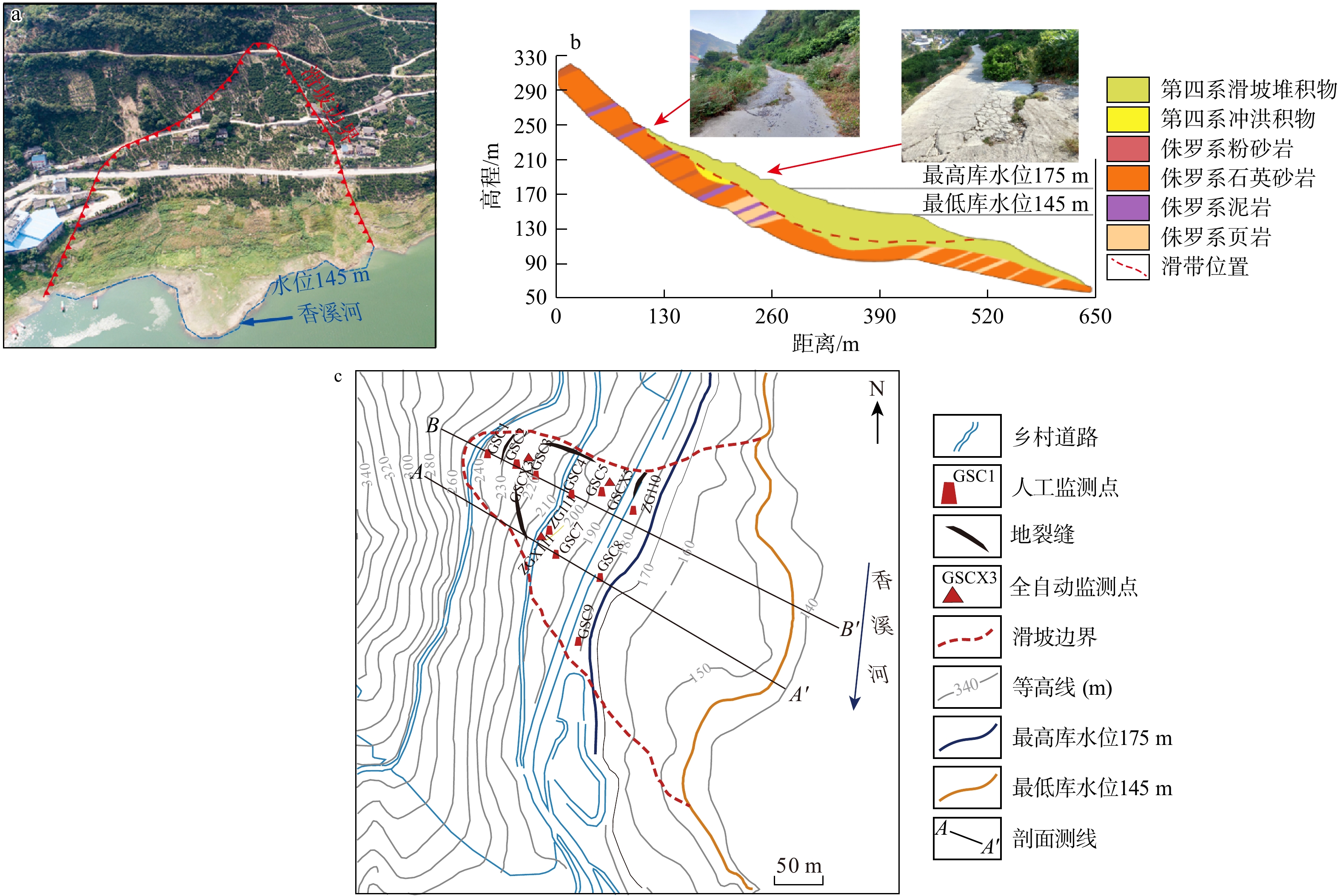
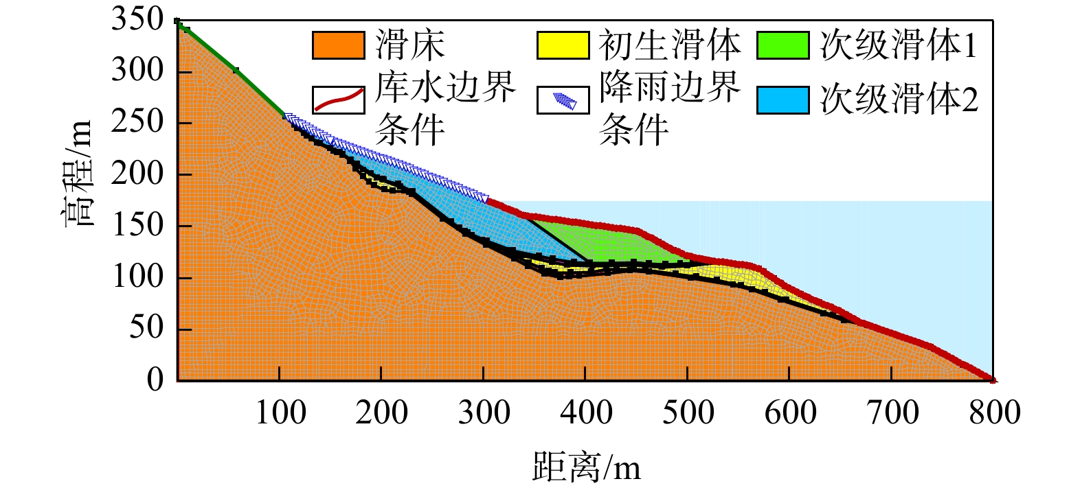
Taking the Bazimen landslide in the Three Gorges Reservoir area as an example, this study systematically investigated the influence of rainfall on landslide deformation by integrating geological survey data, correlation analysis, and finite element numerical simulation, revealing its response patterns to rainfall and deformation mechanisms.

Results

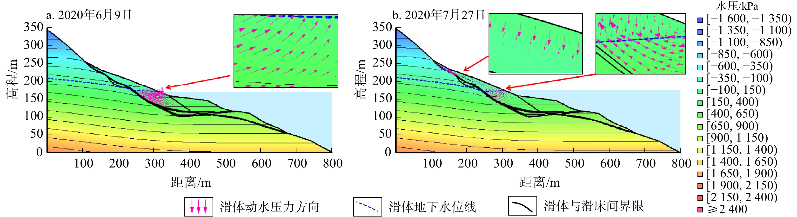
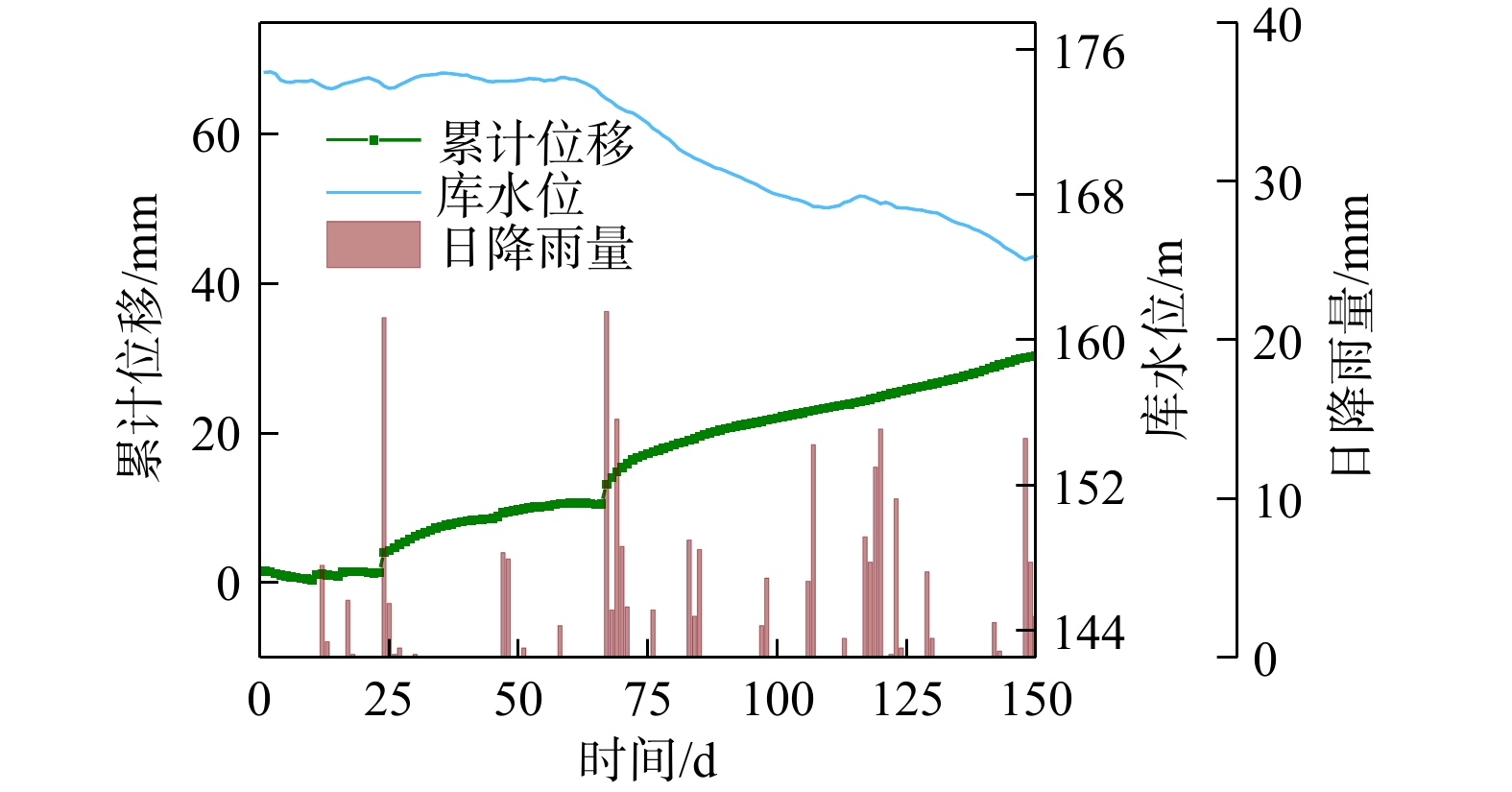
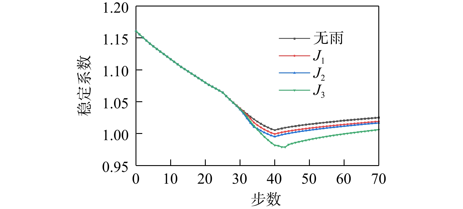
The results showed that fluctuations in reservoir water level and rainfall were the main driving factors of the deformation of the Bazimen landslide. The impact of rainfall on landslide deformation was manifested as follows. During the reservoir water level falling stage, rainfall replenished the internal water head of the slope, further enhancing the effect of dynamic water pressure and significantly aggravating slope deformation. During the reservoir water level rising stage, rainfall infiltrated into the rear edge of the secondary sliding zone, which caused an increase in pore water pressure; this in turn triggered deformation at the rear edge of the landslide and further led to overall deformation of the landslide. Adequate rainfall was the main triggering factor of landslide deformation during the reservoir water level rising stage. The landslide deformation exhibited a certain lag, with a lag time of about 20 days for deformation caused by reservoir water level drawdown and 9 days for deformation caused by rainfall. The attenuation degree of the landslide stability coefficient (1.029) under conditions of long-duration continuous rainfall was higher than that of the coefficient under conditions of rainstorm (1.039).

Conclusion

The research findings deepen the understanding of the deformation mechanisms of dynamic water pressure-induced landslides and can provide insights into the early warning and prediction of such landslides

Hydraulic tomography of typical large-scale aquifers in groundwater exploitation reduction areas of Hebei Province
CHAI Hongli, LIU Fei, ZHEN Pinna, GUO Xiaoshuai, LIU Congli, GUO Yanhui
2026, 45(2): 218-230. doi: 10.19509/j.cnki.dzkq.tb20240709
Abstract:
Objective

One of the main challenges in characterizing the heterogeneity of large-scale aquifers using hydraulic tomography is to find effective excitation sources that can significantly affect regional groundwater dynamics. Therefore, human-induced variations in groundwater exploitation amount may be a feasible option.

Methods

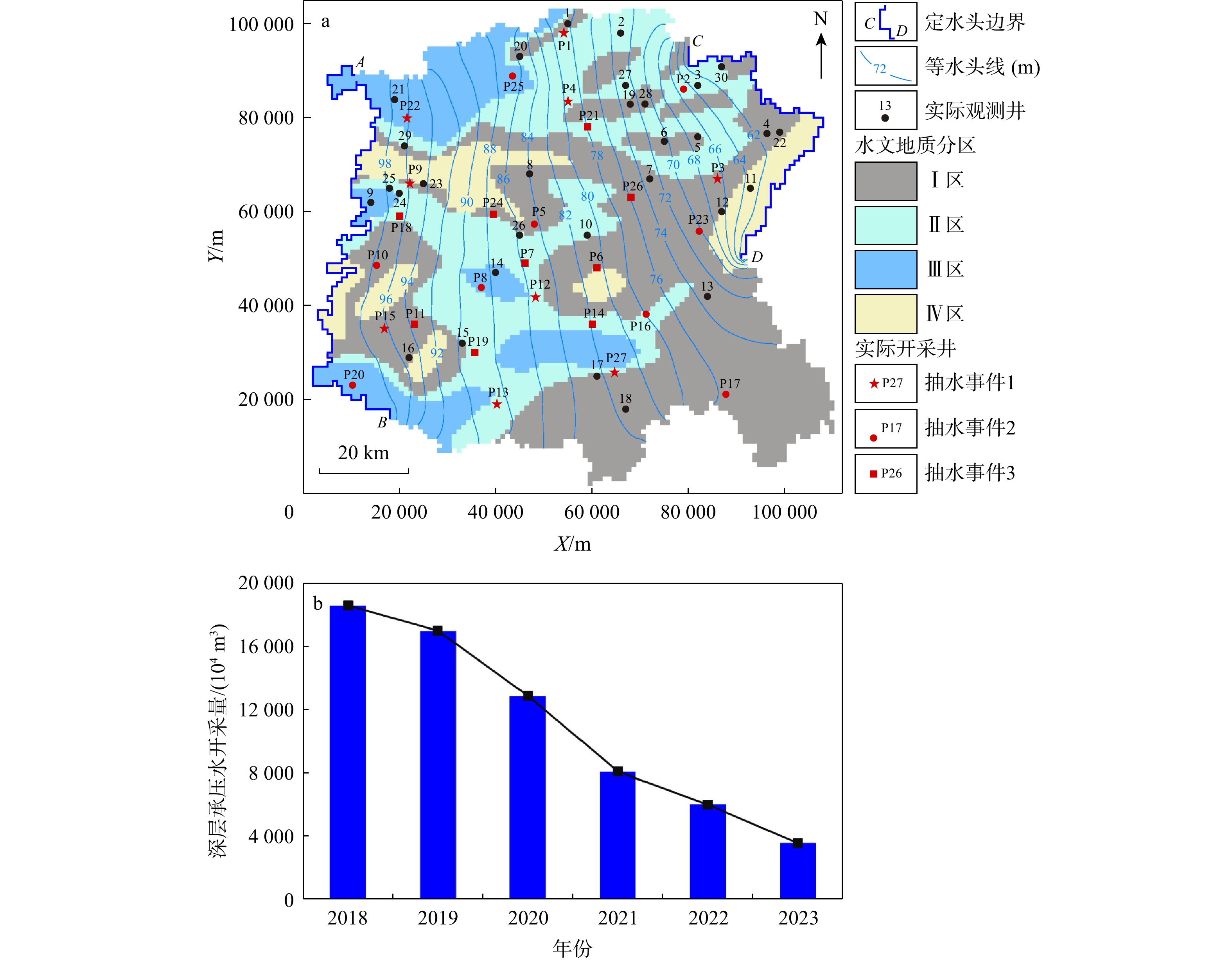
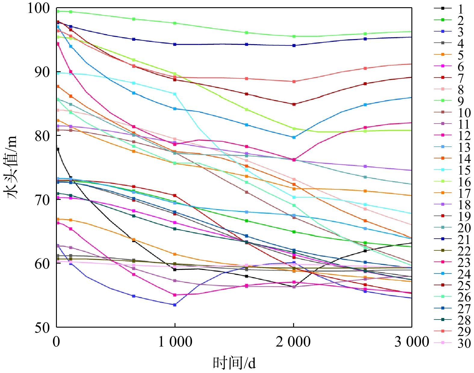
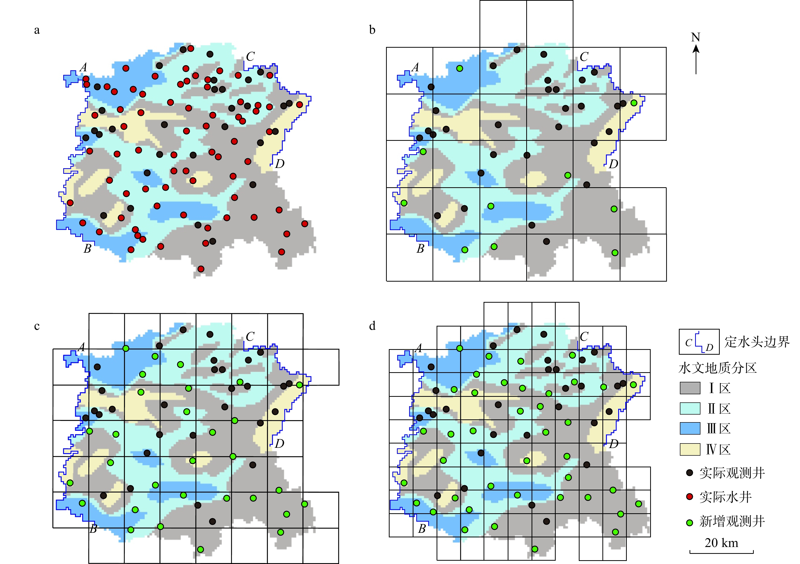
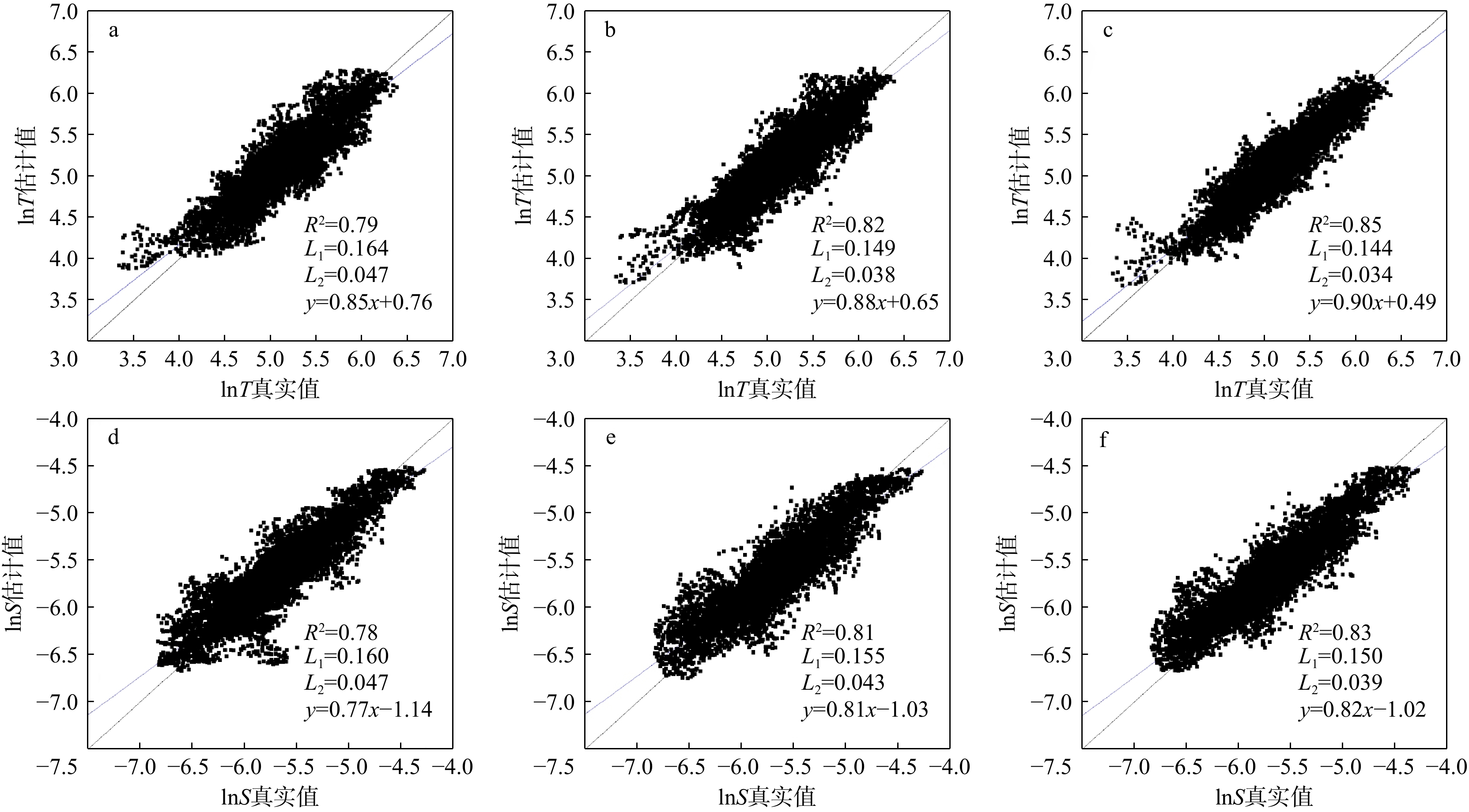
The Handan Eastern Plain, one of the pilot areas for groundwater overexploitation control in Hebei Province, was selected as the study area. Hydraulic tomography was applied to a two-dimensional confined aquifer through groundwater level responses caused by exploitation reduction, and the effects of prior geological information and observation well configuration on hydraulic parameter inversion accuracy were further discussed.

Results

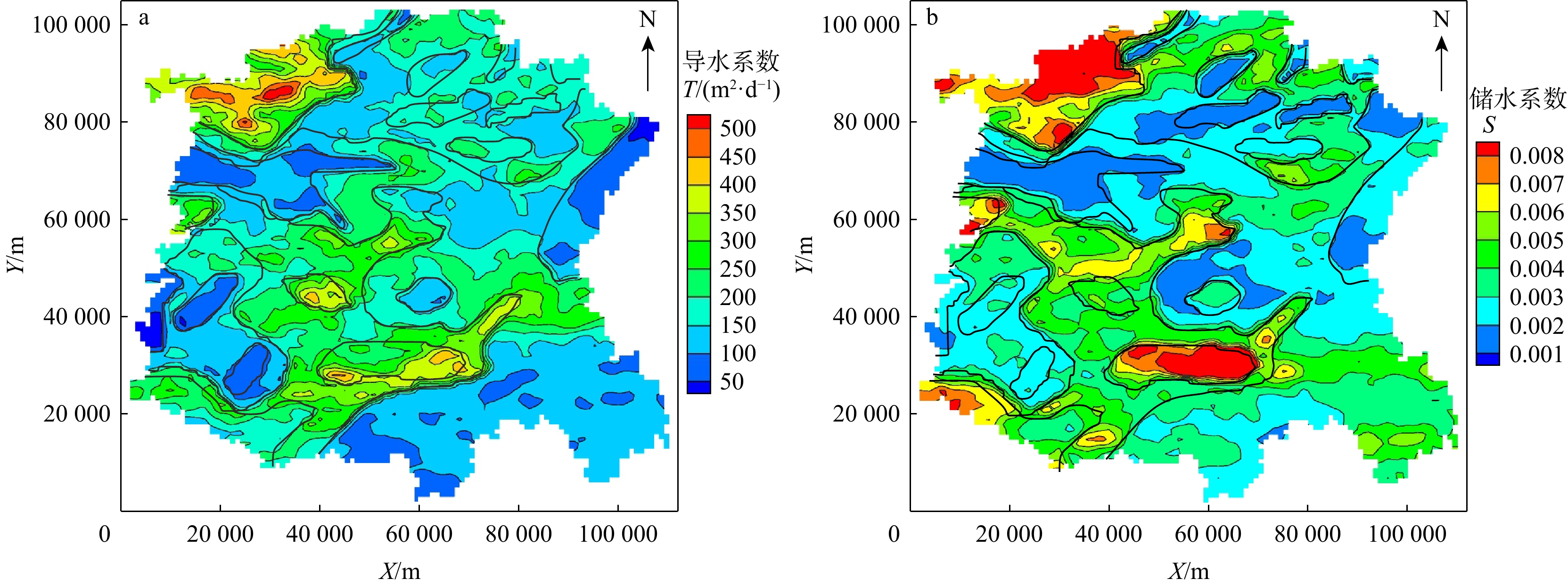
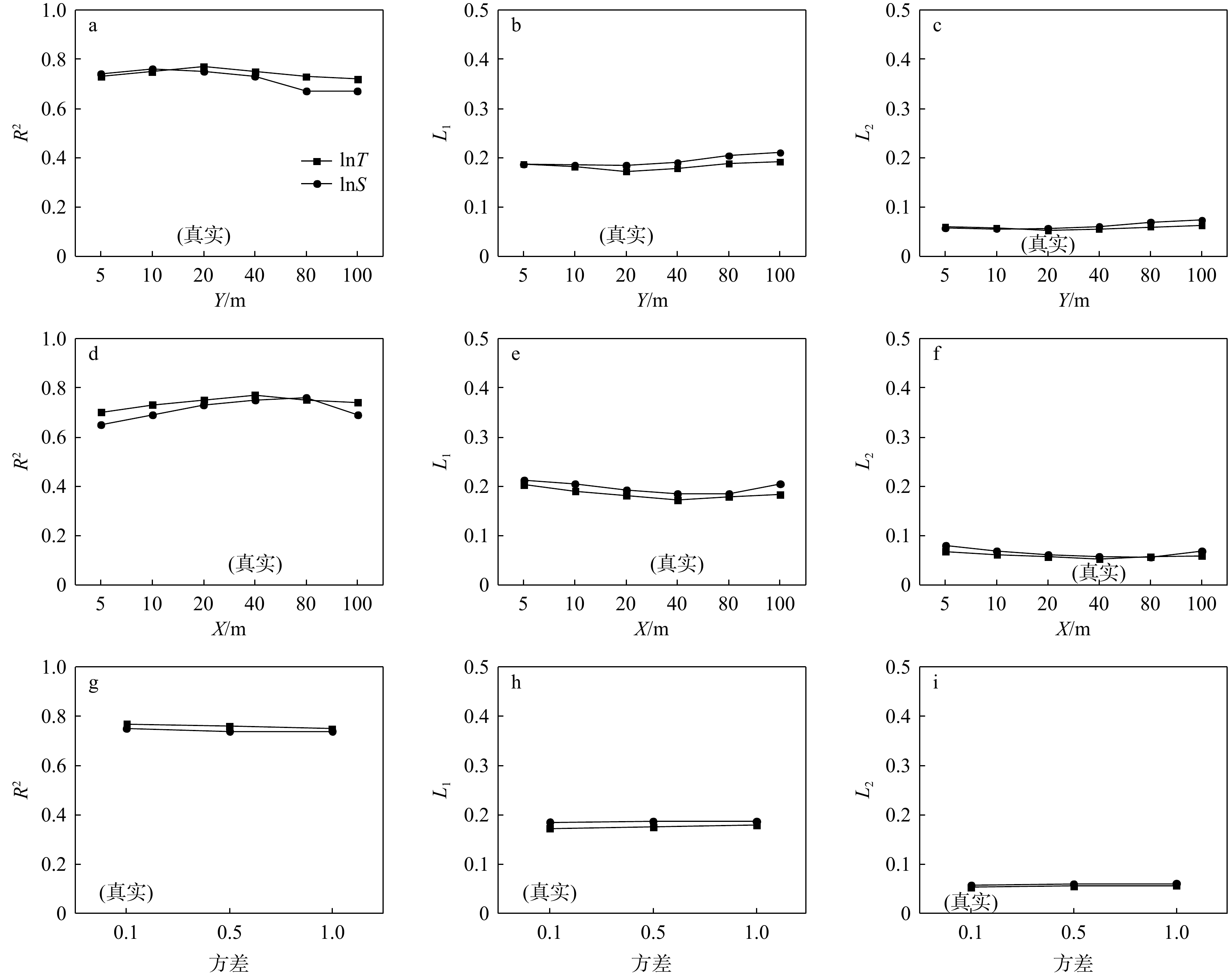
The results showed that hydraulic tomography could effectively characterize the heterogeneity of large-scale aquifers, and accurate information of geological zones could significantly improve parameter estimations. Correlation scales and variances had no significant effect on the inversion results. To improve the precision of aquifer parameter estimation, it was necessary to give full consideration to the prior geological information and existing well data, and incorporate new groundwater observation wells into the existing monitoring network in areas with significant changes in hydrogeological conditions.

Conclusion

This novel method, which characterizes the heterogeneity of large-scale aquifers based on hydraulic tomography, intelligently collects groundwater exploitation and observation data from existing wells in Hebei Province against the backdrop of groundwater exploitation reduction. Therefore, this method saves time and labor costs of additional well drilling and pumping tests, and provides remarkable economic and social benefits for mapping large-scale aquifer heterogeneity.

Organic matter as an indicator of groundwater calcium enrichment in paleo-channel area along middle reaches of the Yangtze River
WANG Rong, YANG Yijun, TIAN Shuhang, DONG Chenhao, WANG Qixiang, DENG Yamin
2026, 45(2): 231-239. doi: 10.19509/j.cnki.dzkq.tb20240491
Abstract:
Objective

As an important source of drinking water, abnormal calcium (Ca) concentrations in groundwater could endanger human growth and lead to health risks. Previous research has primarily focused on how inorganic carbonate equilibrium processes involving atmospheric CO2 regulate groundwater Ca cycling. However, the important role of the organic carbon pool has been overlooked, and the microscopic mechanisms underlying the interactions between different components of organic matter (OM) and Ca remain elusive.

Methods

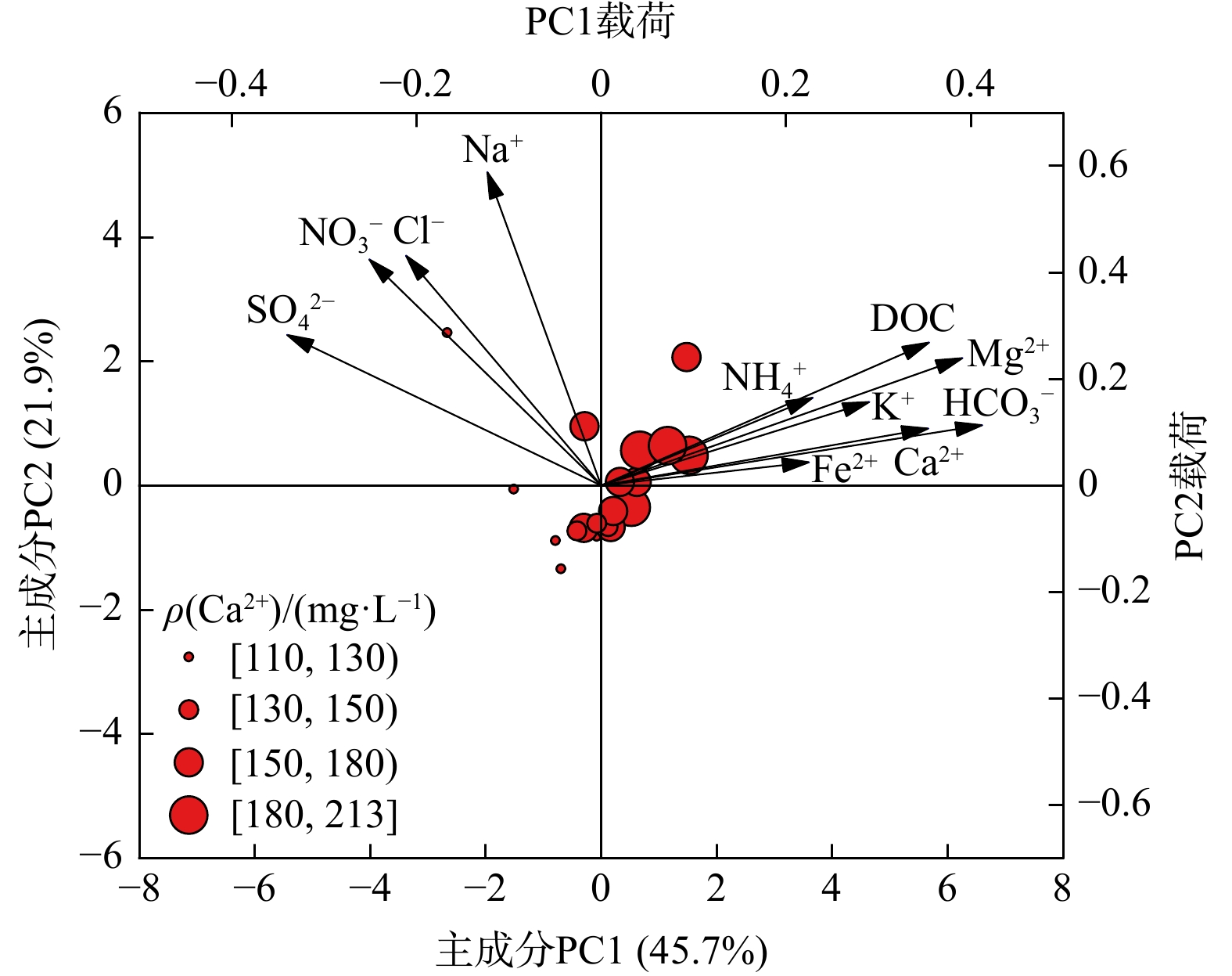
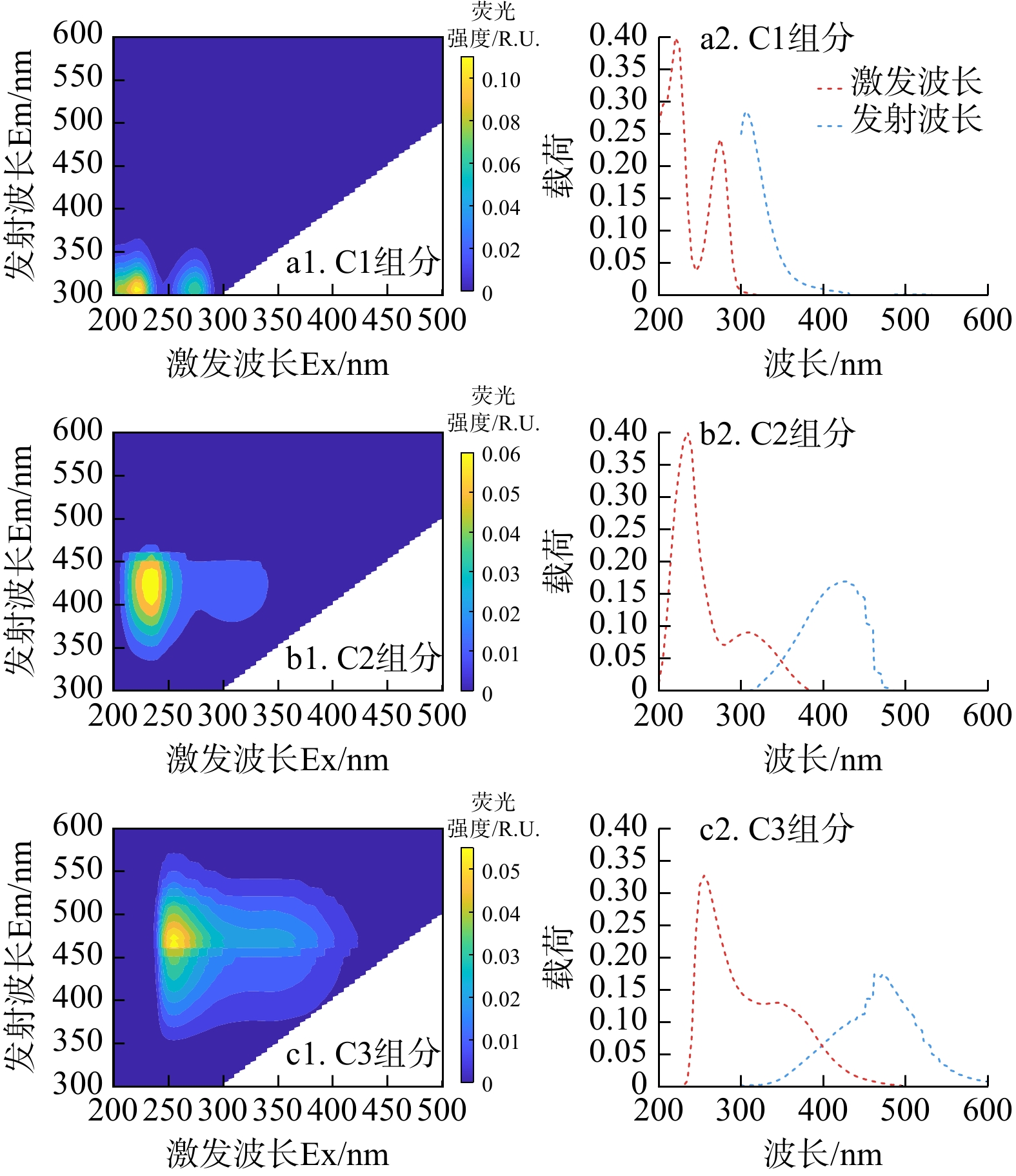
This study took the paleo-channel area along the middle reaches of the Yangtze River as the study area. Groundwater samples were analyzed using hydrochemical analysis, principal component analysis, parallel factor analysis (PARAFAC) of fluorescence excitation-emission matrix (EEM) spectroscopy, and fluorescence excitation-emission matrix regional integration.

Results

The results demonstrated that groundwater Ca concentrations exhibited significant spatial heterogeneity, ranging from 111 to 213 mg/L, mainly concentrated in the meanders and oxbow lakes of the paleo-channel region. Greater OM content was observed in the groundwater with elevated Ca concentration, and the two exhibited similar spatial distribution patterns. In the study area, the EEM-PARAFAC model identified three major components in groundwater, including protein-like components (C1), microbial and terrestrial humic components (C2 and C3).

Conclusion

With the increase of Ca concentration in groundwater, the content of protein-like components decreased while that of the humic-like components increased. Notably, the abundant organic matter buried in the paleo-channel area provides a strong reducing environment that favors the microbial degradation of protein-like organic matter. This process promotes the dissolution of Ca-bearing minerals, which contributes to the groundwater Ca enrichment. This research clarified the heterogeneous spatial distribution and occurrence environments of Ca in groundwater, characterized differences in organic matter composition among groundwater with different Ca concentrations, and revealed the mechanisms by which organic matter influenced the migration and enrichment of Ca in groundwater.

Patterns and mechanisms of sediment charging and discharging driven by groundwater level fluctuations
WANG Peiyuan, TONG Man, ZHANG Peng
2026, 45(2): 240-248. doi: 10.19509/j.cnki.dzkq.tb20240788
Abstract:
Objective

Electron transfer is fundamental to biogeochemical reactions in subsurface environments. Sediments act as key electron reservoirs capable of cyclic electron storage and release under groundwater level fluctuations, thereby significantly influencing material transformation and elemental cycling. However, the patterns and mechanisms governing sediment charging and discharging driven by groundwater level fluctuations remain poorly understood.

Methods

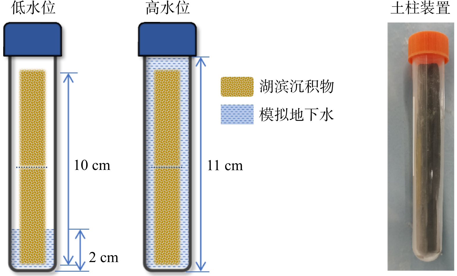
In this study, a one-dimensional soil column system was developed to simulate the groundwater fluctuation zone. The patterns and mechanisms of sediment charging and discharging driven by groundwater level fluctuations were investigated using a combination of chemical analyses, iron mineral speciation, and molecular biological techniques.
Results

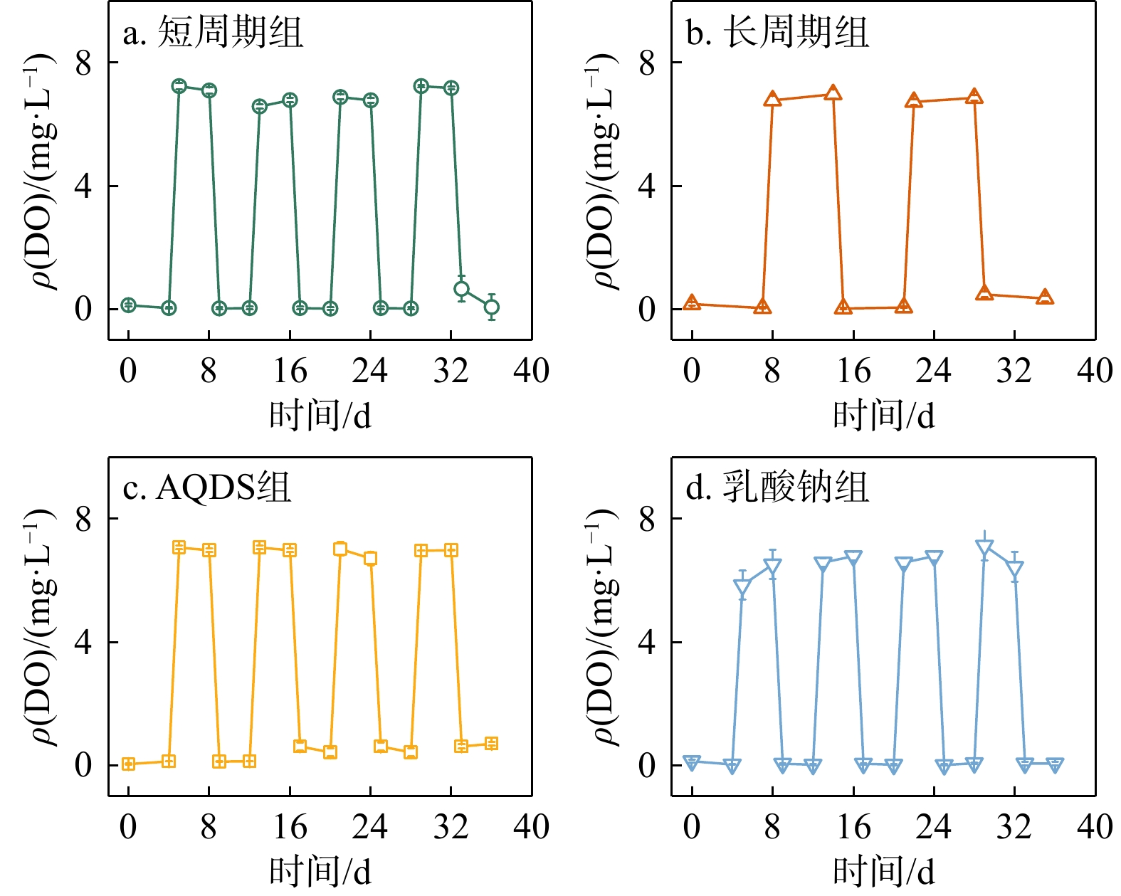
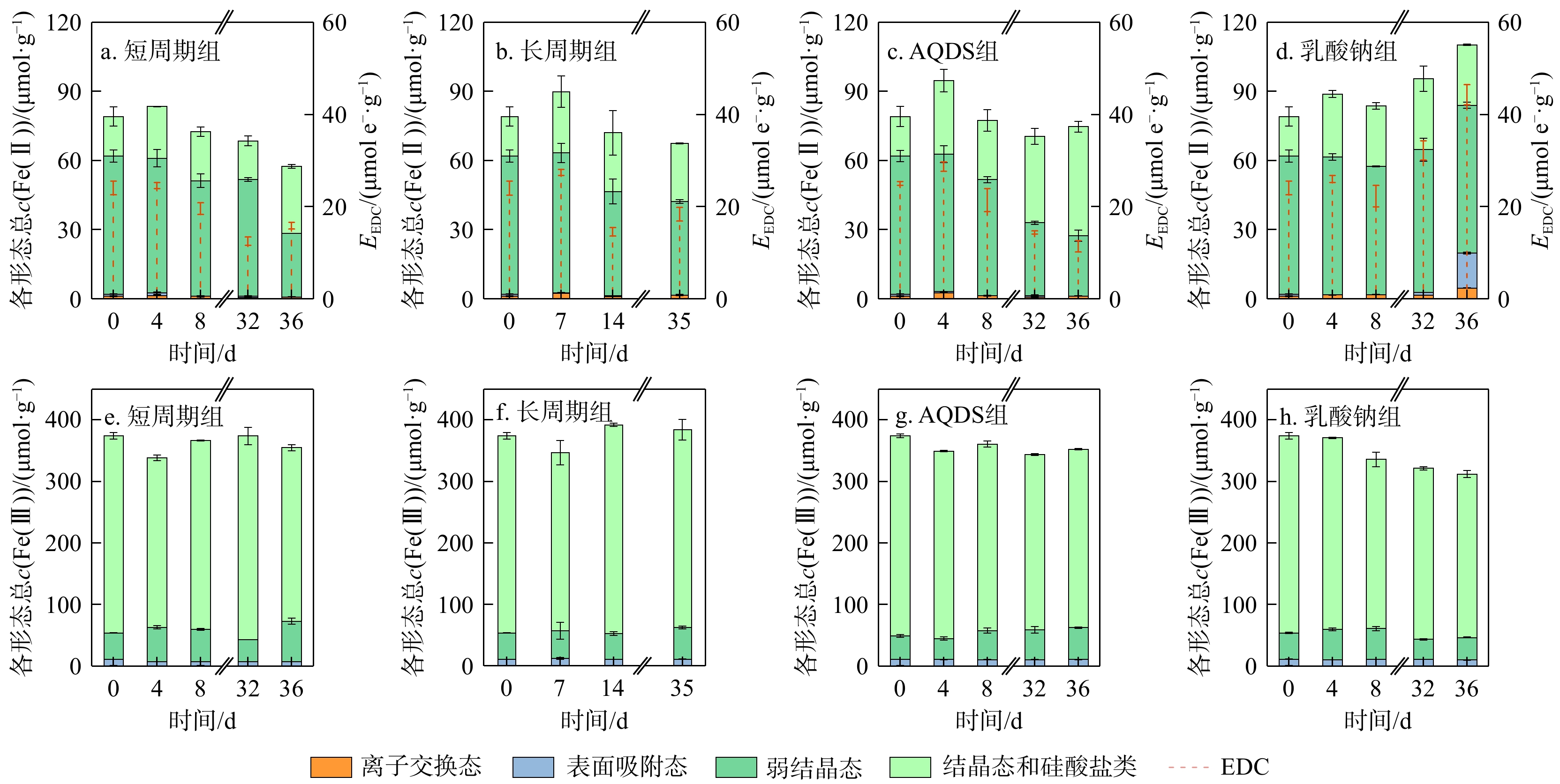
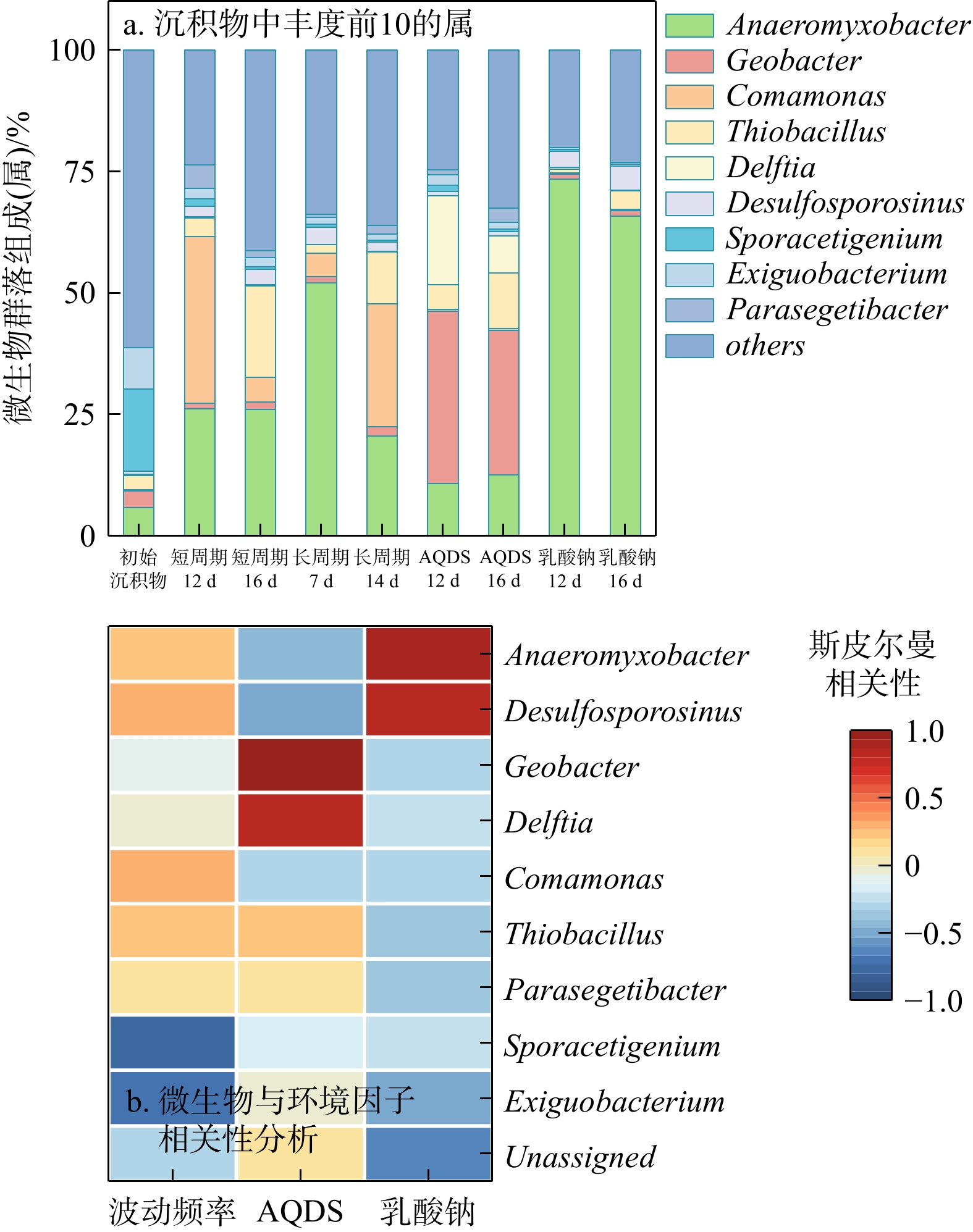
The results showed that under short-cycle fluctuation conditions, sediments completed two charging-discharging cycles, with maximum charge/discharge capacities of 2.3 and 8 μmol e·g−1, and peak rates of 0.577 and 2.012 μmol e·g−1·d−1, respectively. The electron-donating capacity (EDC) of the sediments was mainly contributed by adsorbed, ion-exchangeable, and highly reactive weakly crystalline Fe(Ⅱ). Ground water level fluctuations drove the microbial Fe(Ⅲ) reduction followed by the chemical Fe(Ⅱ) oxidation, thereby enabling the cyclic charging and discharging of sediment. However, repeated redox cycles reduced the bioavailability of iron oxides, ultimately hindering their sustained cyclic electron storage and release. The addition of the electron shuttle anthraquinone-2,6-disulfonate (AQDS) significantly increased the initial charging and discharging rates but also accelerated the decline in Fe(Ⅲ) bioavailability, resulting in a gradual decrease in the charging and discharging rates and the termination of cycling after the third one. In contrast, the addition of sodium lactate (an electron donor) significantly enriched the iron-reducing bacterium Anaeromyxobacter, maintained high Fe(Ⅲ) bioavailability, and markedly enhanced the charging and discharging rates, thus enabling its sustained cyclic charging and discharging under groundwater level fluctuations.

Conclusion

This study clarifies the variation patterns and regulatory mechanisms charging and discharging behaviors of underlying the sediment under different groundwater level fluctuation conditions, and provides new strategies for the prevention and control of groundwater pollution.

Priority control list of volatile organic compounds at organic-contaminated sites
LIU Weijie, XING Xinli, LI Xiaoqian, LIU Yunde, QI Shihua
2026, 45(2): 249-261. doi: 10.19509/j.cnki.dzkq.tb20240613
Abstract:
Objective

A priority control list of pollutants is an essential prerequisite and foundation for the effective management and environmental remediation of organic-contaminated sites, which can provide scientific guidance for the precise prevention and control of organic-contaminated sites.

Methods

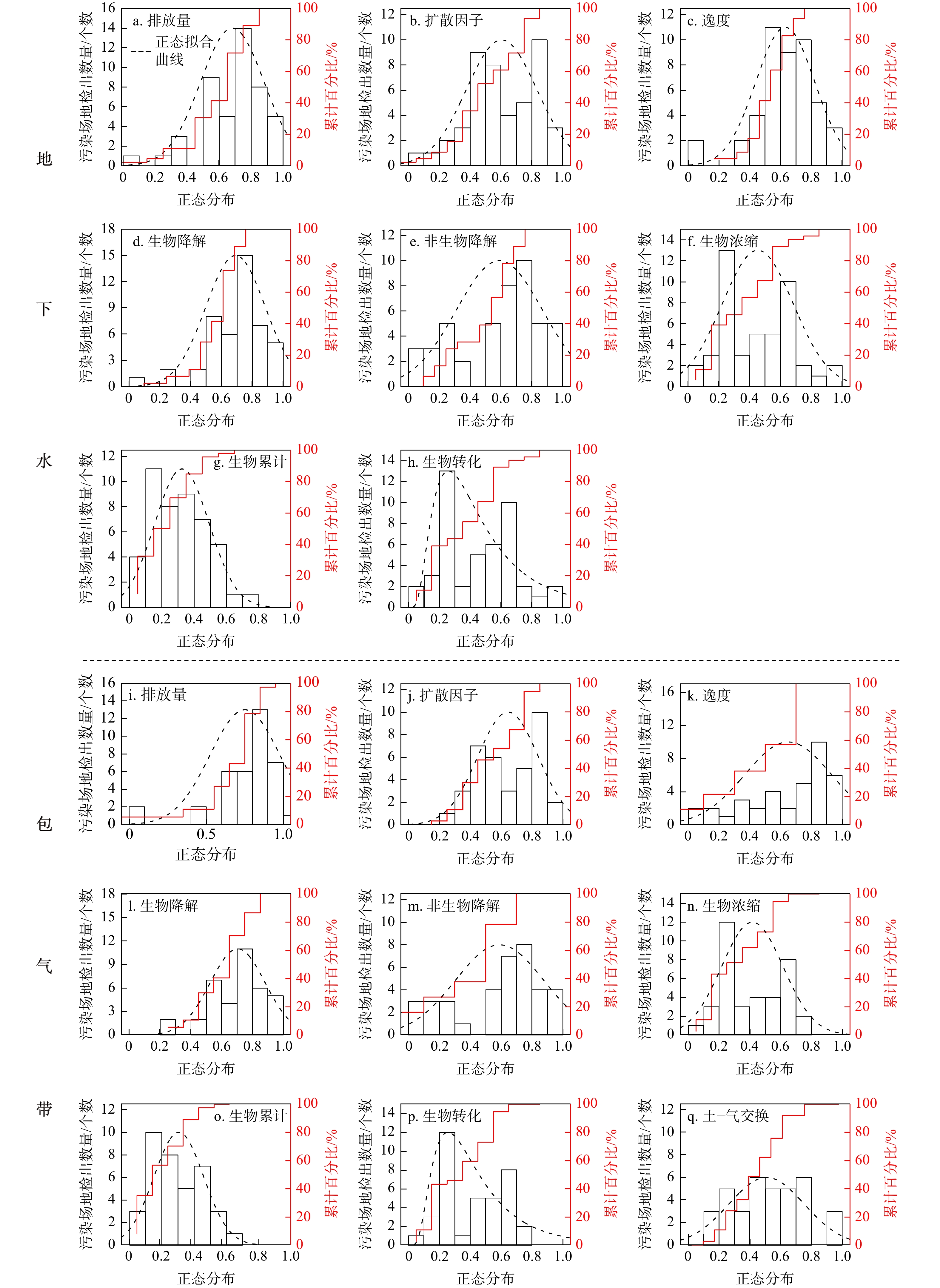
The average detection rates of volatile organic compounds (VOCs) in groundwater and the vadose zone of typical organic-contaminated sites in China were obtained through literature search and data collection. Additionally, the complex environmental behaviors of pollutants were parameterized, and key parameters including the mobility, degradation effects, bioaccumulation, and toxicity of pollutants in different media were selected to establish the screening system for the priority control list. The scores of multiple assessment factors were obtained through logarithmic transformation and normalization, then the weights of the assessment factors were determined using multiple statistical linear regression. Ultimately, the priority control ranking list of VOCs across multiple environmental media at contaminated sites was established.
Results

The results indicated that trichloroethylene and ethylbenzene had high scores in groundwater and vadose zone, indicating that they should be controlled first. In addition, trichloroethylene and its hydrogenolysis reaction products, including 1,1-dichloroethylene, trans-1,2-dichloroethylene, and cis-1,2-dichloroethylene, all exhibited high scores. Therefore, more intensive attention should be paid to the environmental behaviors of trichloroethylene in different media of organic-contaminated sites.

Conclusion

This study provides theoretical and methodological support for the environmental governmence of organic pollutants at organic-contaminated sites and the formulation of priority control lists.

Sr and Nd isotopic compositions and their significance of surface sediments in the Yangtze River Estuary and its adjacent seas
LI Yufeng, LIU Jincun, LIU Jinhua, HU Yating, LI Baichan, ZHOU Lian
2026, 45(2): 262-273. doi: 10.19509/j.cnki.dzkq.tb20240401
Abstract:

The Yangtze River Estuary is a vital hub linking the land and the ocean. Due to its complex topography, abundant terrestrial materials, and close association with human activities, it has attracted extensive attention from researchers.

Methods

Focusing on the surface sediments in the Yangtze River Estuary and its adjacent seas, this study systematically analyzed the geochemical behavior of Sr and Nd isotopes as well as trace elements.

Results

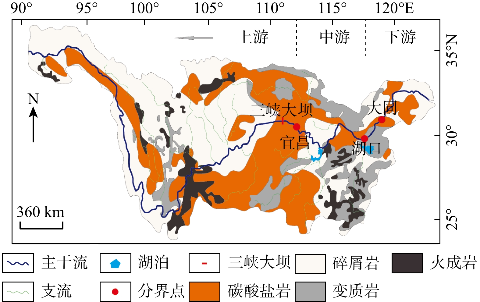
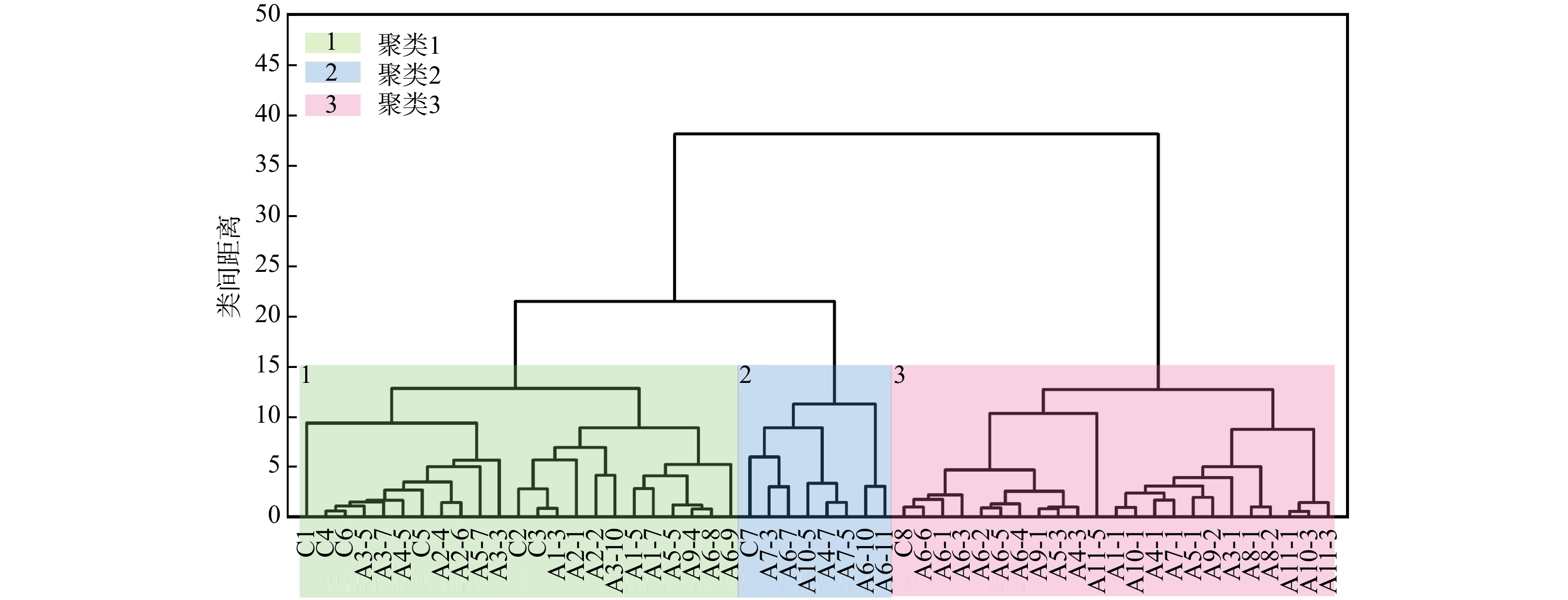
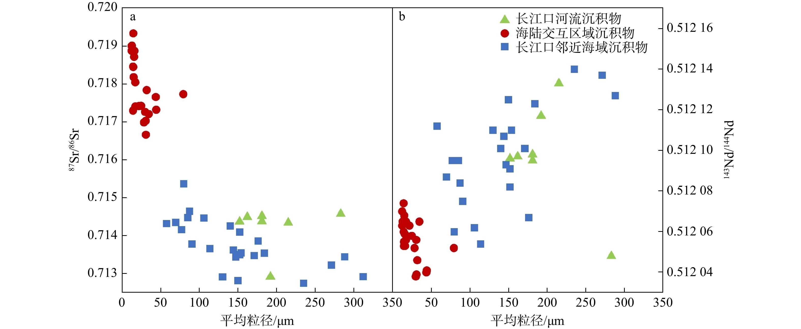
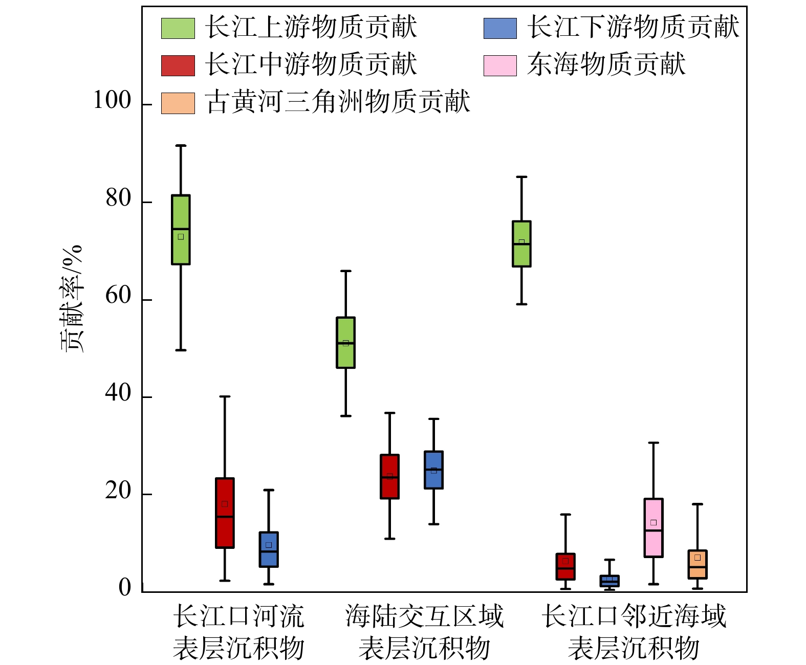
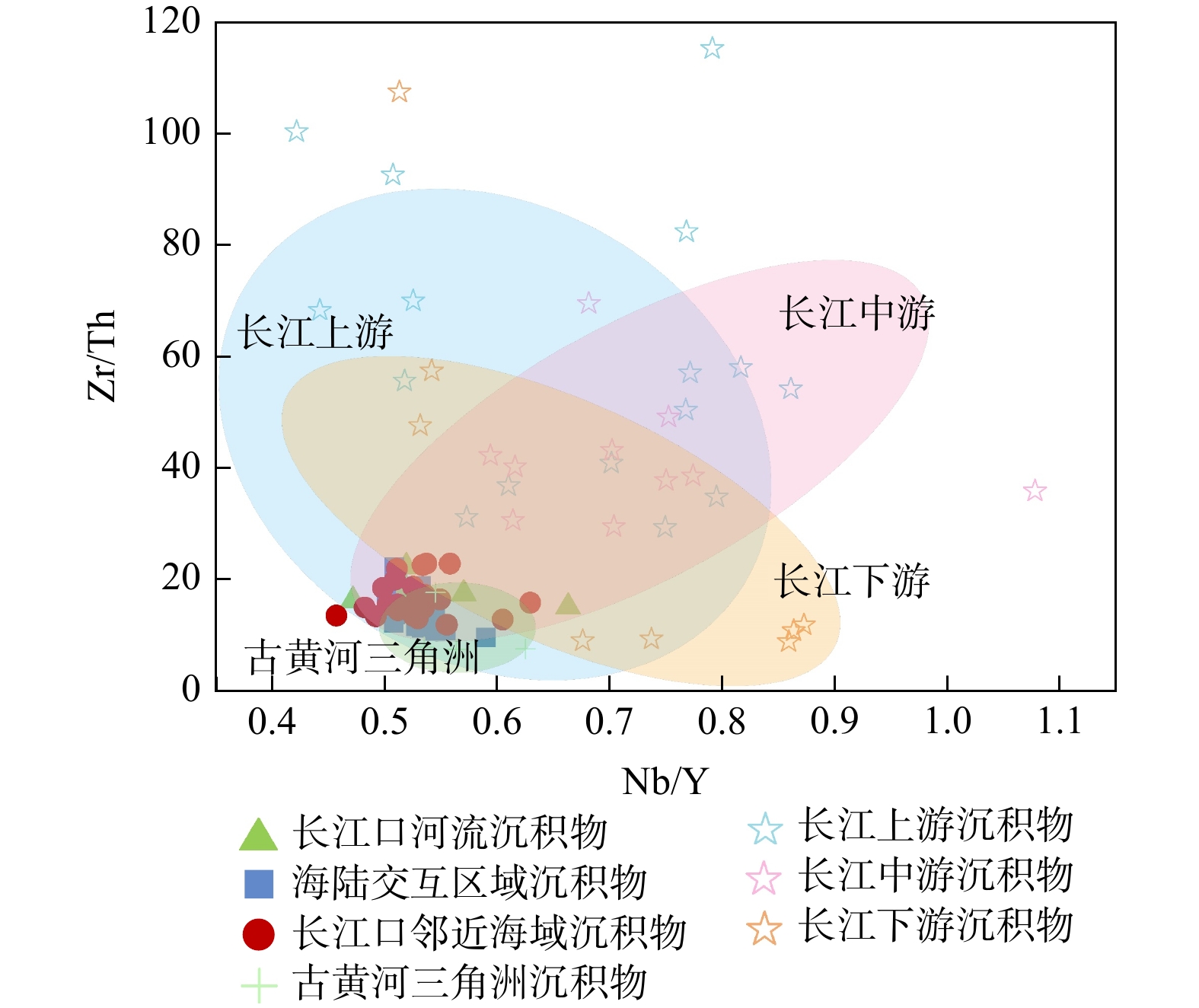
The results showed that the sediments in the Yangtze River Estuary and its adjacent seas were mainly composed of terrestrial materials, dominated by sediments from the Yangtze River Basin, with a portion originating from the ancient Yellow River delta. In the river-sea mixing zone, Nd was significantly enriched due to colloidal coagulation, while complex hydrodynamic conditions resulted in finer sediment particle sizes, and Sr exhibited noticeable depletion. Through analysis using the stable isotope mixing model in R (SIMMR), it was found that the contribution of sediments from the middle and lower reaches of the Yangtze River to the surface sediments in the sea-land interaction zone increased. Sediments from the upper reaches of the Yangtze River have been largely trapped by dam construction, which has turned the river channels in the middle and lower reaches from a sediment "sink" into a sediment supply "source", thereby increasing their contribution to the sediments in the estuary and its adjacent seas. Nevertheless, sediments from the upper reaches of the Yangtze River still dominated the composition of sediments in the estuary.

Objective and Conclusion

The findings reveal the sedimentary environment and source-sink processes in the Yangtze River Estuary and its adjacent seas, providing crucial information for elucidating the surface material cycling process and exploring the evolution of the marine environment.

Extraction of remote sensing ore-indicating information and block optimization in middle-northern segment of Zhongtiao Mountain, Shanxi Province
LIU Zhi, LI Yanxing, YANG Bo, LIU Xiaosong, ZHANG Hang
2026, 45(2): 274-292. doi: 10.19509/j.cnki.dzkq.tb20240617
Abstract:
Objective

Ore block optimization is an important task in the new round of strategic prospecting breakthrough actions, and a key initiative to respond to the Ministry of Natural Resources in further improving the efficiency of prospecting, developing new-quality productive forces, and enhancing the support capacity of mineral resources. As one of China's key national strategic resource concentration areas for gold, copper, iron, and other critical minerals, the Zhongtiao Mountain in Shanxi Province is abundant in mineral resources. However, to date, there is relatively limited research on the large-scale remote sensing geological interpretation and prospecting applications based on remote sensing satellite images in this region, which is of great significance for prospecting prediction.

Methods

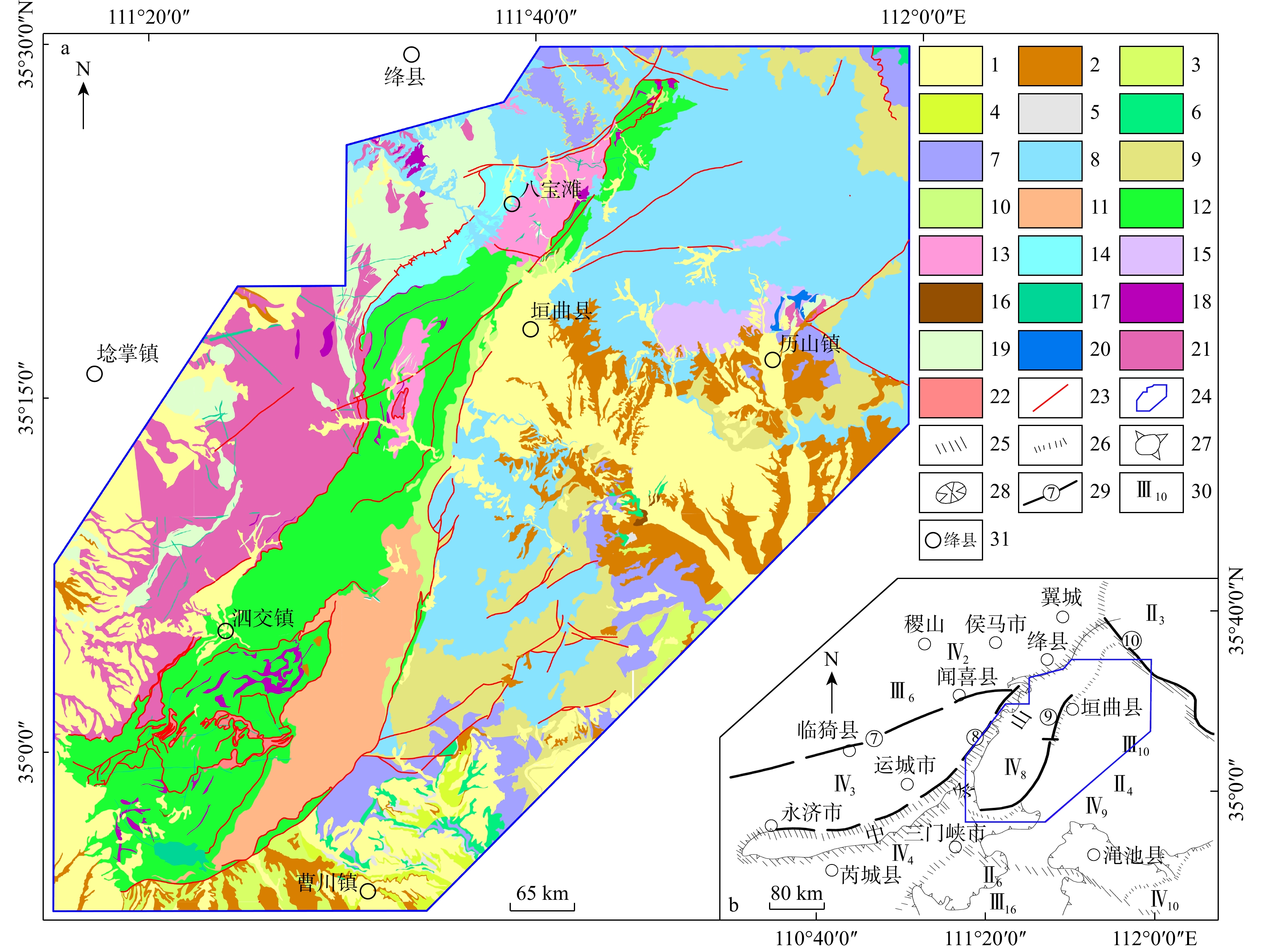
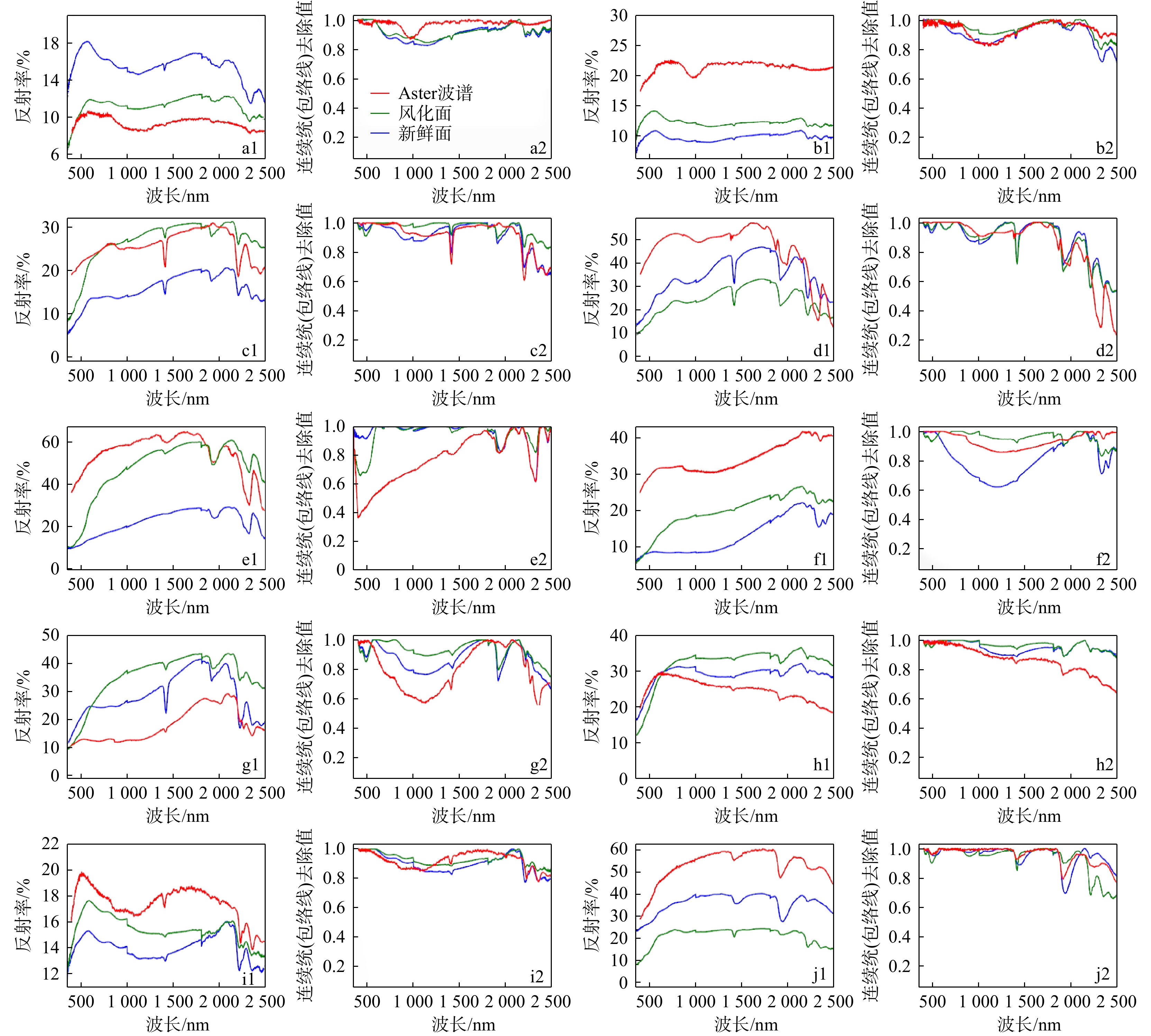
The middle-northern segment of the Zhongtiao Mountain in Shanxi Province was selected as the study area. Based on human-computer interactive interpretation of ore-controlling structural and ore-controlling ring features from Spot-6 remote sensing images, the regional structural distribution of the study area was summarized from a macro perspective. Principal component analysis (PCA) was employed to preliminarily extract mineralization alteration anomaly information via Aster data. Additionally, with field spectral curves of typical rocks and minerals collected by an ASD spectrometer as training samples, the spectral angle mapping (SAM) method was applied to extract the distribution of ore-bearing strata. The distribution results were then used to screen the PCA extraction results to identify three major types of mineralization alterations, including iron staining, hydroxyl, and carbonate. The spatial correlation between alteration anomalies and ore-controlling factors (such as regional structures, ore-bearing strata, and rock mass distribution) was further analyzed.

Results

The results indicated that: (1) The linear and ring structures were well-developed in the study area, with 84 newly interpreted faults and 136 ring structures, which helped refine and supplement the shortcomings of previous geological survey findings. (2) The mineralization and alteration information obtained by PCA and rock-ore spectral inversion could effectively indicate mineralization anomalies, highlighting the important role of regional structures in ore formation. (3) A comprehensive anomaly isodensity map was obtained through combined analysis of field verification and existing regional geological data to delineate three optimal mineralization areas.

Conclusion

The research findings provide a basis and guidance for subsequent evaluation of mineral resource potential, prospecting prediction, and strategic actions of deep prospecting. The findings also promote the application of remote sensing-based geological prospecting in the Zhongtiao Mountain, and provide insights into future remote sensing-based geological prospecting efforts in other regions of Shanxi Province.

A method for optimizing SBAS-InSAR interpretation results based on landslide susceptibility
TANG Luyao, ZENG Bin, YUAN Jingjing, AI Dong, XU Huiyuan
2026, 45(2): 293-305. doi: 10.19509/j.cnki.dzkq.tb20240412
Abstract:
Objective

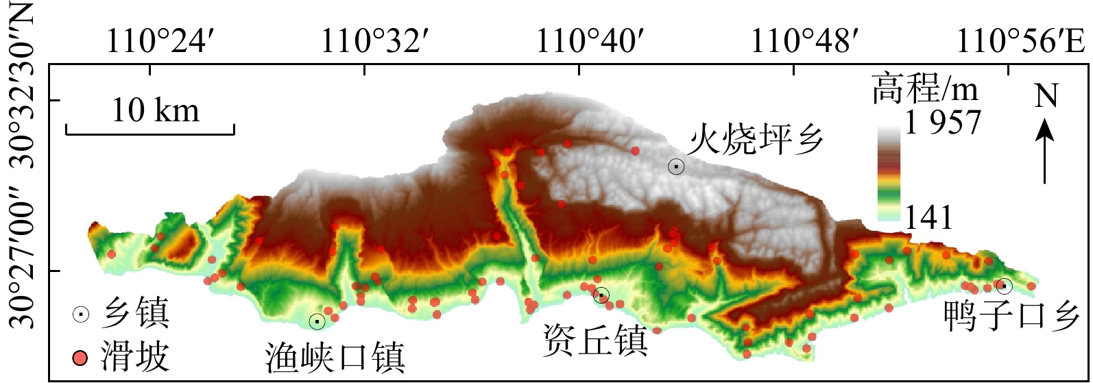
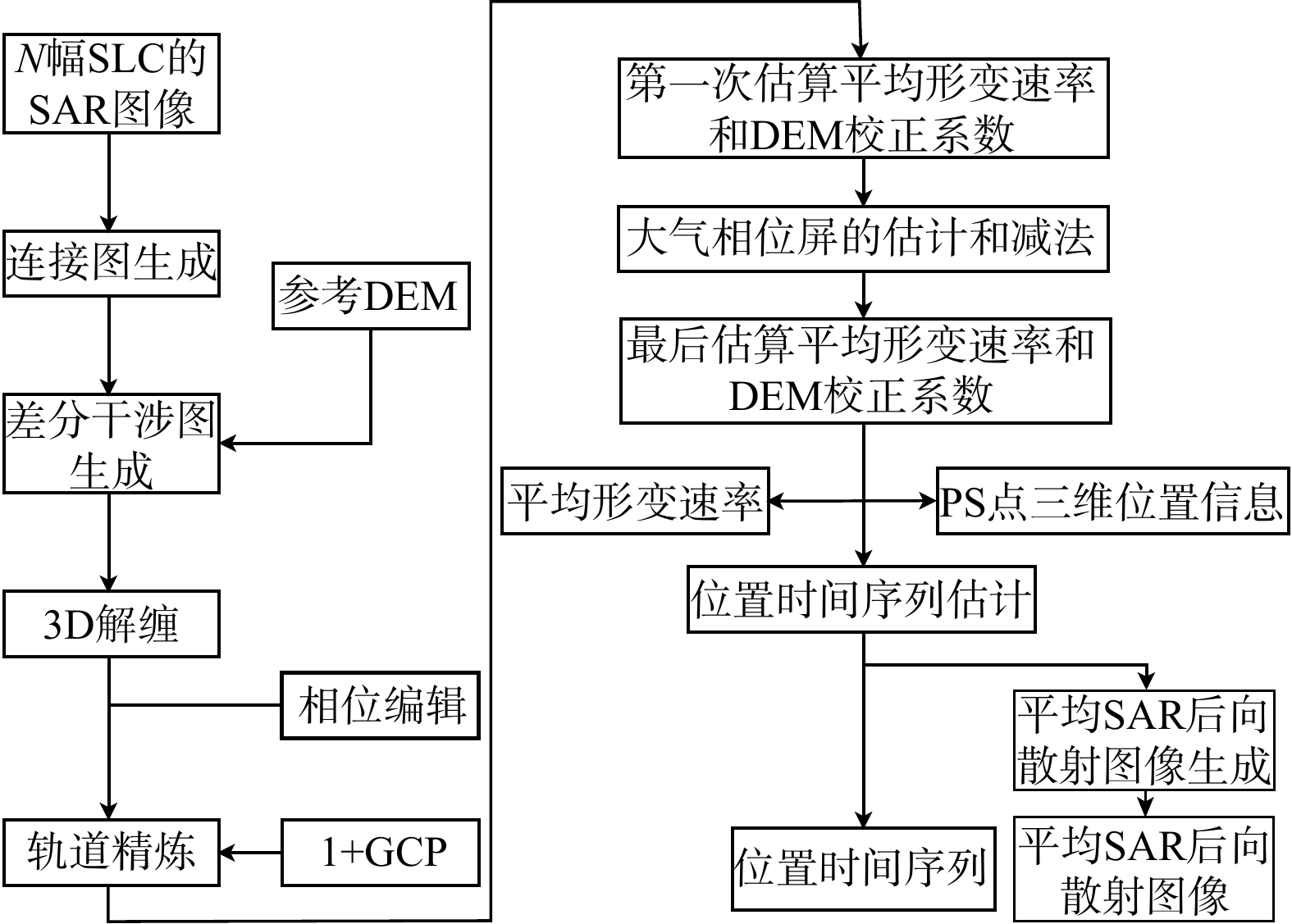
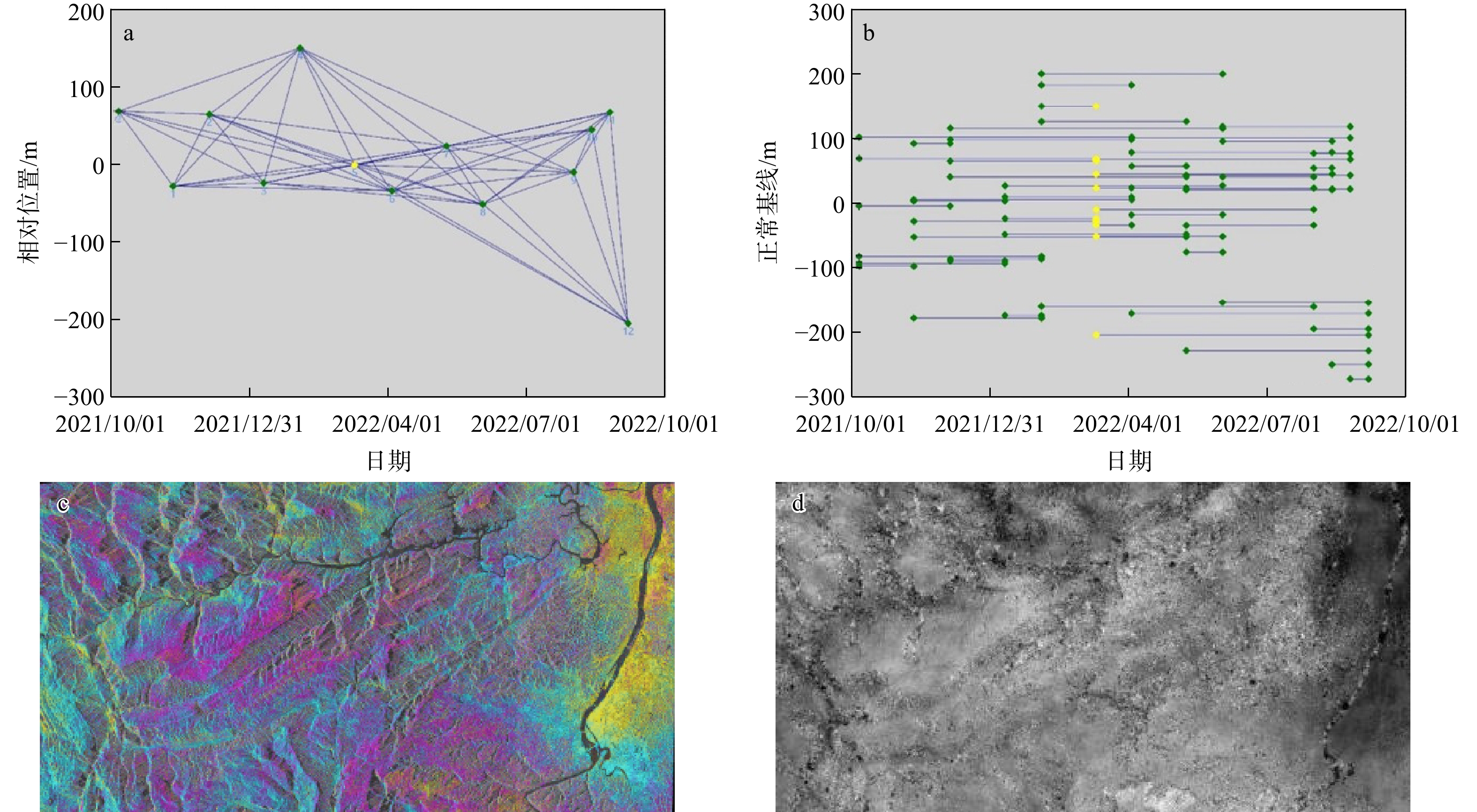
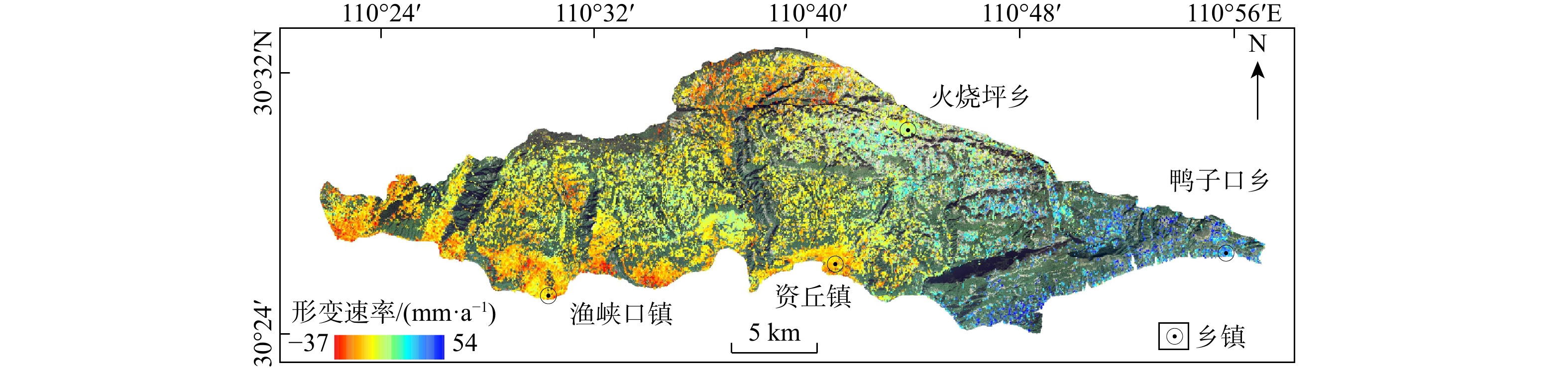
The interpretation results of small baseline subset interferometric synthetic aperture radar (SBAS-InSAR) exhibit multiple solutions, making it uncertain to directly use the interpreted deformation points for identifying potential landslide-prone areas. Therefore, taking the north bank of the Qingjiang River (Changyang Section) as the study area, this study proposed a method to comprehensively optimize SBAS-InSAR interpretation results by incorporating landslide susceptibility evaluation.

Methods

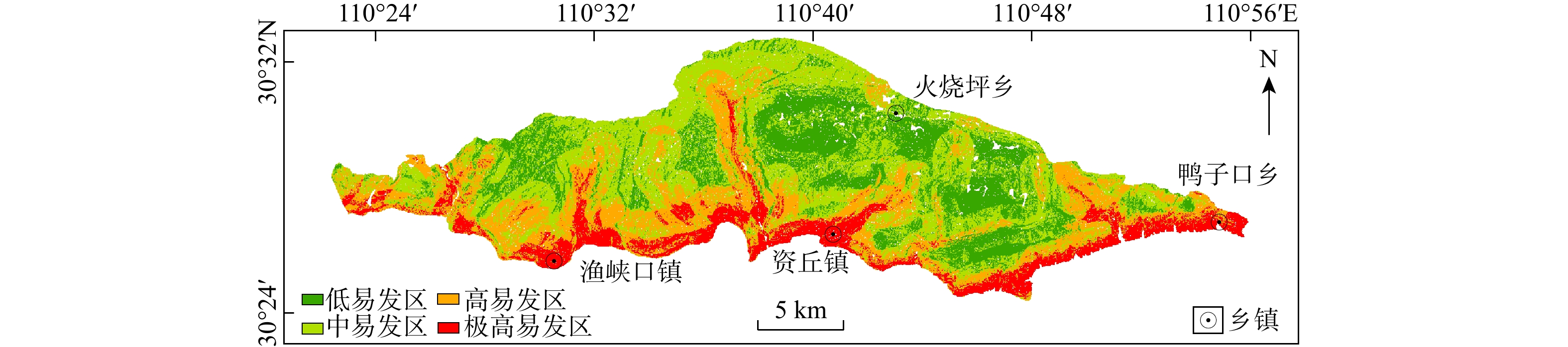
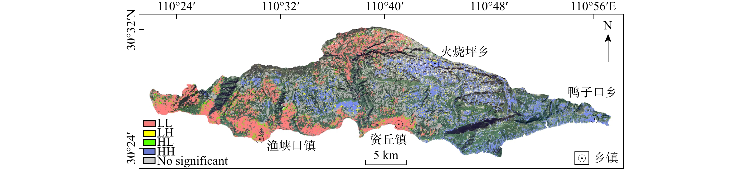
Firstly, the deformation points interpreted by SBAS-InSAR were analyzed using clustering and outlier detection (Anselin Local Moran's I), and low-value cluster deformation points were retained. Subsequently, eight factors, including elevation, slope, slope aspect, engineering geological rock group, distance to fault, distance to water system, distance to road, topographic wetness index, were selected to evaluate and generate a landslide susceptibility zoning map using the information value method. The reliability of the landslide susceptibility evaluation was confirmed by a receiver operating characteristic (ROC) curve, with an AUC value of 0.844.

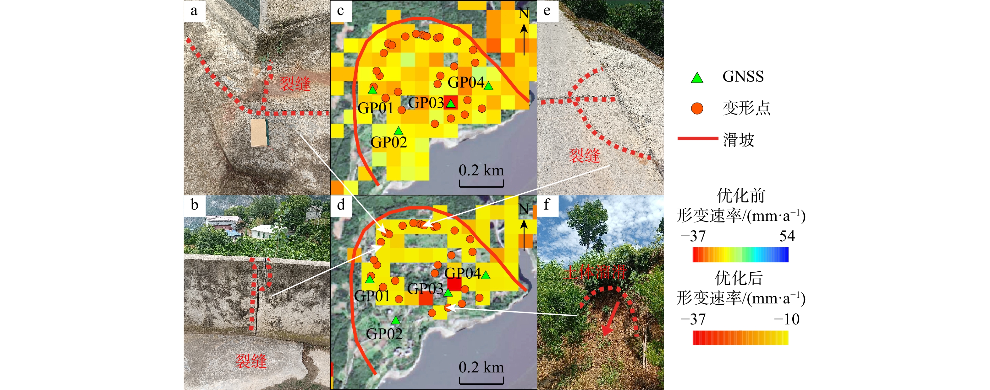
Results

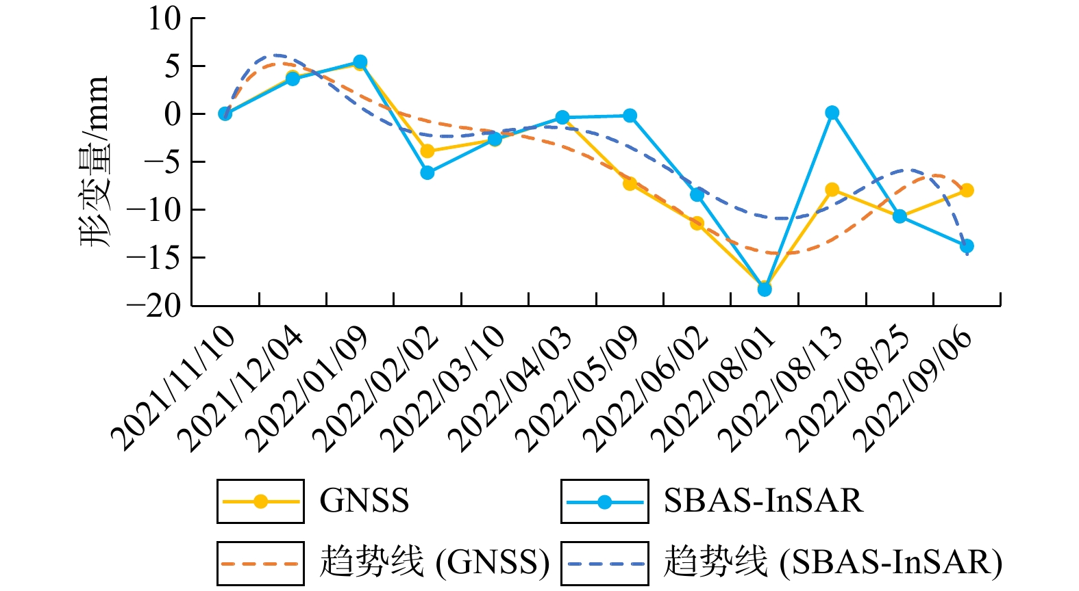
The optimized SBAS-InSAR results were obtained by filtering low-value cluster deformation points based on a threshold value (deformation rate (v) ≤ −10 mm/a) and incorporating the landslide susceptibility zoning map. Field verification in selected areas showed that the number of deformation points was reduced after optimization, and their distribution characteristics were more consistent with the historical landslide development in the study area. Additionally, taking the Yupingcun landslide group and the Pianshan landslide as typical cases, the surface deformation values monitored by SBAS-InSAR and GNSS at the same time were compared. In the case of the Yupingcun landslide, the difference between surface displacement values monitored by SBAS-InSAR and global navigation satellite system (GNSS) ranged from 0 to 7.87 mm, with an average difference of approximately 2.23 mm and an RMSE of 3.67.
Conclusion

The proposed optimization method for SBAS-InSAR interpretation was demonstrated to be both practical and reliable, providing useful references for the application of InSAR technology in the field of geological disasters.

Frontiers and potential directions of international deep Earth exploration
ZHAO Rui, CHEN Si, WANG Haihua, FANG Daren, WANG Hua
2026, 45(2): 306-319. doi: 10.19509/j.cnki.dzkq.tb20240456
Abstract:
Significance

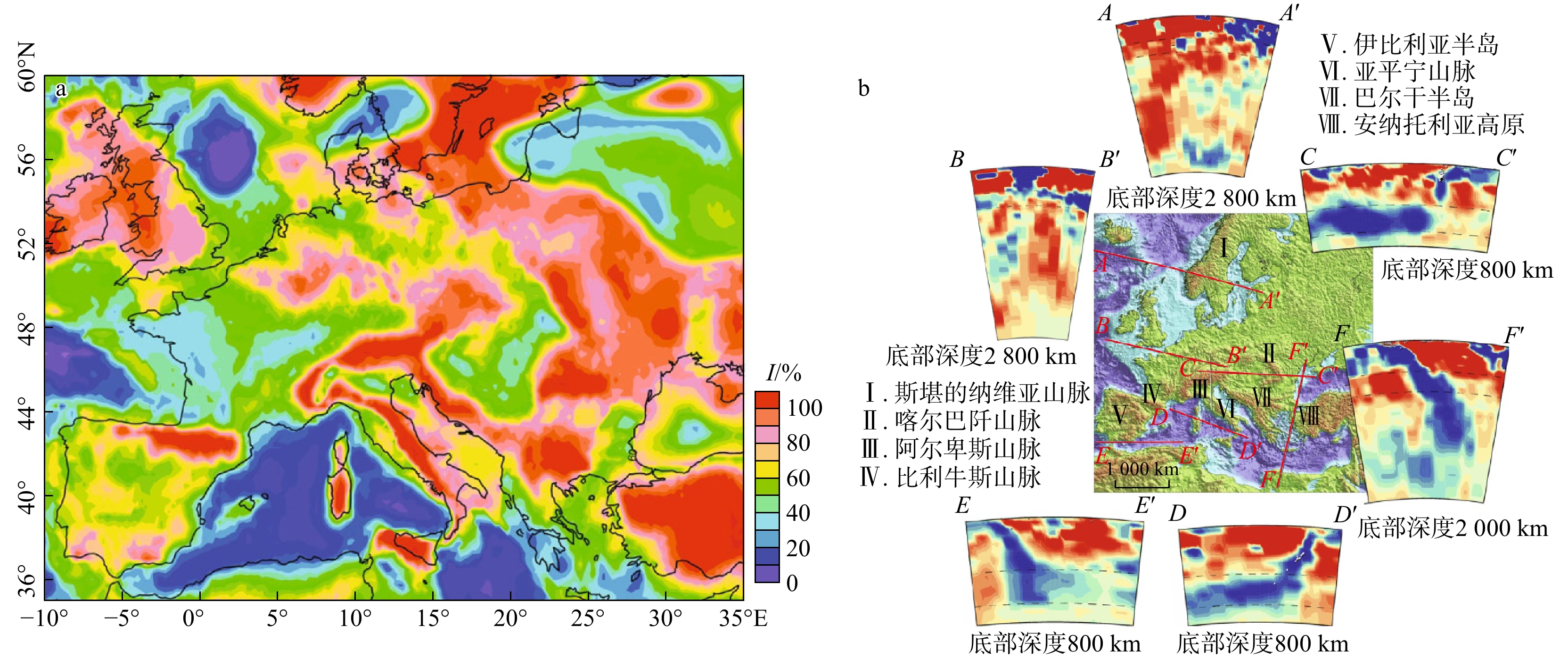
Deep Earth exploration is a multidisciplinary scientific endeavor aimed at uncovering the structure, dynamics, and evolution of continents and their margins. Understanding the Earth's interior is crucial for advancing scientific knowledge and comprehending the fundamental processes that shape our planet. Over the past half-century, many countries worldwide have implemented various deep Earth exploration programs, accumulating valuable experience and achieving significant breakthroughs in technology and methods. These advancements provide important references for deep Earth exploration in China.

Progress

This paper analyzes the technical approaches and achievements of representative deep Earth exploration programs in the United States, Europe, and Australia since the 21st century, summarizing the latest progress of these programs.

Conclusions and Prospects

Six frontiers and key potential directions of deep Earth exploration are summarized, including seismic tomography for deep Earth structure detection, magnetotellurics for mineral resource exploration, GNSS monitoring for Earth's motion and state changes, coupled surface-to-deep Earth processes, advanced data processing, analysis, and modeling capabilities, and open data sharing. These are expected to provide information support and references for the "SinoProbe-Ⅱ" deep exploration program, the "Earth CT" international cooperative research program, and the National Science and Technology Major Projects focused on deep Earth and mineral resources exploration in China.

A rugged seabed signal compensation method based on W transform compressive sensing framework
HUANG Yu, LI Fang, REN Ting
2026, 45(2): 320-326. doi: 10.19509/j.cnki.dzkq.tb20250358
Abstract:

The Qiongdongnan Basin, situated in the northern part of the South China Sea, is a geologically significant and resource-rich marine area, characterized by extremely complex seabed topography that transitions seamlessly across shallow coastal waters, gently sloping continental shelves, steep shelf break zones, and abyssal deep-sea basins. Within this basin, the vicinities of the rugged and uneven seabed-marked by abrupt topographic variations such as submerged ridges, fault scarps, and scattered seamounts-have emerged as key exploration zones, as geological surveys and preliminary prospecting have identified a multitude of potential hydrocarbon and mineral reserve targets in these sub-seabed formations. However, the amplitude and frequency of seismic data under the rugged seabed in deep water are distorted, and there is a large gap between the seismic data collected on land and that under the rugged seabed. Traditional signal compensation methods fail to effectively process such data.

Objective

In order to obtain high-quality seismic data and accurately evaluate targets under the rugged seabed, it is urgent to develop a reasonable and effective compensation method.

Methods

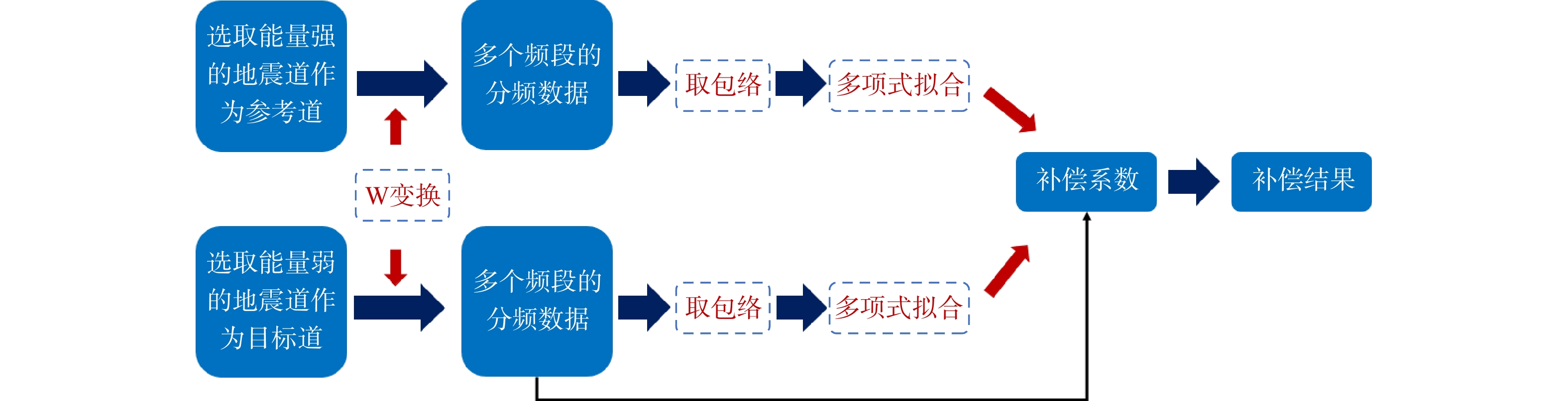
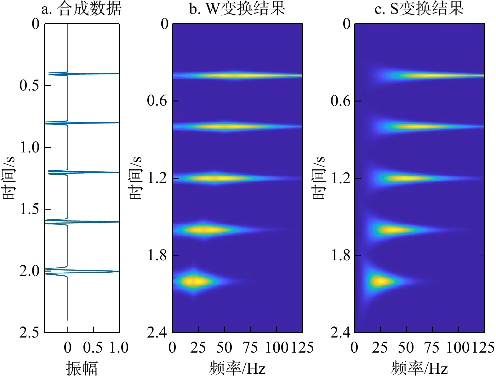
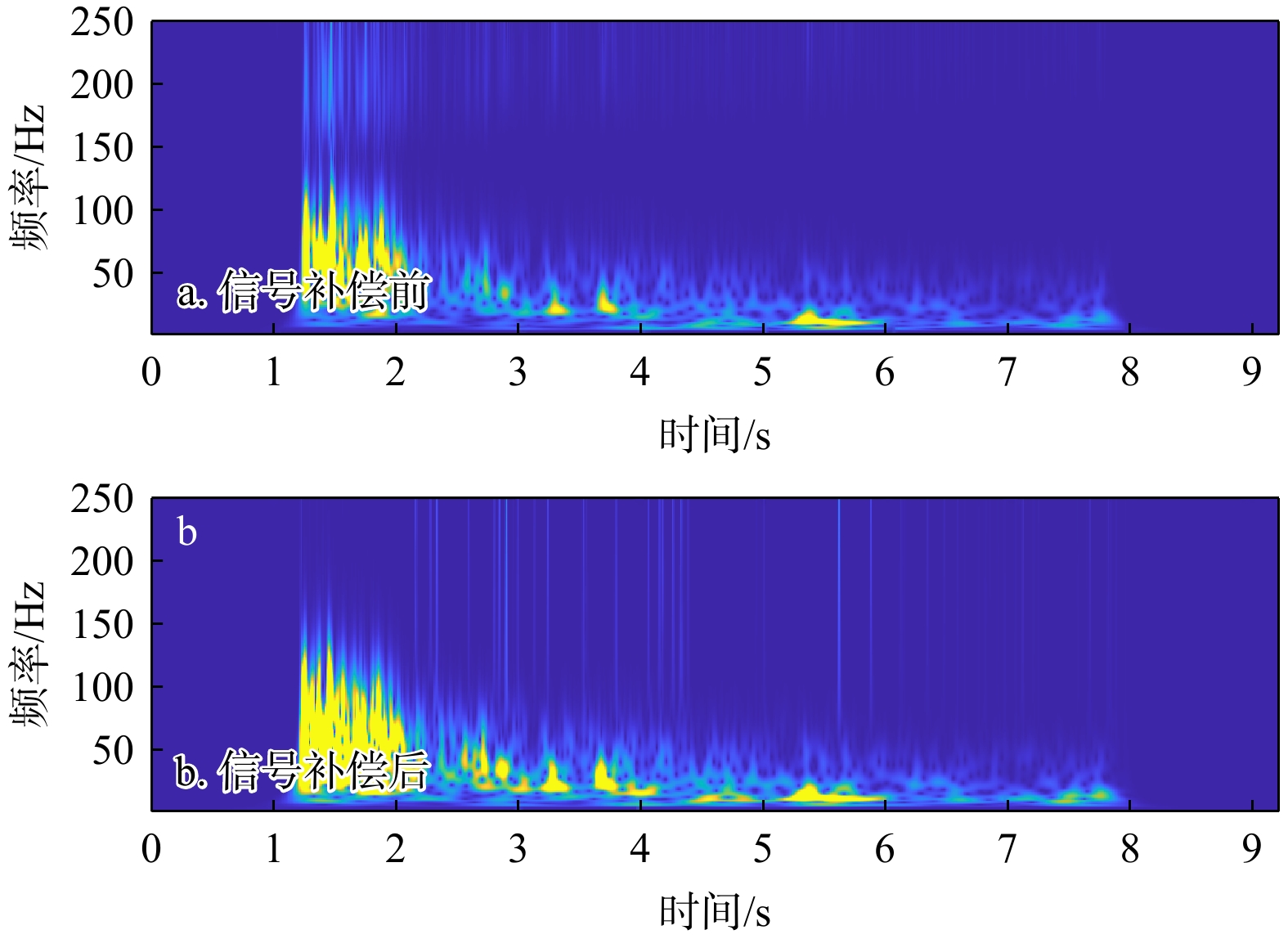
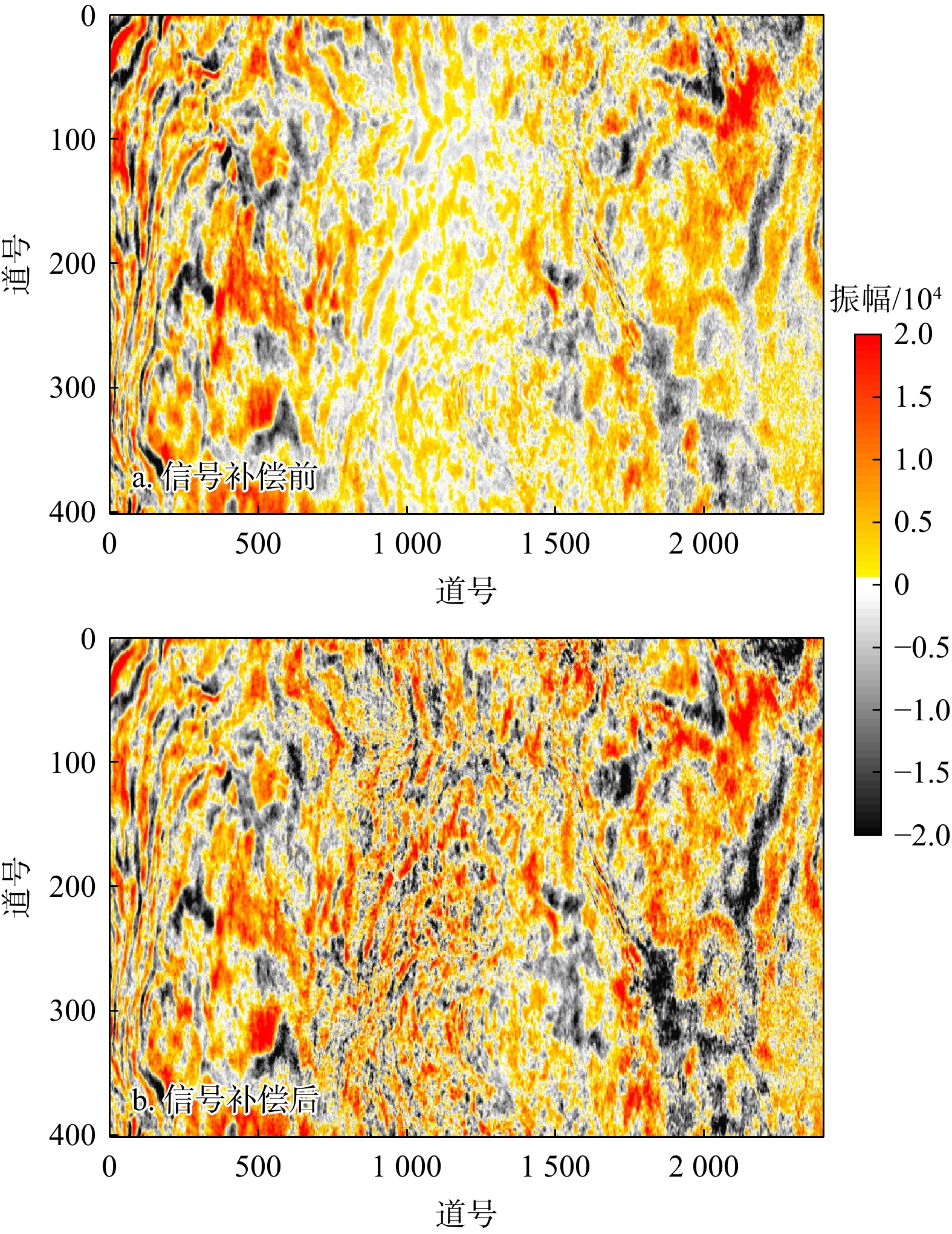
Inspired by time-frequency analysis and compressive sensing methods, this paper designed a compressive sensing compensation framework based on W transform. By constructing the compensation matrix between the reference trace and the target trace, the amplitude compensation of seismic data was rapidly achieved in a single step. The sparse transform regularization method was introduced to ensure the high signal-to-noise ratio of the compensation data and improve the quality of the seismic data.

Results

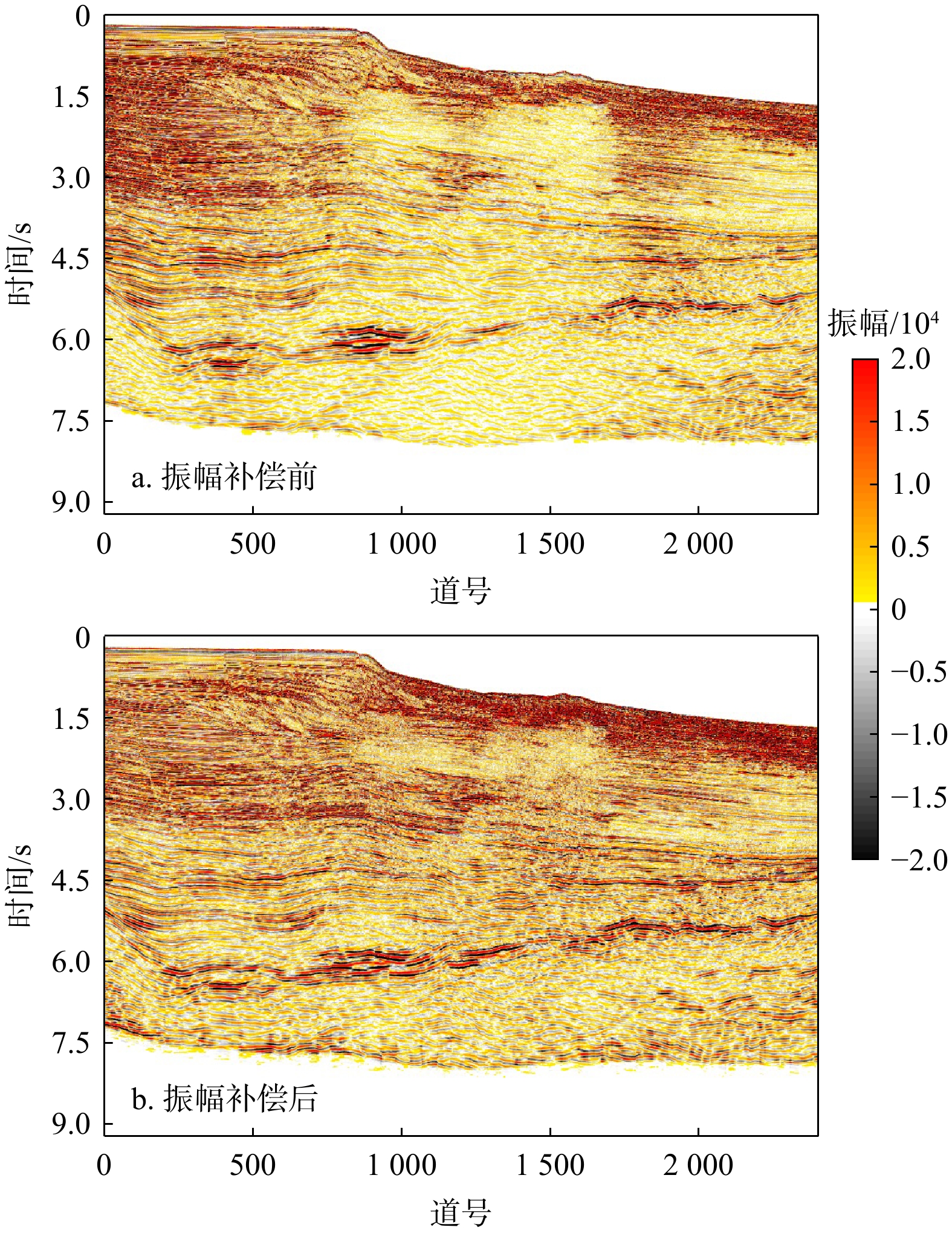
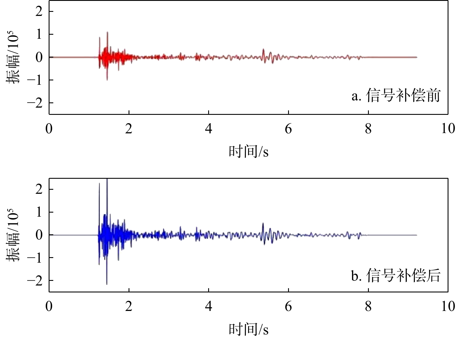
This method was used to compensate the seismic data under complex rugged seabed conditions in the northern part of the South China Sea, and the consistency of the energy distribution of the seismic data profile after compensation was effectively improved.

Conclusion

The successful application of the signal compensation processing demonstrates the feasibility of the method and provides a reference for the signal compensation processing of similar seismic data.

Current status and prospects of calculation methods for dam and dike failures (Ⅱ):Two-dimensional and three-dimensional mathematical models
LIU Zhankui, GUO Qiuge, YANG Yang, JIE Yuxin, ZHANG Baosen, WANG Jingwen, ZHOU Ting
2026, 45(2): 327-337. doi: 10.19509/j.cnki.dzkq.tb20250303
Abstract:
Significance

Dam and dike failure, as one of the most frequent disaster events worldwide, exerts a profound impact on human production and daily life. Research on breach calculation methods is crucial for the assessment, prediction, and risk prevention of dam-break and dike-break floods.

Progress

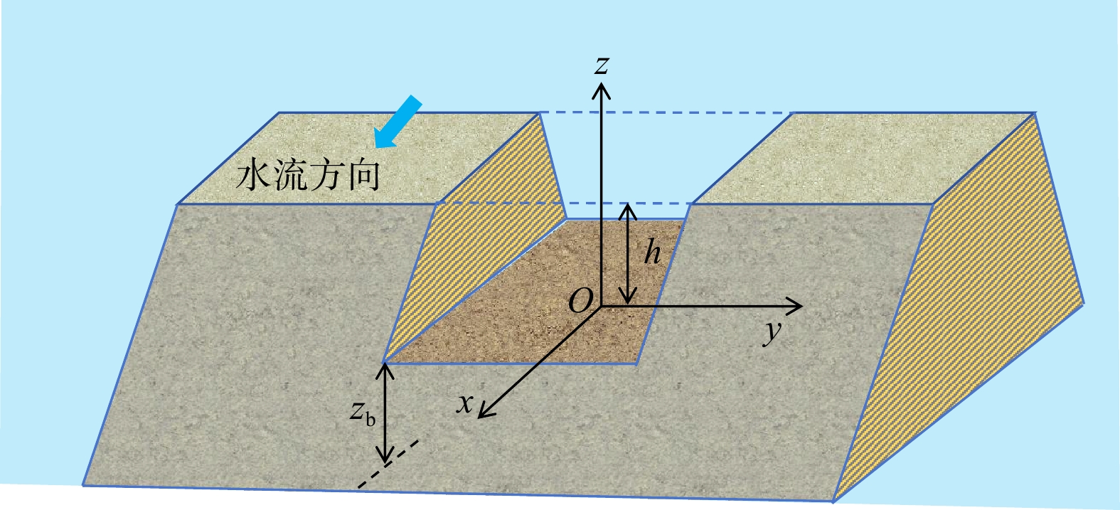
From a mathematical modeling perspective, this paper reviews and summarizes two-dimensional (2D) and three-dimensional (3D) computational models for breach development. The characteristics of common 2D and 3D mathematical models are summarized, and a comparative table of typical breach calculation methods is presented. Three representative 2D mathematical models are briefly introduced to facilitate comparative studies among researchers and to better understand the current development of dam-breach mathematical models. Furthermore, commonly used numerical computation techniques, commercial software, and open-source tools are summarized and compared. The current applications and future prospects of machine learning methods in breach calculation are also discussed, along with suggestions for future research directions and key priorities.

Conclusion and Prospect

Overall, existing studies on breach development mechanisms and numerical simulations still involve many simplifications and assumptions. Both 2D and 3D numerical methods are evolving toward more refined descriptions of breach development processes, but they require significant computational resources and time. Accurate and efficient full-process simulation of breach evolution is expected to remain an active research topic. Machine learning methods have gradually been applied to the prediction and analysis of breach development, and they are expected to extensively and in-depth applied in future relevant research.

Susceptibility assessment and zoning of coastal landslides based on heterogeneous ensemble machine learning models
DOU Hongqiang, LIU Yin, WANG Hao, JIAN Wenbin, YAN Huaxiang
2026, 45(2): 338-350. doi: 10.19509/j.cnki.dzkq.tb20240567
Abstract:
Objective

With the rapid development of marine engineering and the increasing frequency of extreme weather events, the risk of coastal landslides has risen significantly. However, existing studies on landslide susceptibility and zoning mainly focus on inland mountainous landslides, and systematic research on coastal landslide susceptibility remains insufficient.

Methods

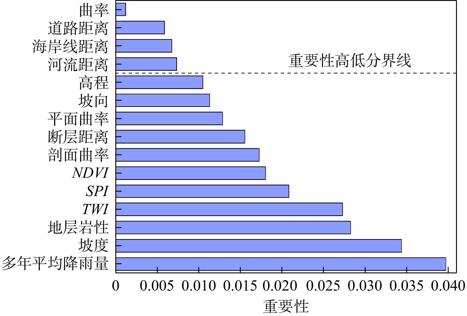
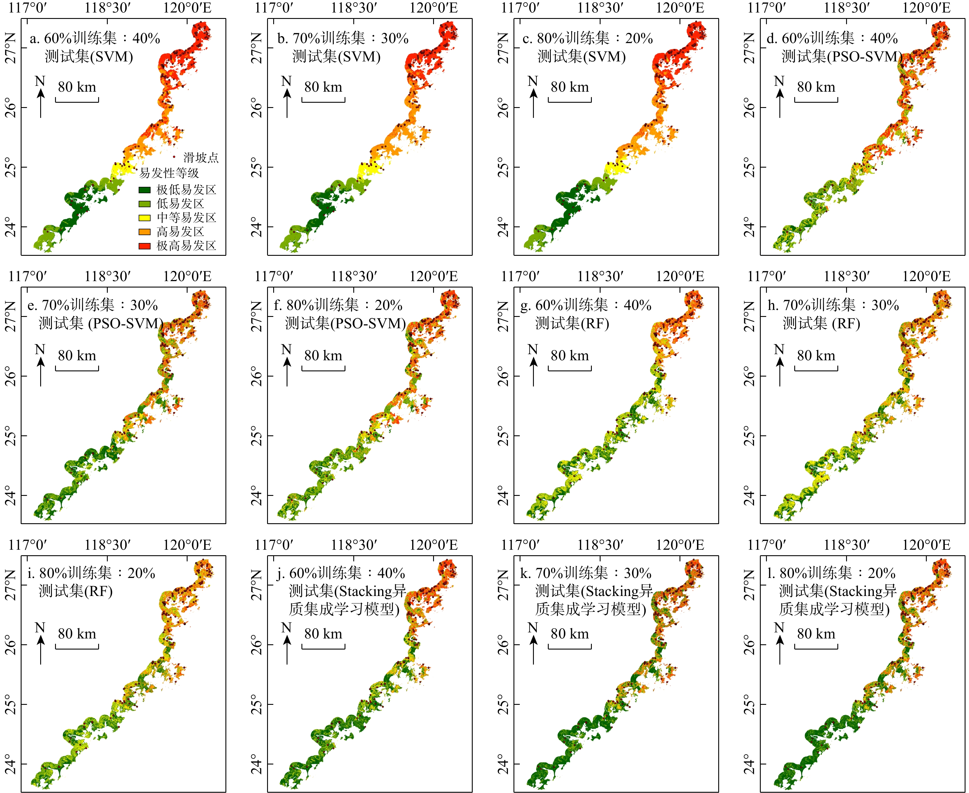
In this study, the coastal zone of Fujian Province was selected as the study area. Historical data on coastal landslides were collected, and a susceptibility assessment index system suitable for coastal landslides was established using the information gain ratio method and Pearson correlation coefficient method. Particle swarm optimization support vector machine (PSO-SVM) and random forest (RF) were used as base learners to construct a stacking heterogeneous ensemble learning model. This model was adopted to perform the susceptibility assessment and zoning of coastal landslides in Fujian Province, and the influence of different training-to-testing data splitting ratios on the prediction accuracy of the heterogeneous ensemble model was also analyzed.
Results

The comparison results demonstrated that the Stacking model performed optimally when the training-to-testing ratio was 70:30, achieving Accuracy of 0.869, Precision of 0.842, Recall of 0.909, and F1-Score of 0.874. Compared with other models, the Accuracy, Precision, and F1-Score improved by up to 0.198, 0.227, and 0.140, respectively. In addition, the area under the curve (AUC) value was 0.938, 0.019−0.216 higher than that of the other models.

Conclusion

The findings indicate that the Stacking heterogeneous ensemble model exhibits strong applicability and excellent performance in susceptibility assessment of coastal landslides.

Exploration of groundwater table spatial estimation in Jiangsu Province based on machine learning and multi-source data fusion
DANG Jingxuan, TIAN Tao, LI Chuang, KANG Xueyuan, SHI Xiaoqing
2026, 45(2): 351-360. doi: 10.19509/j.cnki.dzkq.tb20240228
Abstract:
Objective

Characterizing the spatial distribution of the regional groundwater table is critical for effective groundwater management and pollution control. However, the limited number and uneven distribution of observation wells in many regions, including Jiangsu Province, China, make it difficult for traditional interpolation or physically based numerical models to provide reliable predictions. Interpolation methods such as Kriging depend heavily on well coverage, which restricts their applicability in data-scarce areas, while numerical models require large amounts of hydrogeological parameters and boundary conditions that are often unavailable in practice.

Methods

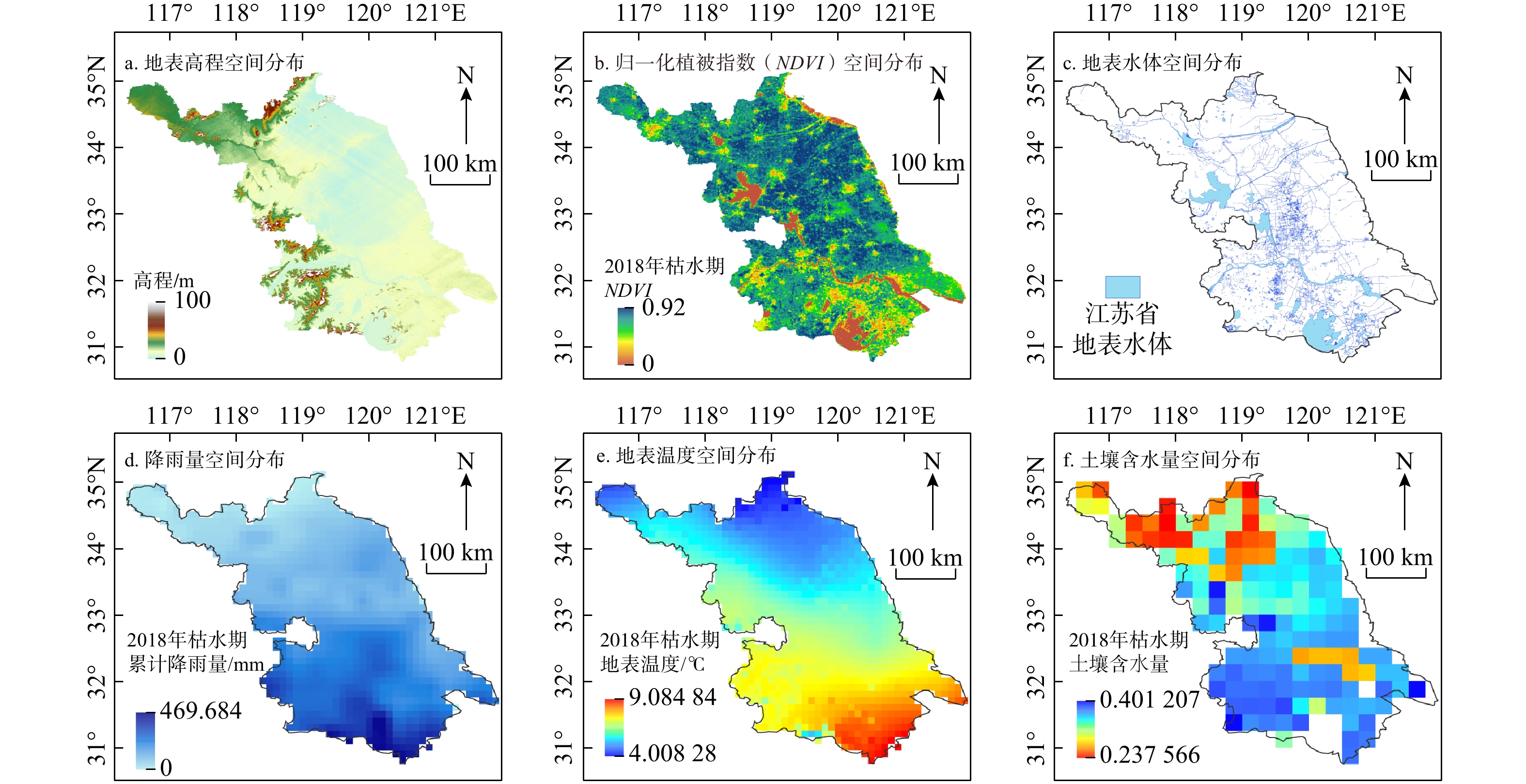
To address these limitations, this study develops a machine learning-based framework that integrates multi-source data, including elevation, vegetation coverage, rainfall, distance from surface water, land surface temperature, and soil moisture. A dataset of 953 groundwater observations collected during the dry season, complemented by surface water levels and published measurements, was compiled and standardized. A deep neural network (DNN) was trained using 80% of the data, validated on 10%, and tested on the remaining 10%.

Results

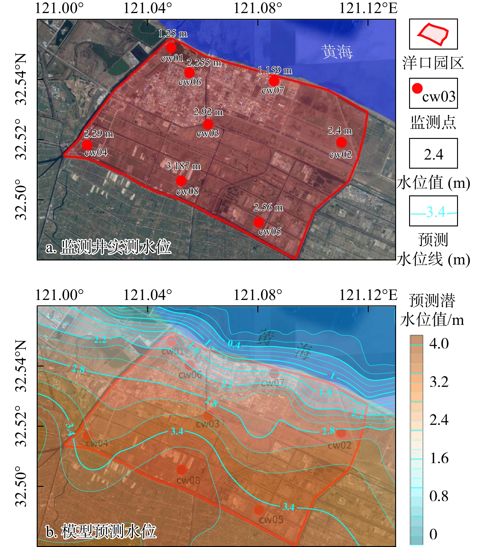
The model achieved a determination coefficient (R2) of 0.91 on the test dataset, substantially outperforming ordinary Kriging (R2=0.63). The predicted groundwater table maps revealed clear large-scale patterns consistent with hydrogeological understanding, including a west-to-east flow gradient and discharge into the Yangtze River, Taihu Lake, and the East China Sea. Compared with nationwide groundwater models, the proposed approach provided finer spatial resolution and captured more local flow features. Validation in three representative demonstration areas-a coastal industrial park, a riverside development zone, and a cross-hydrogeological unit-confirmed that predicted groundwater flow directions matched observed values, even where monitoring wells were sparse. To enhance interpretability, Shapley additive explanations (SHAP) analysis was applied, which revealed that land surface temperature, vegetation cover, and distance to surface water exerted dominant influences at the provincial scale, while site-specific analyses emphasized the importance of local hydrological connectivity.

Conclusion

Overall, the machine learning framework developed in this study provides an efficient and scalable tool for estimating groundwater table distributions in data-limited regions. By integrating diverse environmental factors, this approach improves predictive accuracy, enhances the spatial resolution of groundwater flow mapping, and offers insights into governing factors. The results highlight the potential of combining big data and artificial intelligence methods to support groundwater monitoring optimization, regional environmental impact assessments, and sustainable water resource management.