| Citation: | LI Hao,HUA Weihua,WEI Wencheng,et al. 3D geological modeling method for Quaternary strata based on stratigraphic penetration and layer connections[J]. Bulletin of Geological Science and Technology,2026,45(4):1-11 doi: 10.19509/j.cnki.dzkq.tb20250147

|
The Quaternary strata are widely developed in urban areas. They exhibit complex sedimentary characteristics, including frequent sedimentary cycles, multiple interbedded lens bodies, and laterally disordered distribution. Traditional 3D geological modeling methods rely heavily on fixed stratigraphic sequences and struggle to handle discontinuous lens bodies, disordered layer connections, and locally inverted strata, leading to distorted interfaces, illogical connectivity, and low modeling accuracy. These limitations severely restrict the digital management of urban underground space and intelligent early warning of geological hazards.
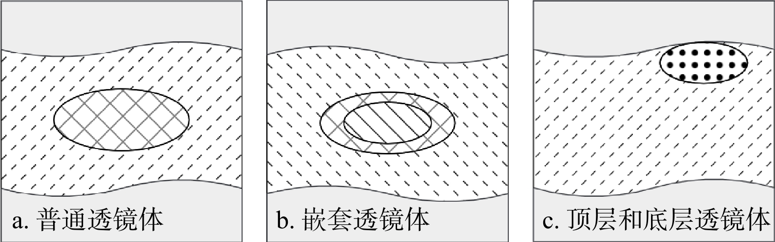
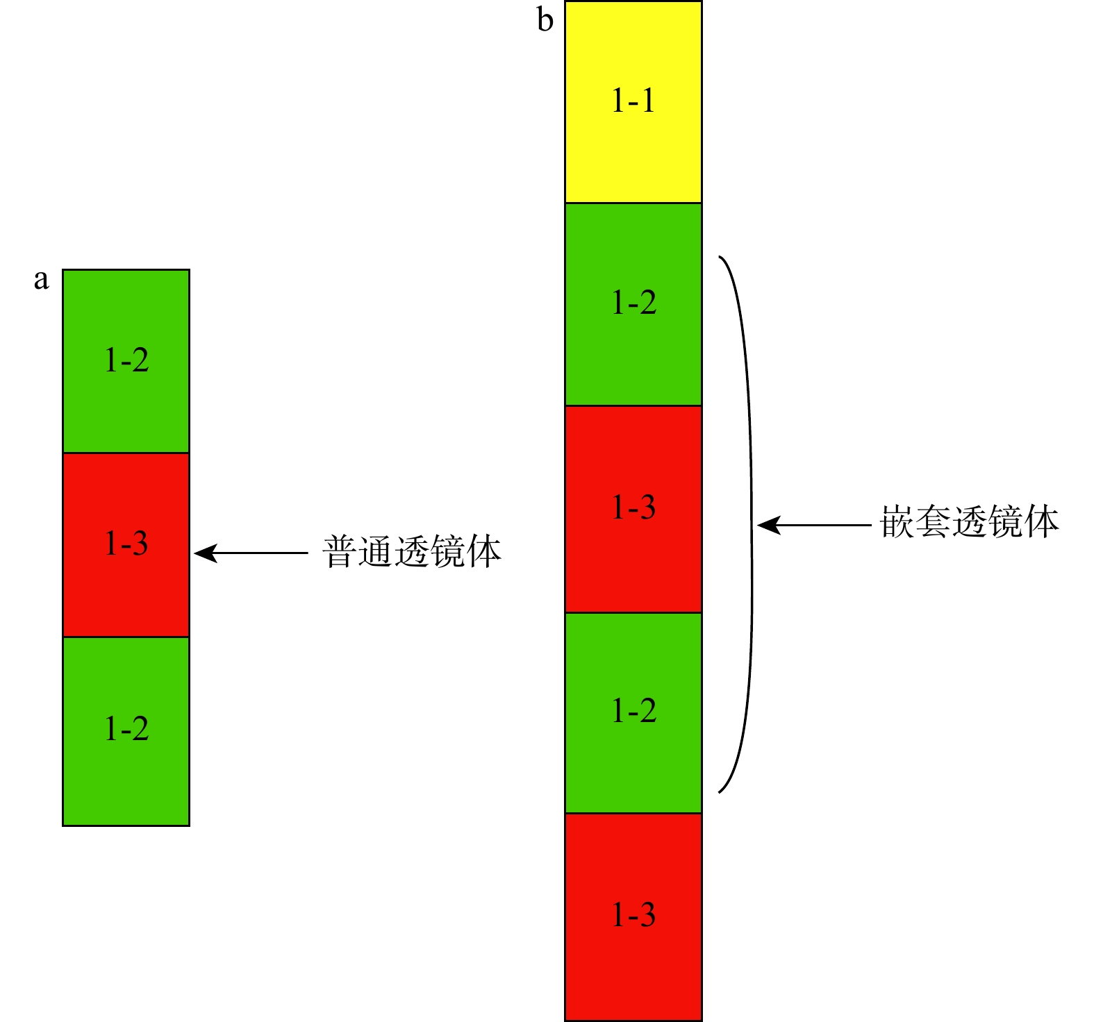
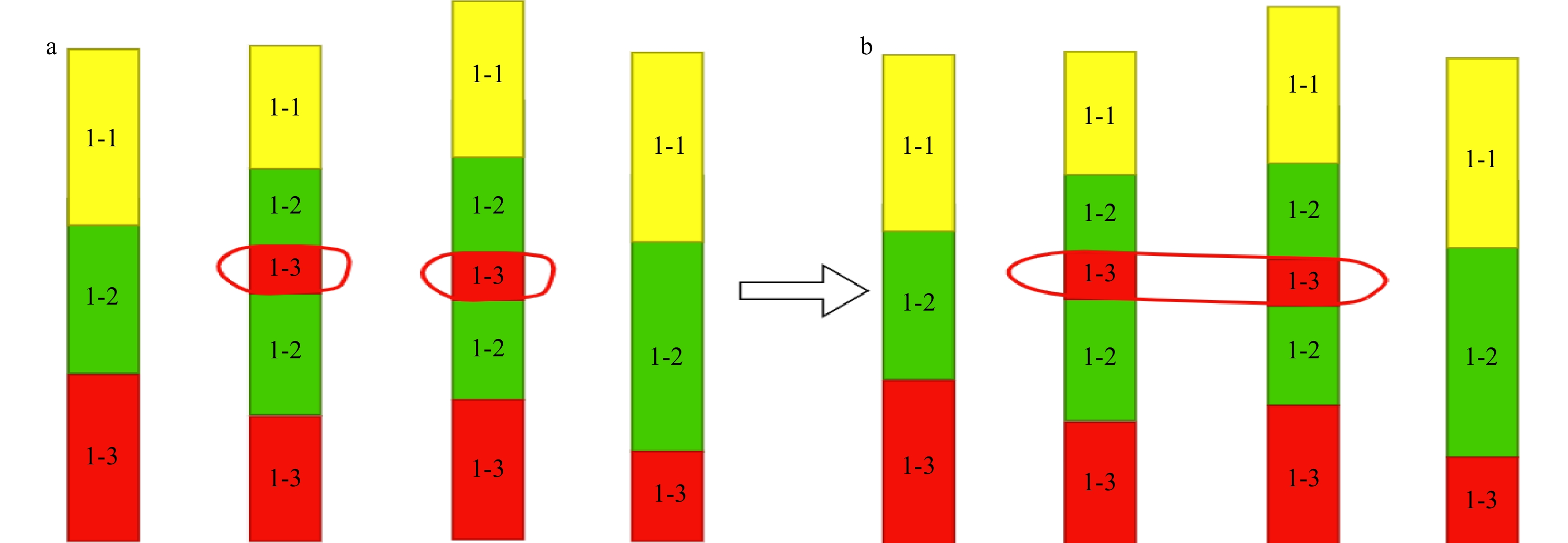
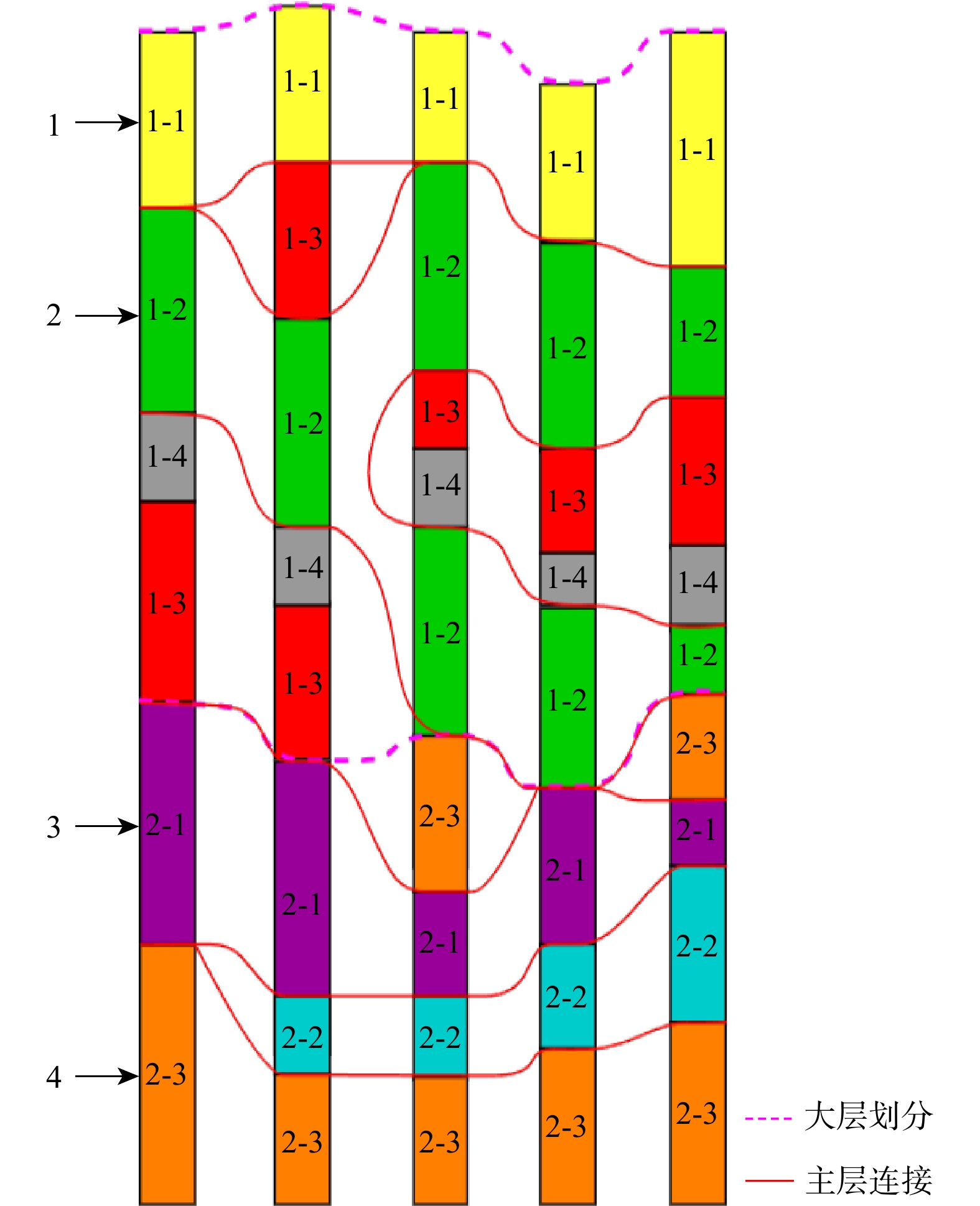
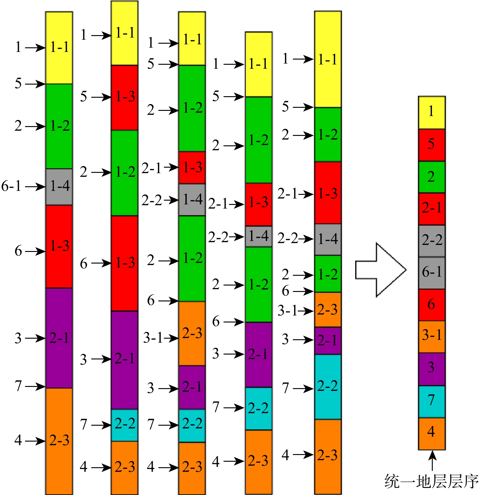
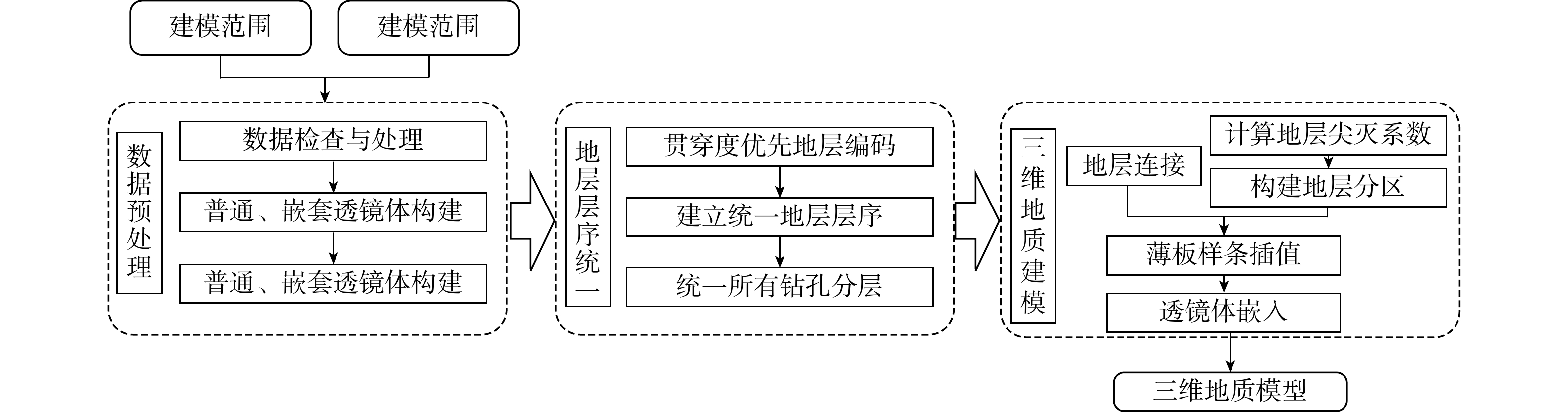
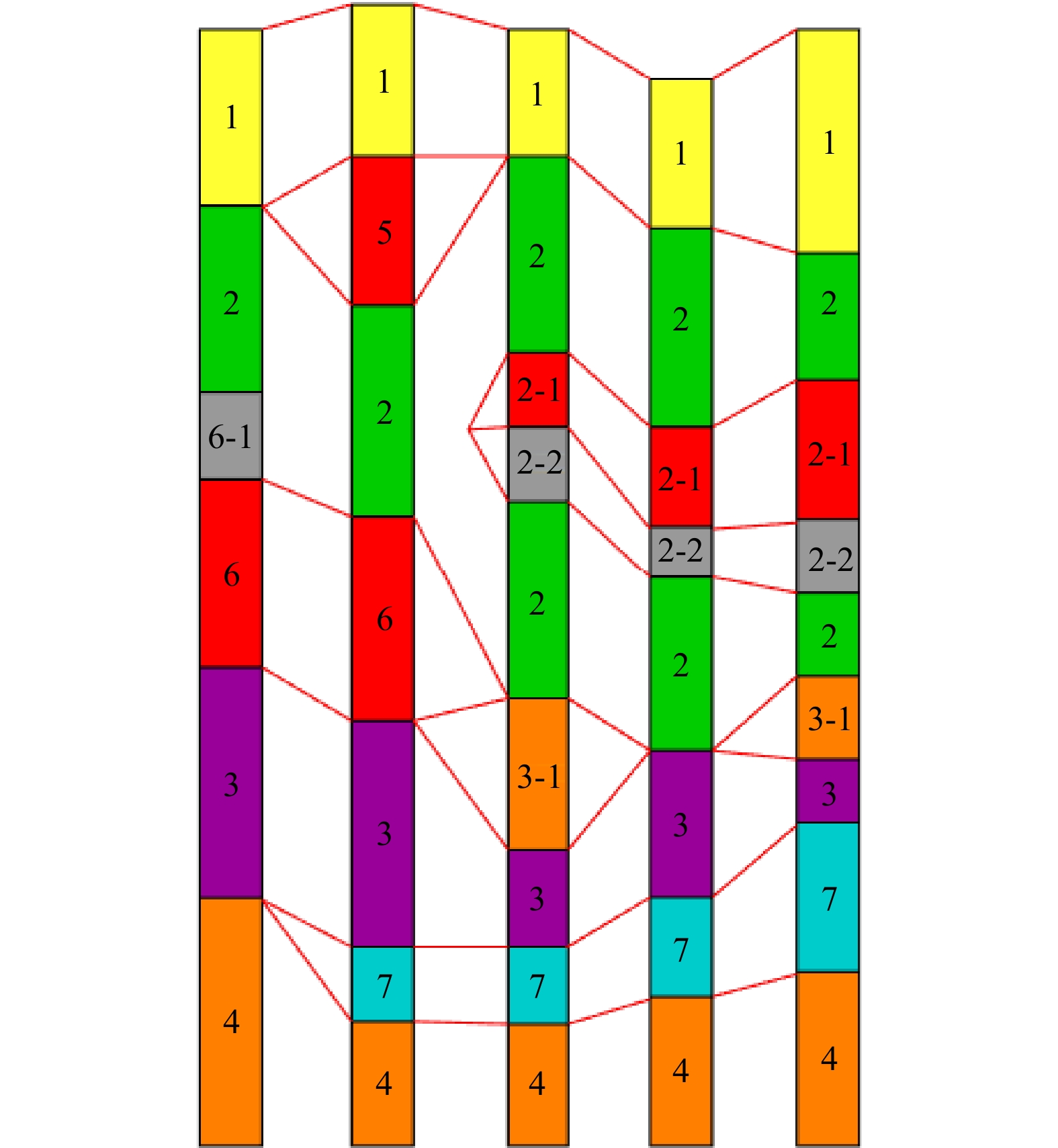
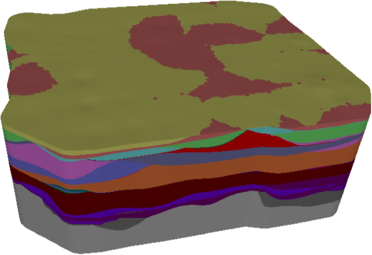
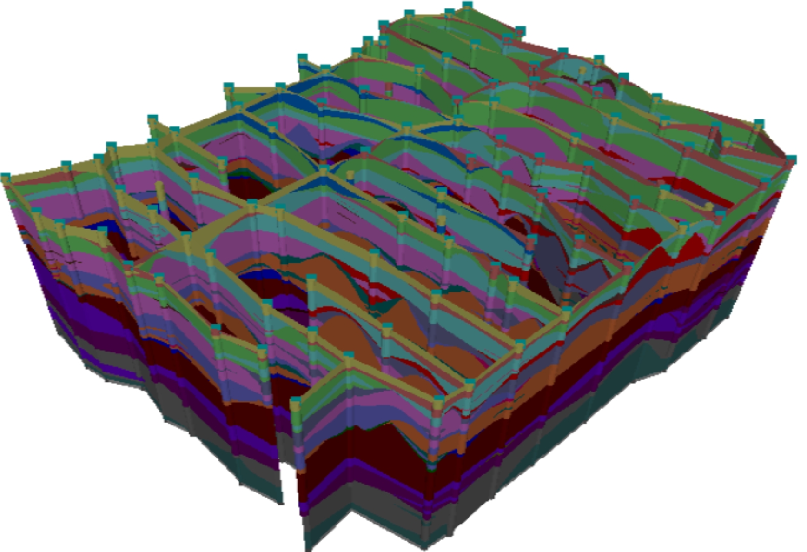
To tackle these key technical bottlenecks, this study proposed an improved 3D geological modeling method for Quaternary strata based on stratigraphic penetration-driven layer correlation. Driven by borehole data, this method first automatically identified three types of lens bodies, including simple, nested, and top/bottom lens bodies, and conducted spatial clustering under the constraints of relative elevation difference and lens body thickness to eliminate local discontinuity interference. Guided by expert geological knowledge, a "major layer-sub-layer-sub-sub-layer" hierarchical system was constructed. With stratigraphic penetration as the core index, strata with high penetration were prioritized for standardized coding to realize the unification of stratigraphic sequences including those with inverted structures. On this basis, the stratigraphic pinch-out boundary was calculated using the angular unconformity pinch-out coefficient, and a stratigraphic partition model was constructed. Finally, a smooth and topologically consistent 3D geological grid model was established via thin-plate spline interpolation, and clustered lens bodies were embedded into the framework model to restore real sedimentary structures.
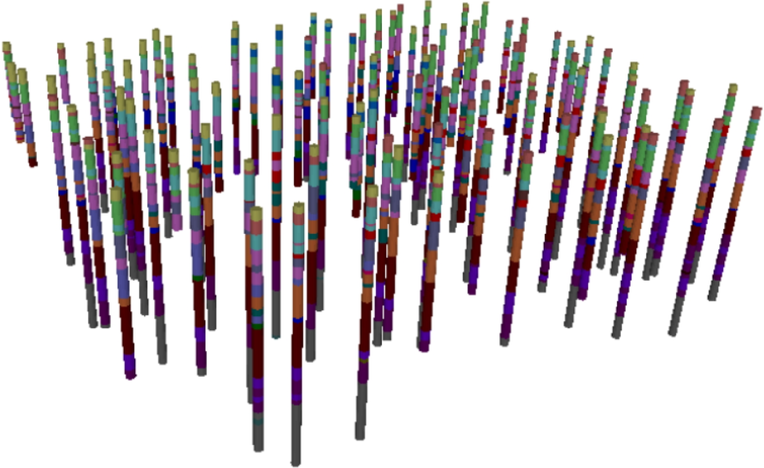
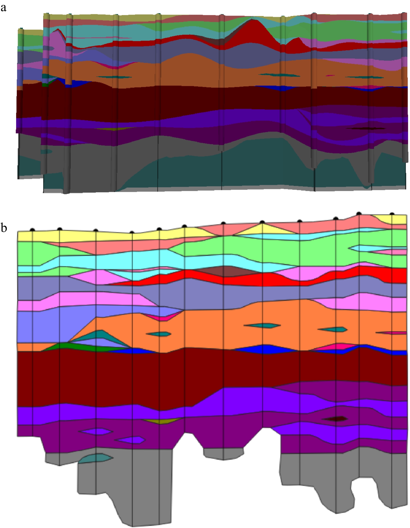
A case study was conducted using 102 engineering boreholes in the Zhongguancun area of Beijing to verify the method. The results showed that profiles extracted from the established 3D model were highly consistent with manual geological profiles. All lens body structures were automatically and accurately identified. The stratigraphic connection error rate decreased by 67%, and the geological interface agreement rate increased to 92%. The method effectively avoided unreasonable layer connections and redundant zero-thickness layers caused by loose Quaternary sediments.
This approach can intelligently identify lens bodies and accurately unify stratigraphic sequences, significantly improving the accuracy and rationality of 3D modeling for complex Quaternary strata. It provides reliable and high-precision geological model support for urban underground space development, intelligent early warning of geological disasters, and engineering survey and design, and has important theoretical value and broad application prospects for international urban geological digitalization.

| [1] |
KIM M, KIM H S, CHUNG C K. A three-dimensional geotechnical spatial modeling method for borehole dataset using optimization of geostatistical approaches[J]. KSCE Journal of Civil Engineering, 2020, 24(3): 778-793. doi: 10.1007/s12205-020-1379-1
|
| [2] |
ALVARADO-NEVES F, AILLERES L, GROSE L, et al. Using 3D models to test geological hypotheses for sill complex geometries: Application to Jurassic dolerite intrusions, Tasmania[J]. Journal of Structural Geology, 2025, 197: 105420. doi: 10.1016/j.jsg.2025.105420
|
| [3] |
张坤, 花卫华, 李叶繁, 等. 地质信息化平台发展综述与研究展望[J]. 铁道建筑技术, 2024(7): 54-56.
ZHANG K, HUA W H, LI Y F, et al. Development review and research prospect of geological information platform[J]. Railway Construction Technology, 2024(7): 54-56. (in Chinese with English abstract)
|
| [4] |
花卫华, 曾新灵, 郭丹阳, 等. 基于构造恢复理论的含复杂断层三维地质建模方法[J]. 地球科学, 2024, 49(4): 1411-1420.
HUA W H, ZENG X L, GUO D Y, et al. 3D geological modeling method based on tectonic restoration theory[J]. Earth Science, 2024, 49(4): 1411-1420. (in Chinese with English abstract)
|
| [5] |
战洪雷, 胡甲齐, 王英楠. 地质矿产勘查中的三维地质建模与应用[J]. 中国金属通报, 2024(7): 103-105.
ZHAN H L, HU J Q, WANG Y N. Three-dimensional geological modeling and application in geological and mineral exploration[J]. China Metal Bulletin, 2024(7): 103-105. (in Chinese with English abstract)
|
| [6] |
袁峰, 李晓晖, 田卫东, 等. 三维成矿预测关键问题[J]. 地学前缘, 2024, 31(4): 119-128.
YUAN F, LI X H, TIAN W D, et al. Key issues in three-dimensional predictive modeling of mineral prospectivity[J]. Earth Science Frontiers, 2024, 31(4): 119-128. (in Chinese with English abstract)
|
| [7] |
李宏达, 吴志春, 柏瑞, 等. 复杂脉状矿体精细化三维建模方法探讨[J]. 地质科技通报, 2025, 44(4): 379-390.
LI H D, WU Z C, BAI R, et al. Discussion on fine 3D modeling method of complex vein-type ore body[J]. Bulletin of Geological Science and Technology, 2025, 44(4): 379-390. (in Chinese with English abstract)
|
| [8] |
张宝一, 尚建嘎, 吴鸿敏, 等. 三维地质建模及可视化技术在固体矿产储量估算中的应用[J]. 地质与勘探, 2007, 43(2): 76-81.
ZHANG B Y, SHANG J G, WU H M, et al. Application of 3D geological modeling and visualization in solid mineral resource estimation[J]. Geology and Exploration, 2007, 43(2): 76-81. (in Chinese with English abstract)
|
| [9] |
姚琪, 鲁人齐, 苏鹏, 等. 三维地质建模为地震数值预测带来的机遇[J]. 地震地质, 2024, 46(1): 1-18.
YAO Q, LU R Q, SU P, et al. Opportunities brought by 3D geoscience modeling for earthquake numerical forecasting[J]. Seismology and Geology, 2024, 46(1): 1-18. (in Chinese with English abstract)
|
| [10] |
韦超俊, 唐正辉, 刘先林, 等. 三维地质建模技术在平陆运河大跨径拱桥中的应用研究[J]. 西部交通科技, 2024(2): 152-155.
WEI C J, TANG Z H, LIU X L, et al. Application of three-dimensional geological modeling technology in Pinglu Canal large-span arch bridge[J]. Western China Communications Science & Technology, 2024(2): 152-155. (in Chinese with English abstract)
|
| [11] |
程俊杰, 刘刚, 吴雪超, 等. 基于轮廓线层间插值和法向优化的复杂矿体三维隐式建模方法[J]. 地质科技通报, 2026, 45(3): 362-373.
CHENG J J, LIU G, WU X C, et al. Three-dimensional implicit modeling method for complex ore bodies basedon inter-layer contour interpolation and normal optimization[J]. Bulletin of Geological Science and Technology, 2026, 45(3): 362-373. (in Chinese with English abstract)
|
| [12] |
郭福钟, 郑博文, 祁生文, 等. 三维地质建模技术与方法综述[J]. 工程地质学报, 2024, 32(3): 1143-1153.
GUO F Z, ZHENG B W, QI S W, et al. A review of 3D geological modeling technology and methods[J]. Journal of Engineering Geology, 2024, 32(3): 1143-1153. (in Chinese with English abstract)
|
| [13] |
LYU M M, REN B Y, WU B P, et al. A parametric 3D geological modeling method considering stratigraphic interface topology optimization and coding expert knowledge[J]. Engineering Geology, 2021, 293: 106300. doi: 10.1016/j.enggeo.2021.106300
|
| [14] |
陈麒玉, 刘刚, 吴冲龙, 等. 城市地质调查中知识驱动的多尺度三维地质体模型构建方法[J]. 地理与地理信息科学, 2016, 32(4): 11-16. doi: 10.3969/j.issn.1672-0504.2016.04.003
CHEN Q Y, LIU G, WU C L, et al. Knowledge-driven multiple scale 3D geological modeling method in urban geological survey[J]. Geography and Geo-Information Science, 2016, 32(4): 11-16. (in Chinese with English abstract) doi: 10.3969/j.issn.1672-0504.2016.04.003
|
| [15] |
翁正平. 复杂地质体三维模型快速构建及更新技术研究[D]. 武汉: 中国地质大学(武汉), 2013.
WENG Z P. Research on rapid construction and updating technology of three-dimensional model of complex geologic body[D]. Wuhan: China University of Geosciences(Wuhan), 2013. (in Chinese with English abstract)
|
| [16] |
FREY M, WEINERT S, BÄR K, et al. Integrated 3D geological modelling of the northern Upper Rhine Graben by joint inversion of gravimetry and magnetic data[J]. Tectonophysics, 2021, 813: 228927. doi: 10.1016/j.tecto.2021.228927
|
| [17] |
WANG Q, LI H, XIA S B, et al. Geometry of the Quaternary strata along the middle segment of the Longmen Shan and its formation mechanism: Insights from AMT, ERT and borehole data[J]. Tectonophysics, 2022, 826: 229226. doi: 10.1016/j.tecto.2022.229226
|
| [18] |
蔡向民, 郭高轩, 栾英波, 等. 北京山前平原区第四系三维结构调查方法研究[J]. 地质学报, 2009, 83(7): 1047-1057. doi: 10.3321/j.issn:0001-5717.2009.07.012
CAI X M, GUO G X, LUAN Y B, et al. Quaternary geological features of Beijing piedmont plain using 3D structural method[J]. Acta Geologica Sinica, 2009, 83(7): 1047-1057. (in Chinese with English abstract) doi: 10.3321/j.issn:0001-5717.2009.07.012
|
| [19] |
李昌领, 张虹, 朱良峰. 含透镜体的地质体真三维建模算法[J]. 计算机工程与设计, 2013, 34(9): 3103-3106. doi: 10.16208/j.issn1000-7024.2013.09.005
LI C L, ZHANG H, ZHU L F. Algorithm for true-3D modeling of geo-body including lenticular-body[J]. Computer Engineering and Design, 2013, 34(9): 3103-3106. (in Chinese with English abstract) doi: 10.16208/j.issn1000-7024.2013.09.005
|
| [20] |
JI G J, WANG Q, ZHOU X Y, et al. An automated method to build 3D multi-scale geological models for engineering sedimentary layers with stratum lenses[J]. Engineering Geology, 2023, 317: 107077. doi: 10.1016/j.enggeo.2023.107077
|
| [21] |
贺怀建, 白世伟, 赵新华, 等. 三维地层模型中地层划分的探讨[J]. 岩土力学, 2002, 23(5): 637-639. doi: 10.16285/j.rsm.2002.05.026
HE H J, BAI S W, ZHAO X H, et al. Discussion on strata partition in three dimension strata model[J]. Rock and Soil Mechanics, 2002, 23(5): 637-639. (in Chinese with English abstract) doi: 10.16285/j.rsm.2002.05.026
|
| [22] |
CHEN Q Y, LIU G, MA X G, et al. 3D stochastic modeling framework for Quaternary sediments using multiple-point statistics: A case study in Minjiang Estuary area, Southeast China[J]. Computers & Geosciences, 2020, 136: 104404. doi: 10.1016/j.cageo.2019.104404
|
| [23] |
ZHAO K, QI J X, CHEN Y, et al. Hydrogeochemical characteristics of groundwater and pore-water and the paleoenvironmental evolution in the past 3.10 Ma in the Xiong'an New Area, North China[J]. China Geology, 2021, 4(3): 476-486. doi: 10.31035/cg2021058
|
| [24] |
JØRGENSEN F, HØYER A S, SANDERSEN P B E, et al. Combining 3D geological modelling techniques to address variations in geology, data type and density: An example from southern Denmark[J]. Computers & Geosciences, 2015, 81: 53-63. doi: 10.1016/j.cageo.2015.04.010
|
| [25] |
王丽芳. 厦门三维地质建模方法研究及其在工程应用[J]. 地质灾害与环境保护, 2016, 27(4): 84-90. doi: 10.3969/j.issn.1006-4362.2016.04.015
WANG L F. Research on three-dimensional geological modeling method in Xiamen and engineering application[J]. Journal of Geological Hazards and Environment Preservation, 2016, 27(4): 84-90. (in Chinese with English abstract) doi: 10.3969/j.issn.1006-4362.2016.04.015
|
| [26] |
成建梅, 柳璨, 李敏敏, 等. 城市化进程下北京平原渗流场与地面沉降发展演化模拟[J]. 地质科技通报, 2020, 39(1): 43-52.
CHENG J M, LIU C, LI M M, et al. Numerical study on evolution of groundwater hydrodynamics and land subsidence under the process of metropolitan urbanization in Beijing Plain, China[J]. Bulletin of Geological Science and Technology, 2020, 39(1): 43-52. (in Chinese with English abstract)
|
| [27] |
孙佳珺, 孟勇琦, 赵帅. 基于钻孔资料的北京平原区第四纪地层分析[J]. 中国矿业, 2019, 28(增刊1): 107-110.
SUN J J, MENG Y Q, ZHAO S. Quaternary stratigraphic analysis of the Beijing Plain based on drill holes[J]. China Mining Magazine, 2019, 28(S1): 107-110. (in Chinese with English abstract)
|
| [28] |
花卫华, 郭丹阳, 刘修国, 等. 含复杂倒转的地层层序统一修正与连接方法[J]. 地球科学, 2023, 48(4): 1532-1542.
HUA W H, GUO D Y, LIU X G, et al. Unified correction and connection method of stratigraphic sequence with complex inversion[J]. Earth Science, 2023, 48(4): 1532-1542. (in Chinese with English abstract)
|
| [29] |
B D P, DODAGOUDAR G R. An integrated geotechnical database and GIS for 3D subsurface modelling: Application to Chennai City, India[J]. Applied Geomatics, 2018, 10(1): 47-64.
|
| [30] |
郭少斌, 陈成龙. 利用米兰科维奇旋回划分柴达木盆地第四系层序地层[J]. 地质科技情报, 2007, 26(4): 27-30.
GUO S B, CHEN C L. Division of sequence stratigraphy of Quaternary Formation in Qaidam Basin using the Milankvitch Cycle[J]. Geological Science and Technology Information, 2007, 26(4): 27-30. (in Chinese with English abstract)
|
| [31] |
张永旺, 庞世龙, 花卫华, 等. 基于地层尖灭的城市地下空间三维地质建模方法及应用: 以广西北海市为例[J]. 地质通报, 2025, 44(6): 1174-1186.
ZHANG Y W, PANG S L, HUA W H, et al. Research on 3D geological modeling method and application of urban underground space based on stratigraphic pinchout: A case study of Beihai City, Guangxi[J]. Geological Bulletin of China, 2025, 44(6): 1174-1186. (in Chinese with English abstract)
|
| [32] |
陈小芳, 马国玺, 王敏, 等. 基于精确划分地层边界的三维地质体模型构建[J]. 地震工程学报, 2023, 45(4): 946-953.
CHEN X F, MA G X, WANG M, et al. Construction of a 3D geological model based on the accurate division of stratigraphic boundaries[J]. China Earthquake Engineering Journal, 2023, 45(4): 946-953. (in Chinese with English abstract)
|
| [33] |
CALCAGNO P, CHILÈS J P, COURRIOUX G, et al. Geological modelling from field data and geological knowledge[J]. Physics of the Earth and Planetary Interiors, 2008, 171(1/2/3/4): 147-157.
|
| [34] |
ZHANG B Y, DU L Z, KHAN U, et al. AdaHRBF v1.0: Gradient-adaptive Hermite-Birkhoff radial basis function interpolants for three-dimensional stratigraphic implicit modeling[J]. Geoscientific Model Development, 2023, 16(13): 3651-3674.
|
| [35] |
DUBRULE O. Two methods with different objectives: Splines and Kriging[J]. Journal of the International Association for Mathematical Geology, 1983, 15(2): 245-257.
|
| [36] |
牛文杰. 薄板样条法和泛克里金法在理论和应用方面的比较[J]. 工程图学学报, 2010, 31(4): 123-129.
NIU W J. Comparison of theory and application between thin plate spline and universal Kriging[J]. Journal of Engineering Graphics, 2010, 31(4): 123-129. (in Chinese with English abstract)
|
| [37] |
孙海燕, 丁咚. 薄板样条函数及复杂曲面的数学表示[J]. 测绘工程, 2006, 15(2): 7-8.
SUN H Y, DING D. Thin plate spline and mathematic description of complicated surface[J]. Engineering of Surveying and Mapping, 2006, 15(2): 7-8. (in Chinese with English abstract)
|
| [38] |
郭甲腾, 吴立新, 周文辉. 基于径向基函数曲面的矿体隐式自动三维建模方法[J]. 煤炭学报, 2016, 41(8): 2130-2135.
GUO J T, WU L X, ZHOU W H. Automatic ore body implicit 3D modeling based on radial basis function surface[J]. Journal of China Coal Society, 2016, 41(8): 2130-2135. (in Chinese with English abstract)
|
| [39] |
花卫华, 邓伟萍, 刘修国, 等. 一种改进的不规则三角网格曲面切割算法[J]. 地球科学, 2006, 31(5): 619-623.
HUA W H, DENG W P, LIU X G, et al. Improved partition algorithm between triangulated irregular network[J]. Earth Science, 2006, 31(5): 619-623. (in Chinese with English abstract)
|
| [40] |
CAUMON G, COLLON-DROUAILLET P, LE CARLIER DE VESLUD C, et al. Surface-based 3D modeling of geological structures[J]. Mathematical Geosciences, 2009, 41(8): 927-945.
|
| [41] |
王振娟, 花卫华, 刘修国, 等. 一种消除三维地质模型边界裂缝的锁边LOD方法[J]. 地球信息科学学报, 2023, 25(5): 967-981.
WANG Z J, HUA W H, LIU X G, et al. An edge-locking LOD method for eliminating boundary cracks in 3D geological models[J]. Journal of Geo-Information Science, 2023, 25(5): 967-981. (in Chinese with English abstract)
|
| [42] |
梁栋, 花卫华, 赵亚博, 等. 一种基于地层相关结构约束的地质模型修正方法[J]. 地球科学, 2023, 48(8): 3179-3192.
LIANG D, HUA W H, ZHAO Y B, et al. Error correction in geological model based on stratigraphic interdependency[J]. Earth Science, 2023, 48(8): 3179-3192. (in Chinese with English abstract)
|
| [43] |
周英, 牛露佳, 王占刚, 等. 工程地质三维岩性网格模型体绘制的边界平滑方法[J]. 河南理工大学学报(自然科学版), 2024, 43(2): 77-87.
ZHOU Y, NIU L J, WANG Z G, et al. Boundary smoothing for volume rendering of 3D lithology grid model in engineering geology[J]. Journal of Henan Polytechnic University (Natural Science), 2024, 43(2): 77-87. (in Chinese with English abstract)
|
| [44] |
田宜平, 吴冲龙, 翁正平, 等. 地质大数据可视化关键技术探讨[J]. 地质科技通报, 2020, 39(4): 29-36.
TIAN Y P, WU C L, WENG Z P, et al. Key technologies of geological big data visualization[J]. Bulletin of Geological Science and Technology, 2020, 39(4): 29-36. (in Chinese with English abstract)
|
Supported by:
Beijing Renhe Information Technology Co., Ltd.


 Submission System

 DownLoad: